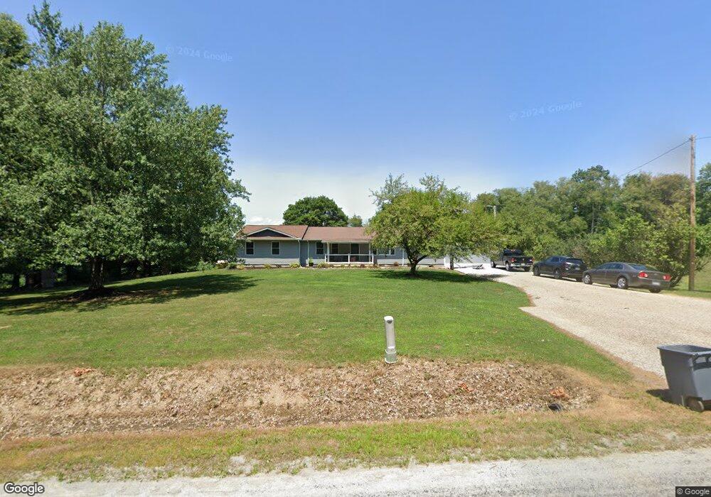
10333 Martin Rd West Salem, OH 44287
Estimated Value: $259,000 - $309,000
3
Beds
2
Baths
884
Sq Ft
$320/Sq Ft
Est. Value
About This Home
This home is located at 10333 Martin Rd, West Salem, OH 44287 and is currently estimated at $283,291, approximately $320 per square foot. 10333 Martin Rd is a home located in Wayne County with nearby schools including Northwestern Elementary School and Northwestern Middle School.
Ownership History
Date
Name
Owned For
Owner Type
Purchase Details
Closed on
Nov 21, 2020
Sold by
Howman Sara K
Bought by
Howman Sara K and White Ryan C
Current Estimated Value
Home Financials for this Owner
Home Financials are based on the most recent Mortgage that was taken out on this home.
Original Mortgage
$266,000
Outstanding Balance
$240,061
Interest Rate
3.62%
Mortgage Type
Construction
Estimated Equity
$43,230
Purchase Details
Closed on
Aug 20, 2019
Sold by
Keener Philip and Keener Jean L
Bought by
Howman Sara K
Home Financials for this Owner
Home Financials are based on the most recent Mortgage that was taken out on this home.
Original Mortgage
$59,500
Interest Rate
3.7%
Mortgage Type
New Conventional
Purchase Details
Closed on
Sep 6, 2002
Sold by
Chavis Betty
Bought by
Keener Jean L
Create a Home Valuation Report for This Property
The Home Valuation Report is an in-depth analysis detailing your home's value as well as a comparison with similar homes in the area
Home Values in the Area
Average Home Value in this Area
Purchase History
| Date | Buyer | Sale Price | Title Company |
|---|---|---|---|
| Howman Sara K | -- | None Available | |
| Howman Sara K | $80,000 | Southern Title | |
| Keener Jean L | $64,000 | -- |
Source: Public Records
Mortgage History
| Date | Status | Borrower | Loan Amount |
|---|---|---|---|
| Open | Howman Sara K | $266,000 | |
| Closed | Howman Sara K | $59,500 |
Source: Public Records
Tax History Compared to Growth
Tax History
| Year | Tax Paid | Tax Assessment Tax Assessment Total Assessment is a certain percentage of the fair market value that is determined by local assessors to be the total taxable value of land and additions on the property. | Land | Improvement |
|---|---|---|---|---|
| 2024 | $2,636 | $67,130 | $12,690 | $54,440 |
| 2023 | $2,636 | $67,340 | $12,690 | $54,650 |
| 2022 | $2,431 | $56,110 | $10,570 | $45,540 |
| 2021 | $1,657 | $39,260 | $10,570 | $28,690 |
| 2020 | $1,410 | $33,050 | $10,570 | $22,480 |
| 2019 | $1,308 | $28,070 | $9,230 | $18,840 |
| 2018 | $1,287 | $28,070 | $9,230 | $18,840 |
| 2017 | $1,198 | $28,070 | $9,230 | $18,840 |
| 2016 | $1,206 | $26,920 | $8,800 | $18,120 |
| 2015 | $1,119 | $26,920 | $8,800 | $18,120 |
| 2014 | $1,132 | $26,920 | $8,800 | $18,120 |
| 2013 | $1,196 | $27,430 | $9,180 | $18,250 |
Source: Public Records
Map
Nearby Homes
- 10212 Lattasburg Rd
- 1137 County Road 175
- 999 Township Road 133
- 164 State Route 302
- 9657 W Smithville Western Rd
- 568 County Road 175
- 104 N Maple St
- 156 U S 250
- 58 State Route 42
- 7789 Cedar Valley Rd
- 11827 Stratton Rd
- 17 Andrew Ct
- 0 Congress Unit 5159386
- 0 Congress Unit 5150334
- 8743 Ashland Rd
- V/L #10 Rice Hill Rd
- V/L #8 Rice Hill Rd
- V/L #7 Rice Hill Rd
- 174 County Road 700
- V/L #13 Rice Hill Rd
- 10383 Martin Rd
- 8450 N Elyria Rd
- 8548 N Elyria Rd
- 10167 Martin Rd
- 10089 Martin Rd
- 8160 N Elyria Rd
- 10001 Martin Rd
- 9877 Martin Rd
- 8743 N Elyria Rd
- 8681 N Elyria Rd
- 9611 Martin Rd
- 8161 Camp Rd
- 9786 Martin Rd
- 9757 Martin Rd
- 8979 N Elyria Rd
- 9716 Martin Rd
- 9971 Howman Rd
- 9705 Martin Rd
- 9651 Martin Rd
- 9595 Martin Rd