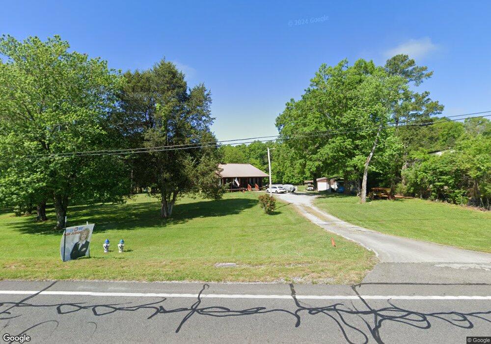
10333 N Highway 27 Rock Spring, GA 30739
Rock Spring NeighborhoodEstimated Value: $294,000 - $403,000
--
Bed
--
Bath
1,472
Sq Ft
$234/Sq Ft
Est. Value
About This Home
This home is located at 10333 N Highway 27, Rock Spring, GA 30739 and is currently estimated at $344,064, approximately $233 per square foot. 10333 N Highway 27 is a home with nearby schools including Lafayette High School and Oakwood Christian Academy.
Ownership History
Date
Name
Owned For
Owner Type
Purchase Details
Closed on
Oct 22, 2019
Sold by
Durham Freda J Estate
Bought by
Matteson David L and Matteson Paulette D
Current Estimated Value
Purchase Details
Closed on
Jan 3, 1999
Sold by
Hegwood Orville
Bought by
Durham Freda J
Purchase Details
Closed on
Jan 2, 1999
Sold by
Murdock Keith
Bought by
Hegwood Orville
Purchase Details
Closed on
Aug 10, 1992
Sold by
Emmons Gary R
Bought by
Murdock Keith
Purchase Details
Closed on
Jan 30, 1992
Sold by
Emmons Gary R and Emmons Sherry
Bought by
Emmons Gary R
Purchase Details
Closed on
Apr 23, 1985
Sold by
Richard C Knight
Bought by
Emmons Gary R and Emmons Sherry
Purchase Details
Closed on
Aug 16, 1965
Bought by
Richard C Knight
Create a Home Valuation Report for This Property
The Home Valuation Report is an in-depth analysis detailing your home's value as well as a comparison with similar homes in the area
Home Values in the Area
Average Home Value in this Area
Purchase History
| Date | Buyer | Sale Price | Title Company |
|---|---|---|---|
| Matteson David L | $170,000 | -- | |
| Durham Freda J | $68,700 | -- | |
| Hegwood Orville | $68,700 | -- | |
| Murdock Keith | $85,000 | -- | |
| Emmons Gary R | -- | -- | |
| Emmons Gary R | $71,500 | -- | |
| Richard C Knight | -- | -- |
Source: Public Records
Tax History Compared to Growth
Tax History
| Year | Tax Paid | Tax Assessment Tax Assessment Total Assessment is a certain percentage of the fair market value that is determined by local assessors to be the total taxable value of land and additions on the property. | Land | Improvement |
|---|---|---|---|---|
| 2024 | $1,612 | $150,518 | $79,270 | $71,248 |
| 2023 | $1,274 | $129,144 | $61,655 | $67,489 |
| 2022 | $1,234 | $119,619 | $61,655 | $57,964 |
| 2021 | $1,035 | $103,419 | $61,655 | $41,764 |
| 2020 | $305 | $94,884 | $61,655 | $33,229 |
| 2019 | $2,845 | $99,114 | $72,266 | $26,848 |
| 2018 | $2,623 | $99,114 | $72,266 | $26,848 |
| 2017 | $3,117 | $99,114 | $72,266 | $26,848 |
| 2016 | $4,085 | $190,178 | $158,000 | $32,178 |
| 2015 | $2,298 | $83,230 | $50,560 | $32,670 |
| 2014 | $2,114 | $83,230 | $50,560 | $32,670 |
| 2013 | -- | $83,230 | $50,560 | $32,670 |
Source: Public Records
Map
Nearby Homes
- 124 Fieldstone Commons
- 103 Deer Ridge Ln
- 200 Hunting Ridge Cir
- 28 Cobblestone Trail
- 149 Stone Throw Ln
- 135 Stone Throw Ln
- 74 Sycamore Dr
- 269 Quartz Dr
- 283 Quartz Dr
- 44 Bending Oak Dr
- 190 Sycamore Dr
- 162 Bending Oak Dr
- 918 Old Lafayette Rd
- 680 Glass Mill Rd
- 54 Cedar Farm Ln
- 1121 Arnold Rd
- 1476 Arnold Rd
- 788 Long Hollow Rd
- 183 Long Hollow Rd
- 294 E Long Hollow Rd
- 0 Fieldstone Pkwy Unit 1151449
- 0 Fieldstone Pkwy Unit 1151447
- 0 Fieldstone Pkwy Unit 1151451
- 0 Fieldstone Pkwy Unit 1151448
- 0 Fieldstone Pkwy Unit 1151450
- 0 Fieldstone Pkwy Unit 1151444
- 0 Fieldstone Pkwy Unit 1151446
- 0 Fieldstone Pkwy Unit 1172115
- 11 Fieldstone Common
- 15 Fieldstone Common
- 7 Fieldstone Common
- 11 Fieldstone Common
- 15 Fieldstone Common
- 25 Fieldstone Common
- 29 Fieldstone Common
- 33 Fieldstone Common
- 33 Fieldstone Common
- 7 Fieldstone Common
- 10437 N Highway 27
- 18 Fieldstone Common