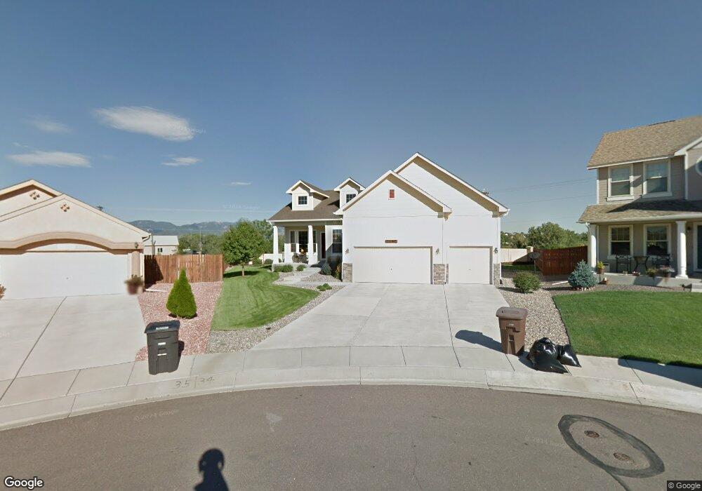
10334 Buck Rake Ct Fountain, CO 80817
Central Fountain Valley NeighborhoodEstimated Value: $515,000 - $600,000
5
Beds
3
Baths
1,810
Sq Ft
$300/Sq Ft
Est. Value
About This Home
This home is located at 10334 Buck Rake Ct, Fountain, CO 80817 and is currently estimated at $543,856, approximately $300 per square foot. 10334 Buck Rake Ct is a home located in El Paso County with nearby schools including Jordahl Elementary School, Fountain Middle School, and Fountain-Fort Carson High School.
Ownership History
Date
Name
Owned For
Owner Type
Purchase Details
Closed on
Feb 28, 2022
Sold by
Taumallelei Pauga
Bought by
Jepson Robert T and Jepson Lura A
Current Estimated Value
Home Financials for this Owner
Home Financials are based on the most recent Mortgage that was taken out on this home.
Original Mortgage
$436,020
Outstanding Balance
$407,383
Interest Rate
3.92%
Mortgage Type
VA
Estimated Equity
$136,473
Purchase Details
Closed on
May 1, 2006
Sold by
Creekstone Development Inc
Bought by
Pauga Taumailelei and Pauga Debra A
Home Financials for this Owner
Home Financials are based on the most recent Mortgage that was taken out on this home.
Original Mortgage
$280,029
Interest Rate
6.62%
Mortgage Type
Fannie Mae Freddie Mac
Create a Home Valuation Report for This Property
The Home Valuation Report is an in-depth analysis detailing your home's value as well as a comparison with similar homes in the area
Home Values in the Area
Average Home Value in this Area
Purchase History
| Date | Buyer | Sale Price | Title Company |
|---|---|---|---|
| Jepson Robert T | -- | Empire Land Title | |
| Pauga Taumailelei | $350,036 | Security Title |
Source: Public Records
Mortgage History
| Date | Status | Borrower | Loan Amount |
|---|---|---|---|
| Open | Jepson Robert T | $436,020 | |
| Previous Owner | Pauga Taumailelei | $280,029 |
Source: Public Records
Tax History Compared to Growth
Tax History
| Year | Tax Paid | Tax Assessment Tax Assessment Total Assessment is a certain percentage of the fair market value that is determined by local assessors to be the total taxable value of land and additions on the property. | Land | Improvement |
|---|---|---|---|---|
| 2025 | $2,037 | $37,860 | -- | -- |
| 2024 | $1,858 | $37,240 | $6,570 | $30,670 |
| 2022 | $1,609 | $27,590 | $5,180 | $22,410 |
| 2021 | $1,495 | $28,380 | $5,330 | $23,050 |
| 2020 | $1,427 | $26,520 | $4,650 | $21,870 |
| 2019 | $1,400 | $26,520 | $4,650 | $21,870 |
| 2018 | $1,214 | $22,210 | $4,100 | $18,110 |
| 2017 | $1,200 | $22,210 | $4,100 | $18,110 |
| 2016 | $1,160 | $21,470 | $4,300 | $17,170 |
| 2015 | $1,162 | $21,470 | $4,300 | $17,170 |
| 2014 | $1,119 | $20,790 | $4,300 | $16,490 |
Source: Public Records
Map
Nearby Homes
- 119 & 121 E Ohio Ave
- 7354 Countryside Grove
- 7355 Countryside Grove
- 10677 Traders Pkwy
- 7427 Middle Bay Way
- 10594 Traders Pkwy
- 10684 Calista Way
- 10733 Calista Way
- 10747 Hidden Prairie Pkwy
- 508 E Ohio Ave
- 505 E Missouri Ave
- 10797 Hidden Prairie Pkwy
- 10807 Hidden Prairie Pkwy
- 541 Autumn Place
- 7770 Del Ray Bay St
- 10994 Tidal Run Cir
- 11081 Buckhead Place
- 601 Autumn Place
- 601 Harvest Field Way
- 10898 Hidden Prairie Pkwy
- 10318 Buck Rake Ct
- 10350 Buck Rake Ct
- 10302 Buck Rake Ct
- 10366 Buck Rake Ct
- 10382 Buck Rake Ct
- 10367 Buck Rake Ct
- 10335 Buck Rake Ct
- 10425 Jimmy Camp Rd
- 10319 Buck Rake Ct
- 10303 Buck Rake Ct
- 7646 High Gate Dr
- 10336 Honeytree Ct
- 10356 Honeytree Ct
- 10255 Jimmy Camp Rd
- 7605 High Gate Dr
- 7633 High Gate Dr
- 10315 Honeytree Ct
- 7647 High Gate Dr
- 7674 High Gate Dr
- 7675 High Gate Dr