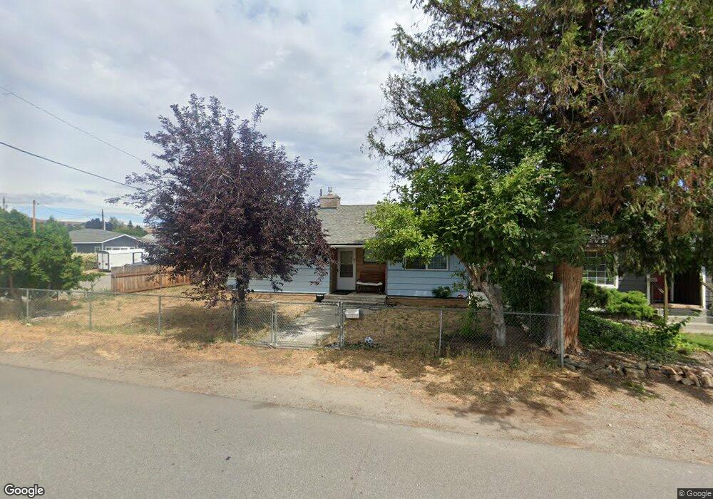
1034 7th St Wenatchee, WA 98801
Estimated Value: $399,006 - $448,000
2
Beds
1
Bath
1,176
Sq Ft
$359/Sq Ft
Est. Value
About This Home
This home is located at 1034 7th St, Wenatchee, WA 98801 and is currently estimated at $422,002, approximately $358 per square foot. 1034 7th St is a home located in Chelan County with nearby schools including Lewis & Clark Elementary School, Foothills Middle School, and Wenatchee High School.
Ownership History
Date
Name
Owned For
Owner Type
Purchase Details
Closed on
Jun 19, 2007
Sold by
Haas Justin M
Bought by
Hunsinger Brett Anthony and Hunsinger Denise Ann
Current Estimated Value
Home Financials for this Owner
Home Financials are based on the most recent Mortgage that was taken out on this home.
Original Mortgage
$195,331
Outstanding Balance
$119,328
Interest Rate
6.16%
Mortgage Type
VA
Estimated Equity
$302,674
Purchase Details
Closed on
Aug 11, 2006
Sold by
Gere Lyle D and Gere Dolores C
Bought by
Haas Justin M
Home Financials for this Owner
Home Financials are based on the most recent Mortgage that was taken out on this home.
Original Mortgage
$169,900
Interest Rate
6.76%
Mortgage Type
New Conventional
Create a Home Valuation Report for This Property
The Home Valuation Report is an in-depth analysis detailing your home's value as well as a comparison with similar homes in the area
Home Values in the Area
Average Home Value in this Area
Purchase History
| Date | Buyer | Sale Price | Title Company |
|---|---|---|---|
| Hunsinger Brett Anthony | $189,000 | Landamerica Transnation Titl | |
| Haas Justin M | $169,900 | First American Title Insuran |
Source: Public Records
Mortgage History
| Date | Status | Borrower | Loan Amount |
|---|---|---|---|
| Open | Hunsinger Brett Anthony | $195,331 | |
| Previous Owner | Haas Justin M | $169,900 |
Source: Public Records
Tax History Compared to Growth
Tax History
| Year | Tax Paid | Tax Assessment Tax Assessment Total Assessment is a certain percentage of the fair market value that is determined by local assessors to be the total taxable value of land and additions on the property. | Land | Improvement |
|---|---|---|---|---|
| 2021 | $2,366 | $271,870 | $49,500 | $222,370 |
| 2020 | $2,137 | $270,178 | $49,500 | $220,678 |
| 2019 | $1,896 | $206,252 | $49,500 | $156,752 |
| 2018 | $2,304 | $193,250 | $49,500 | $143,750 |
| 2017 | $1,859 | $192,562 | $48,150 | $144,412 |
| 2016 | $1,468 | $168,702 | $45,000 | $123,702 |
| 2015 | $1,468 | $156,620 | $45,000 | $111,620 |
| 2013 | $1,468 | $124,386 | $45,000 | $79,386 |
Source: Public Records
Map
Nearby Homes
- 512 4th St
- 936 Vassar Ave
- 307 N Franklin Ave
- 1020 Harvard Ave
- 1013 Amherst Ave
- 230 N Emerson Ave
- 246 N Delaware Ave
- 106 N Franklin Ave
- 226 Pennsylvania Ave
- 33 Furney St
- 110 N Delaware Ave Unit A/B
- 201 Pennsylvania Ave Unit 4
- 1525 Westwood Ave
- 22 S Emerson Ave
- 412 Palouse St
- 909 Meadow Ridge Dr Unit 37
- 9 Elliott Ave N
- 1625 Pleasant Ave
- 204 Pershing Cir
- 1311 Maple St Unit 18