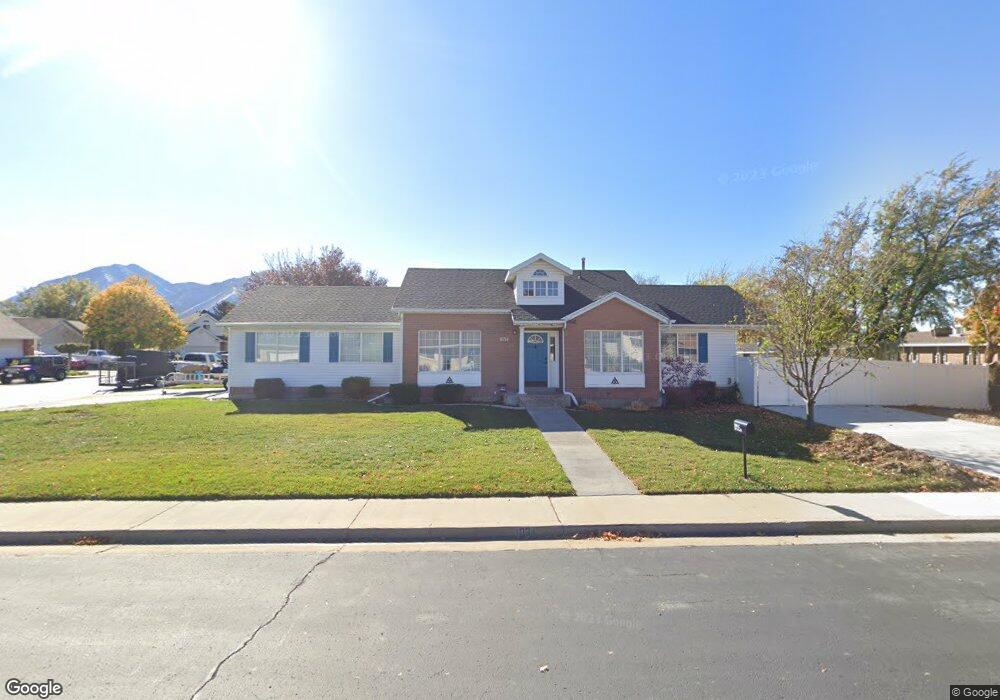
1034 E 180 S Spanish Fork, UT 84660
Estimated Value: $517,000 - $536,000
5
Beds
2
Baths
2,720
Sq Ft
$193/Sq Ft
Est. Value
About This Home
This home is located at 1034 E 180 S, Spanish Fork, UT 84660 and is currently estimated at $526,048, approximately $193 per square foot. 1034 E 180 S is a home located in Utah County with nearby schools including Larsen Elementary School, Spanish Fork Jr High School, and Spanish Fork High School.
Ownership History
Date
Name
Owned For
Owner Type
Purchase Details
Closed on
Nov 12, 2009
Sold by
Lee David Earl and The Carl A Lee Family Trust
Bought by
Carr Michael J and Carr Leslie J
Current Estimated Value
Home Financials for this Owner
Home Financials are based on the most recent Mortgage that was taken out on this home.
Original Mortgage
$195,395
Outstanding Balance
$126,800
Interest Rate
4.88%
Mortgage Type
FHA
Estimated Equity
$399,248
Purchase Details
Closed on
May 29, 2002
Sold by
Graff Jeffery L and Graff Mary Lynne
Bought by
Lee Carl A and Lee Sylvia B
Create a Home Valuation Report for This Property
The Home Valuation Report is an in-depth analysis detailing your home's value as well as a comparison with similar homes in the area
Home Values in the Area
Average Home Value in this Area
Purchase History
| Date | Buyer | Sale Price | Title Company |
|---|---|---|---|
| Carr Michael J | -- | Title West Spanish Fork | |
| Lee Carl A | -- | Sundance Title Ins Agency |
Source: Public Records
Mortgage History
| Date | Status | Borrower | Loan Amount |
|---|---|---|---|
| Open | Carr Michael J | $195,395 |
Source: Public Records
Tax History
| Year | Tax Paid | Tax Assessment Tax Assessment Total Assessment is a certain percentage of the fair market value that is determined by local assessors to be the total taxable value of land and additions on the property. | Land | Improvement |
|---|---|---|---|---|
| 2025 | $2,435 | $271,700 | -- | -- |
| 2024 | $2,435 | $251,020 | $0 | $0 |
| 2023 | $2,504 | $258,335 | $0 | $0 |
| 2022 | $2,509 | $253,880 | $0 | $0 |
| 2021 | $2,096 | $339,300 | $110,300 | $229,000 |
| 2020 | $1,984 | $312,300 | $100,300 | $212,000 |
| 2019 | $1,821 | $301,600 | $89,600 | $212,000 |
| 2018 | $1,687 | $270,000 | $81,000 | $189,000 |
| 2017 | $1,520 | $130,790 | $0 | $0 |
| 2016 | $1,386 | $117,645 | $0 | $0 |
| 2015 | $1,337 | $112,200 | $0 | $0 |
| 2014 | $1,239 | $104,335 | $0 | $0 |
Source: Public Records
Map
Nearby Homes
- 1159 E 100 S
- 973 E 60 S
- 1238 E 100 S
- 2998 Canyon Dr Unit 333
- 3014 Canyon Dr Unit 332
- 325 S 1230 E
- 136 N 1120 E
- 277 S 700 E
- 2583 E 300 S Unit 21
- 1455 E 100 S
- 306 N 1070 E
- 306 N 1070 E Unit 17
- 274 N 1070 E Unit 14
- 299 N 1070 E
- 299 N 1070 E Unit 8
- 212 N 1070 E Unit 9
- 224 N 1070 E Unit 10
- 1108 E 260 N
- 284 N 1000 E
- 998 E 260 N Unit 16
Your Personal Tour Guide
Ask me questions while you tour the home.