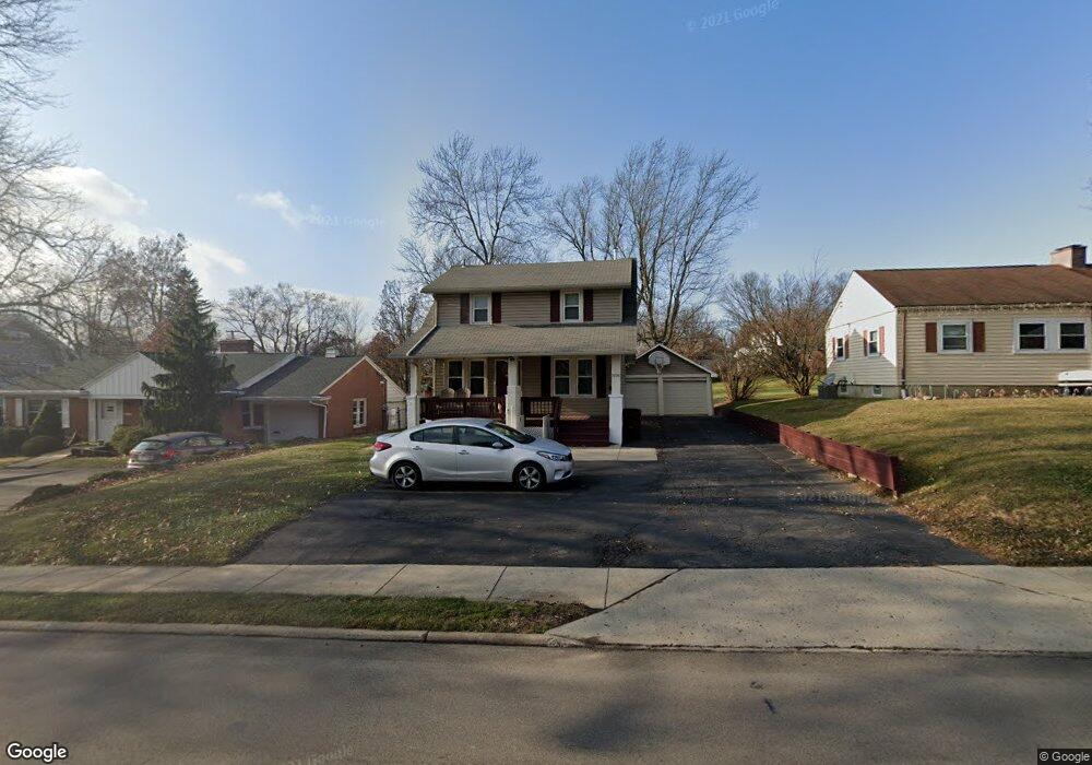
1034 Lexington Ave Mansfield, OH 44907
Estimated Value: $182,522 - $218,000
3
Beds
1
Bath
1,548
Sq Ft
$129/Sq Ft
Est. Value
About This Home
This home is located at 1034 Lexington Ave, Mansfield, OH 44907 and is currently estimated at $200,381, approximately $129 per square foot. 1034 Lexington Ave is a home located in Richland County with nearby schools including Mansfield Christian School, Discovery School, and Mansfield Seventh-day Adventist School.
Ownership History
Date
Name
Owned For
Owner Type
Purchase Details
Closed on
Jul 18, 1995
Sold by
Weed Michael J
Bought by
Saalman Stan
Current Estimated Value
Home Financials for this Owner
Home Financials are based on the most recent Mortgage that was taken out on this home.
Original Mortgage
$47,500
Interest Rate
7.79%
Mortgage Type
New Conventional
Create a Home Valuation Report for This Property
The Home Valuation Report is an in-depth analysis detailing your home's value as well as a comparison with similar homes in the area
Home Values in the Area
Average Home Value in this Area
Purchase History
| Date | Buyer | Sale Price | Title Company |
|---|---|---|---|
| Saalman Stan | $50,000 | -- |
Source: Public Records
Mortgage History
| Date | Status | Borrower | Loan Amount |
|---|---|---|---|
| Closed | Saalman Stan | $47,500 |
Source: Public Records
Tax History Compared to Growth
Tax History
| Year | Tax Paid | Tax Assessment Tax Assessment Total Assessment is a certain percentage of the fair market value that is determined by local assessors to be the total taxable value of land and additions on the property. | Land | Improvement |
|---|---|---|---|---|
| 2024 | $2,042 | $43,610 | $7,360 | $36,250 |
| 2023 | $2,042 | $43,610 | $7,360 | $36,250 |
| 2022 | $1,770 | $31,670 | $6,420 | $25,250 |
| 2021 | $1,782 | $31,670 | $6,420 | $25,250 |
| 2020 | $1,822 | $31,670 | $6,420 | $25,250 |
| 2019 | $1,718 | $26,950 | $5,440 | $21,510 |
| 2018 | $1,695 | $26,950 | $5,440 | $21,510 |
| 2017 | $1,649 | $26,950 | $5,440 | $21,510 |
| 2016 | $1,691 | $26,800 | $6,250 | $20,550 |
| 2015 | $1,691 | $26,800 | $6,250 | $20,550 |
| 2014 | $1,594 | $26,800 | $6,250 | $20,550 |
| 2012 | $1,152 | $25,420 | $6,580 | $18,840 |
Source: Public Records
Map
Nearby Homes
- 1009 Woodhill Rd
- 501 Clifton Blvd
- 654 Courtwright Blvd
- 589 Andover Rd
- 476 Glendale Blvd
- 0 U S Highway 42
- 1163 Woodland Rd
- 1156 Briarwood Rd
- 0 George Ave
- 421 Edgewood Rd
- 0 Lexington Ave Unit 224009661
- 1156 Yorkwood Rd
- 431 Overlook Rd
- 655 Woodhill Rd
- 646 Kennedy Dr
- 240 Whippoorwill Ln Unit 240
- 136 Elmridge Rd
- 400 Davis Rd
- 710 Cloverleaf Ct
- 0 Bally Row Unit Lot 22940 223011208
- 1026 Lexington Ave
- 1038 Lexington Ave
- 1022 Lexington Ave
- 1044 Lexington Ave
- 567 Westview Blvd
- 561 Westview Blvd
- 573 Westview Blvd
- 580 Clifton Blvd
- 1043 Lexington Ave
- 1047 Lexington Ave
- 579 Westview Blvd
- 1023 Lexington Ave
- 584 Clifton Blvd
- 525 Westview Blvd
- 587 Westview Blvd
- 1055 Lexington Ave
- 592 Clifton Blvd
- 591 Westview Blvd
- 540 Clifton Blvd
- 1063 Lexington Ave