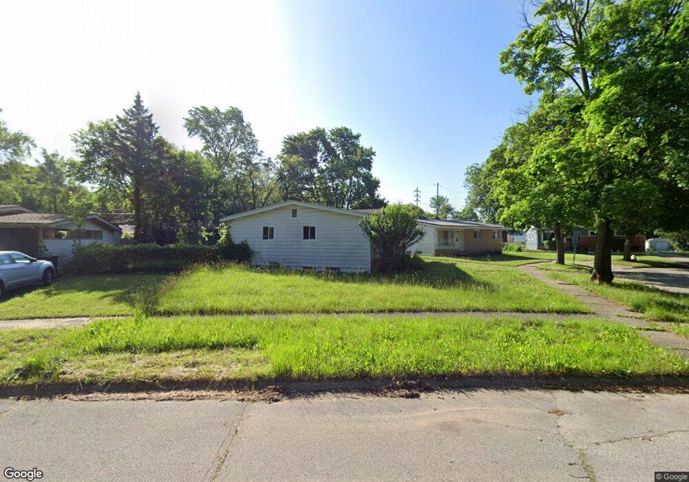
1034 McKeighan Ave Flint, MI 48507
Circle Drive NeighborhoodEstimated Value: $81,000 - $92,000
3
Beds
1
Bath
1,049
Sq Ft
$83/Sq Ft
Est. Value
About This Home
This home is located at 1034 McKeighan Ave, Flint, MI 48507 and is currently estimated at $86,795, approximately $82 per square foot. 1034 McKeighan Ave is a home located in Genesee County with nearby schools including Freeman Elementary School, Flint Southwestern Classical Academy, and International Academy of Flint (K-12).
Ownership History
Date
Name
Owned For
Owner Type
Purchase Details
Closed on
Sep 27, 2016
Sold by
Edwin Enterprises Llc
Bought by
Montague D & M Acquisition Llc
Current Estimated Value
Purchase Details
Closed on
Aug 30, 2012
Sold by
Edwin Enterprise Llc
Bought by
D & M Acquisitions Llc
Purchase Details
Closed on
Jan 8, 2004
Sold by
Johnson Russell E and Johnson Sharon E
Bought by
Edwin Enterprises Llc
Purchase Details
Closed on
Jun 17, 2002
Sold by
Gunderson Marian
Bought by
Johnson Russell and Johnson Sharon
Create a Home Valuation Report for This Property
The Home Valuation Report is an in-depth analysis detailing your home's value as well as a comparison with similar homes in the area
Home Values in the Area
Average Home Value in this Area
Purchase History
| Date | Buyer | Sale Price | Title Company |
|---|---|---|---|
| Montague D & M Acquisition Llc | -- | None Available | |
| D & M Acquisitions Llc | -- | Lighthouse Title Inc | |
| Edwin Enterprises Llc | -- | -- | |
| Johnson Russell | $35,000 | -- |
Source: Public Records
Tax History Compared to Growth
Tax History
| Year | Tax Paid | Tax Assessment Tax Assessment Total Assessment is a certain percentage of the fair market value that is determined by local assessors to be the total taxable value of land and additions on the property. | Land | Improvement |
|---|---|---|---|---|
| 2025 | $992 | $41,800 | $0 | $0 |
| 2024 | $922 | $35,800 | $0 | $0 |
| 2023 | $904 | $30,300 | $0 | $0 |
| 2022 | $0 | $23,500 | $0 | $0 |
| 2021 | $915 | $22,200 | $0 | $0 |
| 2020 | $845 | $21,300 | $0 | $0 |
| 2019 | $1,495 | $11,100 | $0 | $0 |
| 2018 | $811 | $9,800 | $0 | $0 |
| 2017 | $1,209 | $0 | $0 | $0 |
| 2016 | $786 | $0 | $0 | $0 |
| 2015 | -- | $0 | $0 | $0 |
| 2014 | -- | $0 | $0 | $0 |
| 2012 | -- | $15,200 | $0 | $0 |
Source: Public Records
Map
Nearby Homes
- 4424 Cheyenne Ave
- 4310 Cheyenne Ave
- 810 Macdonald Ave
- 3343 Cheyenne Ave
- 621 Burroughs Ave
- 630 Buckingham Ave
- 3614 Comanche Ave
- 3505 Comanche Ave
- 4127 Custer Ave
- 454 E Atherton Rd
- 0000 E Bristol Rd
- 4205 Red Arrow Rd
- 326 Burroughs Ave
- 3115 Circle Dr
- 3512 Barcey Ct
- 2910 Shawnee Ave
- 3129 Christner St
- 2207 E Boatfield Ave
- 2231 E Bergin Ave
- 2220 E Bergin Ave
- 4413 Shawnee Ave
- 4409 Shawnee Ave
- 4420 Cheyenne Ave
- 4428 Cheyenne Ave
- 1030 McKeighan Ave
- 4416 Cheyenne Ave
- 4414 Shawnee Ave
- 1021 McKeighan Ave
- 1026 McKeighan Ave
- 1018 Dell Ave
- 4502 Cheyenne Ave
- 4405 Shawnee Ave
- 4412 Cheyenne Ave
- 1022 McKeighan Ave
- 1015 McKeighan Ave
- 1018 McKeighan Ave
- 4506 Cheyenne Ave
- 4401 Shawnee Ave
- 4408 Cheyenne Ave
- 1014 Dell Ave