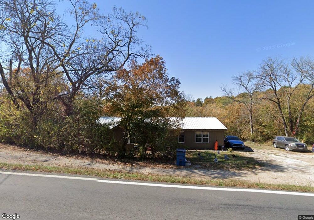
1034 State Highway Bb Hollister, MO 65672
Estimated Value: $163,225 - $281,000
--
Bed
--
Bath
1,856
Sq Ft
$113/Sq Ft
Est. Value
About This Home
This home is located at 1034 State Highway Bb, Hollister, MO 65672 and is currently estimated at $208,806, approximately $112 per square foot. 1034 State Highway Bb is a home located in Taney County with nearby schools including Hollister Elementary School, Hollister Middle School, and Hollister High School.
Ownership History
Date
Name
Owned For
Owner Type
Purchase Details
Closed on
Feb 25, 2015
Sold by
Beasley Walter K and Beasley Sabdra J
Bought by
Kenyon Bobby G and Wilson Danielle
Current Estimated Value
Purchase Details
Closed on
Jun 17, 2014
Sold by
Toner Eugene H
Bought by
Danner G Louanne and G Louanne Danner Revocable Trust
Purchase Details
Closed on
Sep 3, 2013
Sold by
Kelley Kenyson Gene Benton and Kelley Kenyson
Bought by
Kenyon Bobby G and Wilson Danielle
Create a Home Valuation Report for This Property
The Home Valuation Report is an in-depth analysis detailing your home's value as well as a comparison with similar homes in the area
Home Values in the Area
Average Home Value in this Area
Purchase History
| Date | Buyer | Sale Price | Title Company |
|---|---|---|---|
| Kenyon Bobby G | -- | None Available | |
| Danner G Louanne | -- | None Available | |
| Kenyon Bobby G | -- | None Available |
Source: Public Records
Mortgage History
| Date | Status | Borrower | Loan Amount |
|---|---|---|---|
| Closed | Kenyon Bobby G | $0 |
Source: Public Records
Tax History Compared to Growth
Tax History
| Year | Tax Paid | Tax Assessment Tax Assessment Total Assessment is a certain percentage of the fair market value that is determined by local assessors to be the total taxable value of land and additions on the property. | Land | Improvement |
|---|---|---|---|---|
| 2025 | $643 | $10,270 | -- | -- |
| 2023 | $643 | $11,590 | $0 | $0 |
| 2022 | $587 | $10,750 | $0 | $0 |
| 2021 | $568 | $10,750 | $0 | $0 |
| 2019 | $519 | $9,620 | $0 | $0 |
| 2018 | $381 | $6,930 | $0 | $0 |
| 2017 | $377 | $6,930 | $0 | $0 |
| 2016 | $373 | $6,930 | $0 | $0 |
| 2015 | $371 | $6,930 | $0 | $0 |
| 2014 | $358 | $6,650 | $0 | $0 |
Source: Public Records
Map
Nearby Homes
- 215 Sagers Ln
- 181 Sagers Ln
- 235 Sagers Ln
- 229 Sagers Ln
- 243 Sagers Ln
- 169 Michaels Dr
- 152 Rea St
- 142 Oakwood Estates Ct
- 177 Foley St
- 221 Foley St
- 313 Laurel St
- Lot 1 Cedar Landing Subdivision
- 182 Gumdrop Dr
- 1490 State Highway Bb
- 331 Evergreen Ave
- 141 Jade Ct
- 265 Lakeview Dr
- 24 & 25 Lakeview Dr
- 000 Lakeview Dr
- 372 Greenbrier Ln