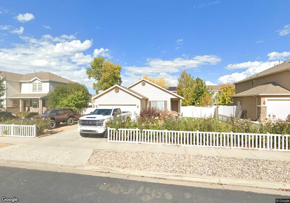
1034 W 520 S Spanish Fork, UT 84660
Estimated Value: $429,000 - $493,000
3
Beds
2
Baths
1,450
Sq Ft
$312/Sq Ft
Est. Value
About This Home
This home is located at 1034 W 520 S, Spanish Fork, UT 84660 and is currently estimated at $452,668, approximately $312 per square foot. 1034 W 520 S is a home located in Utah County with nearby schools including Riverview Elementary School, Spanish Fork Jr High School, and Spanish Fork High School.
Ownership History
Date
Name
Owned For
Owner Type
Purchase Details
Closed on
May 16, 2019
Sold by
Darling Bryan and Darling Sydney
Bought by
Darling Family Holdings Llc Series Four
Current Estimated Value
Purchase Details
Closed on
Mar 21, 2019
Sold by
Darling Bryan and Darling Sydney
Bought by
Darling Family Holdings Llc Series Four
Purchase Details
Closed on
Sep 29, 2015
Sold by
Darling Brian and Darling Sydney
Bought by
Darling Bryan and Darling Sydney
Home Financials for this Owner
Home Financials are based on the most recent Mortgage that was taken out on this home.
Original Mortgage
$138,750
Outstanding Balance
$108,795
Interest Rate
3.78%
Mortgage Type
New Conventional
Estimated Equity
$343,873
Purchase Details
Closed on
Sep 25, 2015
Sold by
Tungsten Peak Properties Llc
Bought by
Darling Brian and Darling Sydney
Home Financials for this Owner
Home Financials are based on the most recent Mortgage that was taken out on this home.
Original Mortgage
$138,750
Outstanding Balance
$108,795
Interest Rate
3.78%
Mortgage Type
New Conventional
Estimated Equity
$343,873
Purchase Details
Closed on
Oct 21, 2013
Sold by
Thomas Jaymon J and Thomas Emma N
Bought by
Tungsten Peak Properties Llc
Home Financials for this Owner
Home Financials are based on the most recent Mortgage that was taken out on this home.
Original Mortgage
$91,200
Interest Rate
4.53%
Mortgage Type
Future Advance Clause Open End Mortgage
Purchase Details
Closed on
Nov 3, 2008
Sold by
Thomas M Jay and Thomas Sharla N
Bought by
Thomas Jaymon J and Thomas Emma N
Home Financials for this Owner
Home Financials are based on the most recent Mortgage that was taken out on this home.
Original Mortgage
$144,000
Interest Rate
6.09%
Mortgage Type
New Conventional
Purchase Details
Closed on
Dec 27, 2007
Sold by
Miner F Dean and Miner Vivian G
Bought by
Thomas M Jay and Thomas Sharla N
Purchase Details
Closed on
Feb 11, 2006
Sold by
Miner F Dean and Miner Vivian G
Bought by
Miner F Dean and Miner Vivian G
Purchase Details
Closed on
Nov 30, 2005
Sold by
Fieldstone Homes Utah Llc
Bought by
Miner F Dean and Miner Vivian G
Home Financials for this Owner
Home Financials are based on the most recent Mortgage that was taken out on this home.
Original Mortgage
$122,600
Interest Rate
6.07%
Mortgage Type
New Conventional
Create a Home Valuation Report for This Property
The Home Valuation Report is an in-depth analysis detailing your home's value as well as a comparison with similar homes in the area
Home Values in the Area
Average Home Value in this Area
Purchase History
| Date | Buyer | Sale Price | Title Company |
|---|---|---|---|
| Darling Family Holdings Llc Series Four | -- | None Available | |
| Darling Family Holdings Llc Series Four | -- | None Available | |
| Darling Bryan | -- | Pro Title And Escrow Inc | |
| Darling Brian | -- | Fidelity Land & Title | |
| Tungsten Peak Properties Llc | -- | Inwest Title Services | |
| Thomas Jaymon J | -- | Utah First Title Insurance | |
| Thomas M Jay | -- | Bonneville Superior Af | |
| Miner F Dean | -- | Bartlett Title Insurance Ag | |
| Miner F Dean | -- | Bartlett Title Insurance Ag |
Source: Public Records
Mortgage History
| Date | Status | Borrower | Loan Amount |
|---|---|---|---|
| Open | Darling Bryan | $138,750 | |
| Previous Owner | Tungsten Peak Properties Llc | $91,200 | |
| Previous Owner | Thomas Jaymon J | $144,000 | |
| Previous Owner | Miner F Dean | $122,600 |
Source: Public Records
Tax History Compared to Growth
Tax History
| Year | Tax Paid | Tax Assessment Tax Assessment Total Assessment is a certain percentage of the fair market value that is determined by local assessors to be the total taxable value of land and additions on the property. | Land | Improvement |
|---|---|---|---|---|
| 2025 | $2,036 | $218,900 | $172,400 | $225,600 |
| 2024 | $2,036 | $209,880 | $0 | $0 |
| 2023 | $2,081 | $214,720 | $0 | $0 |
| 2022 | $2,208 | $223,410 | $0 | $0 |
| 2021 | $1,847 | $299,000 | $103,000 | $196,000 |
| 2020 | $1,759 | $276,800 | $93,600 | $183,200 |
| 2019 | $1,525 | $252,600 | $85,400 | $167,200 |
| 2018 | $1,411 | $225,900 | $78,600 | $147,300 |
| 2017 | $1,298 | $111,705 | $0 | $0 |
| 2016 | $1,167 | $99,055 | $0 | $0 |
| 2015 | $1,132 | $94,930 | $0 | $0 |
| 2014 | $1,060 | $89,265 | $0 | $0 |
Source: Public Records
Map
Nearby Homes
- 1026 W 350 S
- 501 S 880 W
- 333 S 1170 W
- 1076 River Hill Dr
- 429 S 1280 W
- 1171 W 800 S Unit 38
- 231 S 880 W
- 1256 W 800 S Unit 25
- 1256 W 800 S
- 1377 W 450 S
- 1299 W 250 S
- 903 W 100 S
- Aspen Plan at River Point
- Solitude Plan at River Point
- Snowbasin Plan at River Point
- Telluride Plan at River Point
- Breckenridge Plan at River Point
- Sundance Plan at River Point
- Vail Plan at River Point
- Brighton Plan at River Point