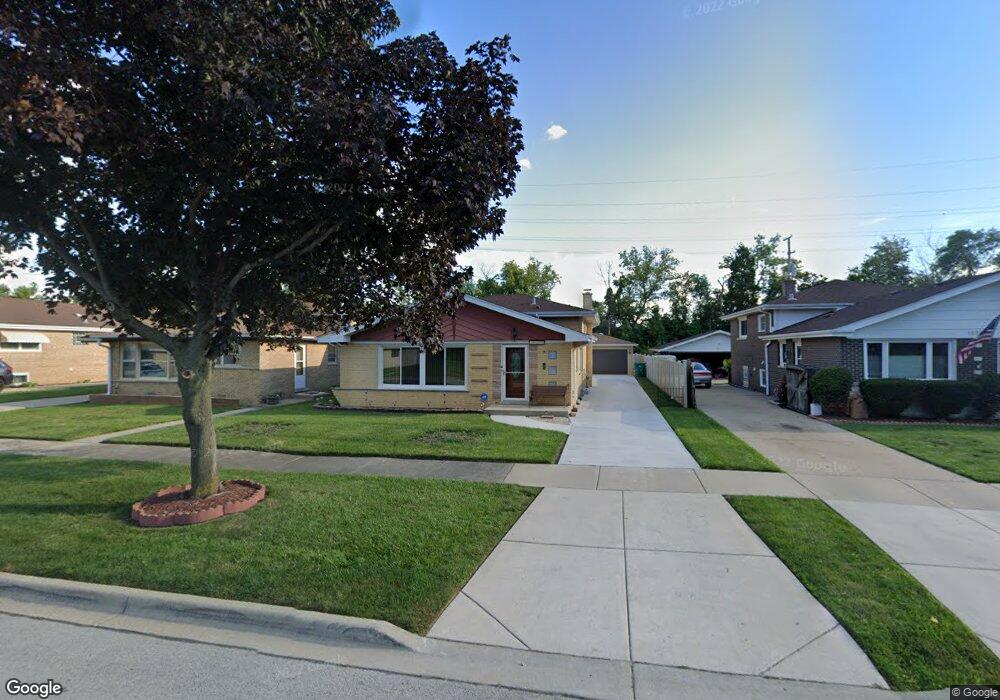
10341 Devonshire Ln Westchester, IL 60154
Estimated Value: $293,000 - $413,000
3
Beds
1
Bath
1,228
Sq Ft
$280/Sq Ft
Est. Value
About This Home
This home is located at 10341 Devonshire Ln, Westchester, IL 60154 and is currently estimated at $344,396, approximately $280 per square foot. 10341 Devonshire Ln is a home located in Cook County with nearby schools including Westchester Primary School, Westchester Intermediate School, and Westchester Middle School.
Ownership History
Date
Name
Owned For
Owner Type
Purchase Details
Closed on
Oct 29, 1999
Sold by
Scott Roger L and Scott Debra L
Bought by
Topps Leland H and Jenkins Mary E
Current Estimated Value
Home Financials for this Owner
Home Financials are based on the most recent Mortgage that was taken out on this home.
Original Mortgage
$161,500
Outstanding Balance
$49,417
Interest Rate
7.78%
Estimated Equity
$294,979
Create a Home Valuation Report for This Property
The Home Valuation Report is an in-depth analysis detailing your home's value as well as a comparison with similar homes in the area
Home Values in the Area
Average Home Value in this Area
Purchase History
| Date | Buyer | Sale Price | Title Company |
|---|---|---|---|
| Topps Leland H | $170,000 | 1St American Title |
Source: Public Records
Mortgage History
| Date | Status | Borrower | Loan Amount |
|---|---|---|---|
| Open | Topps Leland H | $161,500 |
Source: Public Records
Tax History Compared to Growth
Tax History
| Year | Tax Paid | Tax Assessment Tax Assessment Total Assessment is a certain percentage of the fair market value that is determined by local assessors to be the total taxable value of land and additions on the property. | Land | Improvement |
|---|---|---|---|---|
| 2024 | $5,691 | $25,000 | $4,531 | $20,469 |
| 2023 | $4,032 | $25,000 | $4,531 | $20,469 |
| 2022 | $4,032 | $16,637 | $3,988 | $12,649 |
| 2021 | $3,929 | $16,635 | $3,987 | $12,648 |
| 2020 | $3,905 | $16,635 | $3,987 | $12,648 |
| 2019 | $4,057 | $17,789 | $3,625 | $14,164 |
| 2018 | $4,002 | $17,789 | $3,625 | $14,164 |
| 2017 | $3,941 | $17,789 | $3,625 | $14,164 |
| 2016 | $3,553 | $14,680 | $3,262 | $11,418 |
| 2015 | $3,471 | $14,680 | $3,262 | $11,418 |
| 2014 | $3,406 | $14,680 | $3,262 | $11,418 |
| 2013 | $3,557 | $16,781 | $3,262 | $13,519 |
Source: Public Records
Map
Nearby Homes
- 1245 S Mannheim Rd Unit 2
- 1247 S Mannheim Rd Unit 3
- 1244 Westchester Blvd
- 1318 Balmoral Ave
- 1128 Marshall Ave
- 1136 Park Place
- 920 Suffolk Ave
- 10524 Camelot St
- 114 Oak Ridge Ave
- 814 Norfolk Ave
- 10531 Camelot St
- 1406 Portsmouth Ave
- 759 Norfolk Ave
- 1039 Bellwood Ave
- 1035 Bohland Ave
- 923 Manchester Ave
- 1013 Bellwood Ave
- 626 Manchester Ave
- 802 Bristol Ave
- 3901 Jackson St
- 10347 Devonshire Ln
- 10335 Devonshire Ln
- 10351 Devonshire Ln
- 10327 Devonshire Ln
- 10321 Devonshire Ln
- 10357 Devonshire Ln
- 10322 Devonshire Ln
- 10315 Devonshire Ln
- 10309 Devonshire Ln
- 10306 Devonshire Ln
- 930 Worcester Ave
- 1004 Cromwell Ave
- 925 Worcester Ave
- 1000 Cromwell Ave
- 10305 Devonshire Ln
- 926 Cromwell Ave
- 921 Worcester Ave
- 10301 Devonshire Ln
- 957 S Mannheim Rd
- 920 Cromwell Ave