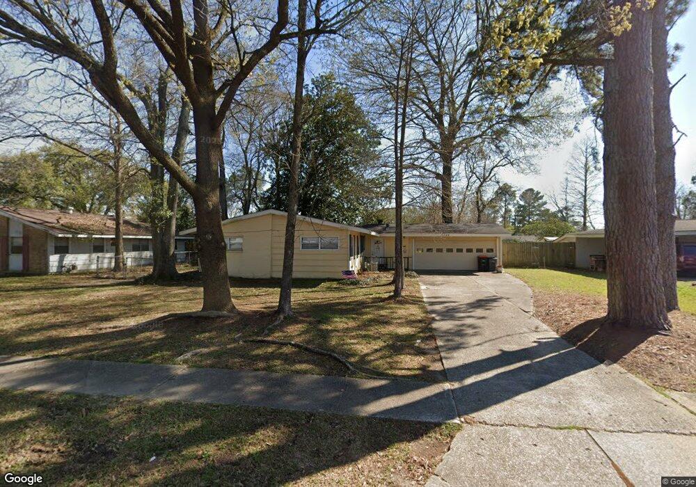
10344 Lebanon St Baton Rouge, LA 70816
Broadmoor/Sherwood NeighborhoodEstimated Value: $132,000 - $168,000
3
Beds
2
Baths
1,250
Sq Ft
$121/Sq Ft
Est. Value
About This Home
This home is located at 10344 Lebanon St, Baton Rouge, LA 70816 and is currently estimated at $151,189, approximately $120 per square foot. 10344 Lebanon St is a home located in East Baton Rouge Parish with nearby schools including Broadmoor Elementary School, Southeast Middle School, and Broadmoor Senior High School.
Ownership History
Date
Name
Owned For
Owner Type
Purchase Details
Closed on
Jul 18, 2003
Sold by
Motoco Enterprises
Bought by
Fakouri Patricia
Current Estimated Value
Home Financials for this Owner
Home Financials are based on the most recent Mortgage that was taken out on this home.
Original Mortgage
$64,900
Outstanding Balance
$27,447
Interest Rate
5.19%
Mortgage Type
New Conventional
Estimated Equity
$123,742
Create a Home Valuation Report for This Property
The Home Valuation Report is an in-depth analysis detailing your home's value as well as a comparison with similar homes in the area
Home Values in the Area
Average Home Value in this Area
Purchase History
| Date | Buyer | Sale Price | Title Company |
|---|---|---|---|
| Fakouri Patricia | $84,900 | -- |
Source: Public Records
Mortgage History
| Date | Status | Borrower | Loan Amount |
|---|---|---|---|
| Open | Fakouri Patricia | $64,900 |
Source: Public Records
Tax History Compared to Growth
Tax History
| Year | Tax Paid | Tax Assessment Tax Assessment Total Assessment is a certain percentage of the fair market value that is determined by local assessors to be the total taxable value of land and additions on the property. | Land | Improvement |
|---|---|---|---|---|
| 2024 | $207 | $8,500 | $1,200 | $7,300 |
| 2023 | $207 | $8,500 | $1,200 | $7,300 |
| 2022 | $1,015 | $8,500 | $1,200 | $7,300 |
| 2021 | $992 | $8,500 | $1,200 | $7,300 |
| 2020 | $985 | $8,500 | $1,200 | $7,300 |
| 2019 | $1,029 | $8,500 | $1,200 | $7,300 |
| 2018 | $1,017 | $8,500 | $1,200 | $7,300 |
| 2017 | $1,017 | $8,500 | $1,200 | $7,300 |
| 2016 | $77 | $5,945 | $1,200 | $4,745 |
| 2015 | $215 | $8,500 | $1,200 | $7,300 |
| 2014 | $215 | $8,500 | $1,200 | $7,300 |
| 2013 | -- | $8,500 | $1,200 | $7,300 |
Source: Public Records
Map
Nearby Homes
- 2321 Emmett Bourgeois Ln
- 10344 Old Hammond Hwy
- 10123 Hyde Park Ct
- 10115 Ambrose Ct
- 10218 N Magna Carta Place
- 10214 N Magna Carta Place
- 10008 N Magna Carta Place
- 1919 W Magna Carta Place
- 2421 Aubin Ln
- 2010 Red Stick Dr
- 2031 Red Stick Villas Dr
- 1850 Wimpole St
- 10926 Old Hammond Hwy Unit 27
- 10926 Old Hammond Hwy Unit 20
- 10970 Darius Dr
- 2020 Lac Cache Ct
- 11110 Boardwalk Dr Unit 55
- 11110 Boardwalk Dr Unit 41
- 1820 Carolyn Sue Dr Unit L
- 1820 Carolyn Sue Dr Unit B
- 10354 Lebanon St
- 10334 Lebanon St
- 10345 Cedarlane Ave
- 10364 Lebanon St
- 10355 Cedarlane Ave
- 10335 Cedarlane Ave
- 10357 Lebanon St
- 10365 Cedarlane Ave
- 10323 Cedarlane Ave
- 10369 Lebanon St
- 10335 Lebanon St
- 10424 Lebanon St
- 10421 Lebanon St
- 2225 Silverest Ave
- 10323 Lebanon St
- 2257 Silverest Ave
- 10434 Lebanon St
- 2279 Silverest Ave
- 10346 Cedarlane Ave
- 10354 Cyprus Cedar Ave