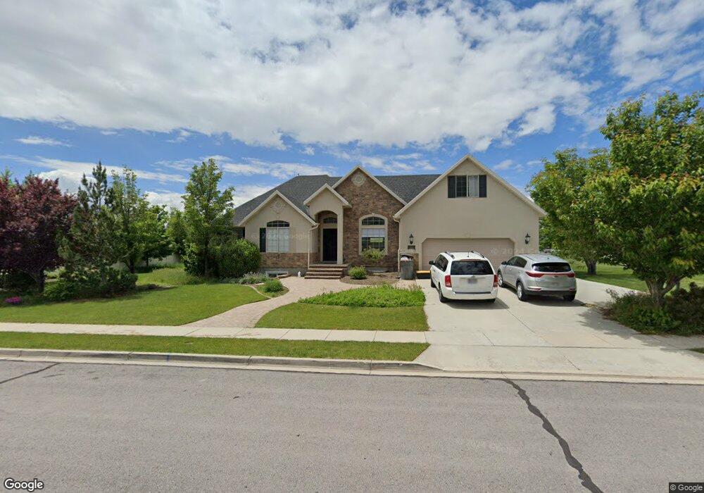
10345 N 4730 W American Fork, UT 84003
Estimated Value: $731,000 - $886,000
4
Beds
3
Baths
1,971
Sq Ft
$405/Sq Ft
Est. Value
About This Home
This home is located at 10345 N 4730 W, American Fork, UT 84003 and is currently estimated at $799,155, approximately $405 per square foot. 10345 N 4730 W is a home located in Utah County with nearby schools including Highland Elementary School, Mountain Ridge Junior High School, and Lone Peak High School.
Ownership History
Date
Name
Owned For
Owner Type
Purchase Details
Closed on
Feb 14, 2005
Sold by
Patriot Homes Inc
Bought by
Kaylor David L and Kaylor Rebekah L
Current Estimated Value
Purchase Details
Closed on
Mar 23, 2004
Sold by
Wild Rose Development Llc
Bought by
Patriot Homes Inc
Home Financials for this Owner
Home Financials are based on the most recent Mortgage that was taken out on this home.
Original Mortgage
$198,230
Interest Rate
5.64%
Mortgage Type
Purchase Money Mortgage
Create a Home Valuation Report for This Property
The Home Valuation Report is an in-depth analysis detailing your home's value as well as a comparison with similar homes in the area
Home Values in the Area
Average Home Value in this Area
Purchase History
| Date | Buyer | Sale Price | Title Company |
|---|---|---|---|
| Kaylor David L | -- | Affiliated First Title Comp | |
| Patriot Homes Inc | -- | Affiliated First Title Comp |
Source: Public Records
Mortgage History
| Date | Status | Borrower | Loan Amount |
|---|---|---|---|
| Previous Owner | Patriot Homes Inc | $198,230 |
Source: Public Records
Tax History Compared to Growth
Tax History
| Year | Tax Paid | Tax Assessment Tax Assessment Total Assessment is a certain percentage of the fair market value that is determined by local assessors to be the total taxable value of land and additions on the property. | Land | Improvement |
|---|---|---|---|---|
| 2025 | $3,273 | $402,380 | $434,100 | $297,500 |
| 2024 | $3,273 | $404,250 | $0 | $0 |
| 2023 | $3,043 | $405,460 | $0 | $0 |
| 2022 | $3,138 | $405,405 | $0 | $0 |
| 2021 | $2,597 | $499,800 | $231,700 | $268,100 |
| 2020 | $2,488 | $469,600 | $201,500 | $268,100 |
| 2019 | $2,201 | $434,600 | $201,500 | $233,100 |
| 2018 | $2,316 | $434,600 | $201,500 | $233,100 |
| 2017 | $2,181 | $218,460 | $0 | $0 |
| 2016 | $2,236 | $209,275 | $0 | $0 |
| 2015 | $2,248 | $199,430 | $0 | $0 |
| 2014 | $2,074 | $182,325 | $0 | $0 |
Source: Public Records
Map
Nearby Homes
- 4756 W 10370 N
- 4616 W Carriage Ln
- 10535 Janie Ln
- 4812 W Pocosin Ct
- 4812 Pocosin Ct Unit 754
- 4816 W Pocosin Ct Unit 755
- 4822 W Pocosin Ct Unit 756
- 4822 W Pocosin Ct
- 10087 N Torreya Dr Unit 728
- 10088 N Loblobby Ln Unit 726
- 10088 N Loblobby Ln
- 4811 Pocosin Ct
- 4821 W Pocosin Ct Unit 751
- 10052 N Marigold Ln
- 4924 Willowstone Dr
- 4696 W Camellia Ln
- 10022 N Loblobby Ln Unit 713
- 10207 N Cottonwood Dr
- 4292 W Joshua Ln
- 10685 N Jerling Dr
- 10327 N 4730 W
- 10348 N 4800 W
- 10322 N 4800 W
- 10309 N 4730 W
- 4718 W 10300 N
- 4742 W 10370 N
- 4772 W 10370 N
- 4704 W 10300 N
- 10291 N 4730 W
- 4788 W 10370 N
- 10600 N 4800 W
- 10298 N 4800 W
- 4717 W 10300 N
- 4755 W Killarney Dr
- 4694 W 10300 N
- 4785 Killarney Dr
- 4785 W Killarney Dr
- 4725 Killarney Dr
- 4701 W 10300 N
- 10300 N 4800 W