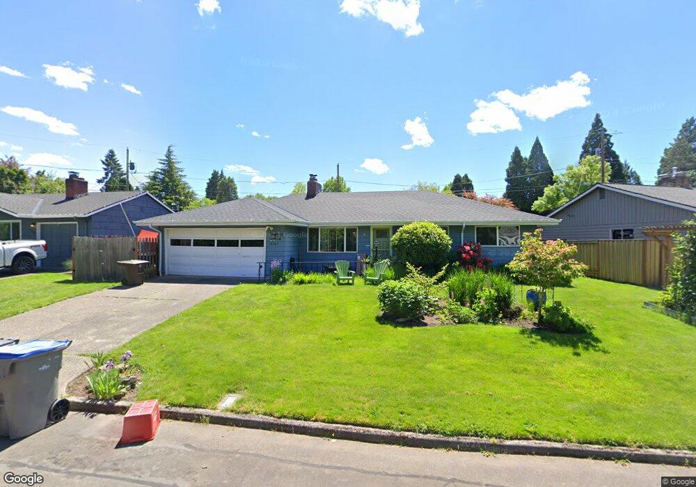
10345 SW Johnson St Portland, OR 97223
Greenburg Road NeighborhoodEstimated Value: $439,000 - $528,000
3
Beds
2
Baths
1,220
Sq Ft
$398/Sq Ft
Est. Value
About This Home
This home is located at 10345 SW Johnson St, Portland, OR 97223 and is currently estimated at $485,806, approximately $398 per square foot. 10345 SW Johnson St is a home located in Washington County with nearby schools including Charles F. Tigard Elementary School, Thomas R. Fowler Middle School, and Tigard High School.
Ownership History
Date
Name
Owned For
Owner Type
Purchase Details
Closed on
Nov 29, 2011
Sold by
Chatfield Walter H
Bought by
Brown Devn T and Brown Stacy M
Current Estimated Value
Home Financials for this Owner
Home Financials are based on the most recent Mortgage that was taken out on this home.
Original Mortgage
$178,438
Outstanding Balance
$124,325
Interest Rate
4.4%
Mortgage Type
FHA
Estimated Equity
$361,481
Create a Home Valuation Report for This Property
The Home Valuation Report is an in-depth analysis detailing your home's value as well as a comparison with similar homes in the area
Home Values in the Area
Average Home Value in this Area
Purchase History
| Date | Buyer | Sale Price | Title Company |
|---|---|---|---|
| Brown Devn T | $183,080 | Fidelity Natl Title Co Of Or |
Source: Public Records
Mortgage History
| Date | Status | Borrower | Loan Amount |
|---|---|---|---|
| Open | Brown Devn T | $178,438 |
Source: Public Records
Tax History Compared to Growth
Tax History
| Year | Tax Paid | Tax Assessment Tax Assessment Total Assessment is a certain percentage of the fair market value that is determined by local assessors to be the total taxable value of land and additions on the property. | Land | Improvement |
|---|---|---|---|---|
| 2025 | $3,681 | $215,880 | -- | -- |
| 2024 | $3,582 | $209,600 | -- | -- |
| 2023 | $3,582 | $203,500 | $0 | $0 |
| 2022 | $3,479 | $203,500 | $0 | $0 |
| 2021 | $3,392 | $191,830 | $0 | $0 |
| 2020 | $3,290 | $186,250 | $0 | $0 |
| 2019 | $3,148 | $180,830 | $0 | $0 |
| 2018 | $3,020 | $175,570 | $0 | $0 |
| 2017 | $2,911 | $170,460 | $0 | $0 |
| 2016 | $2,780 | $165,500 | $0 | $0 |
| 2015 | $2,672 | $160,680 | $0 | $0 |
| 2014 | $2,593 | $156,000 | $0 | $0 |
Source: Public Records
Map
Nearby Homes
- 10060 SW Molly Ct
- 10097 SW Woodard Ln
- 12065 SW Karol Ct
- 12230 SW 106th Dr
- 10455 SW Meadow St
- 10635 SW Watkins Place
- 10200 SW Tigard St
- 13235 SW Ash Dr
- 11010 SW Fonner St
- 11355 SW 97th Ct
- 11464 SW 96th Ave
- 11220 SW Buffalo Place
- 10985 SW Mira Ct
- 12393 SW 114th Terrace
- 13465 SW 107th Ave
- 11044 SW Greenburg Rd Unit 321
- 12557 SW 115th Ave
- 11790 SW 90th Ave
- 11287 SW 112th Ave
- 9096 SW Omara St
- 10375 SW Johnson St
- 10405 SW Johnson St
- 10245 SW Brookside Place
- 12375 SW Brookside Ave
- 10225 SW Brookside Place
- 10315 SW Brookside Place
- 12345 SW Brookside Ave
- 10410 SW Johnson Ct
- 12405 SW Brookside Ave
- 10395 SW Johnson Ct
- 10440 SW Johnson Ct
- 10365 SW Johnson St
- 10270 SW Brookside Place
- 10240 SW Brookside Place
- 23213 SW Johnson Ct
- 12370 SW Brookside Ave
- 10300 SW Brookside Place
- 12340 SW Brookside Ave
- 10210 SW Brookside Place
- 10335 SW Johnson St