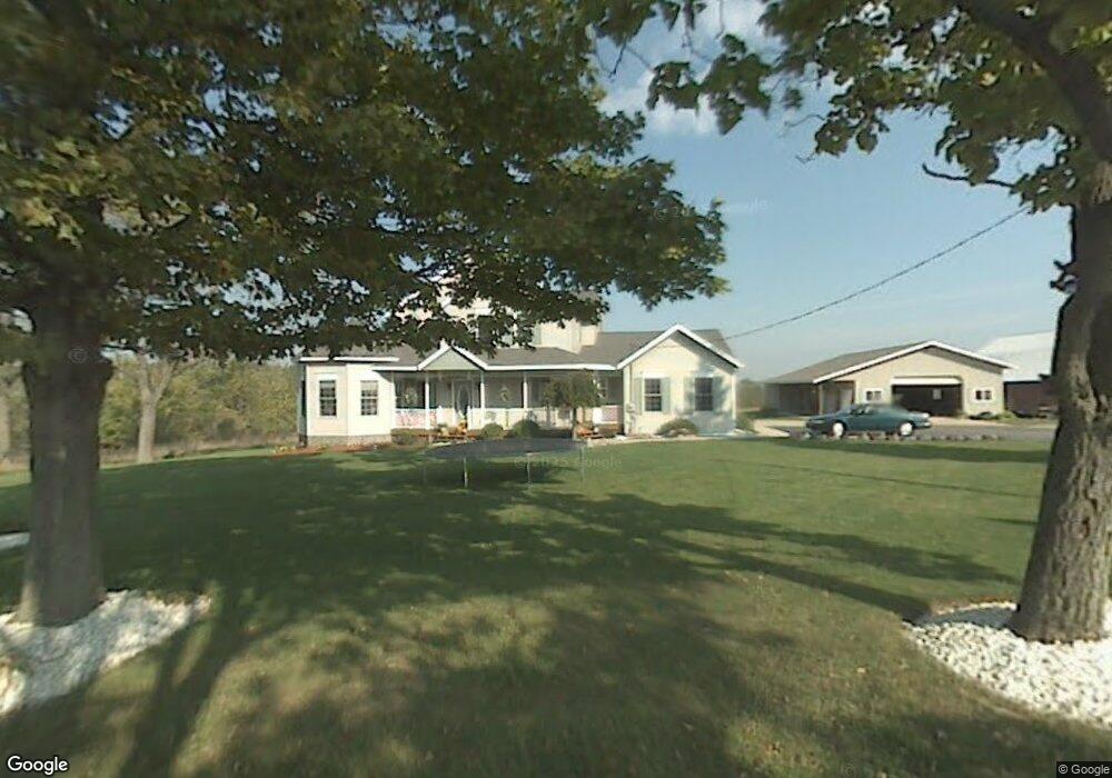
10347 Mason St Holland, MI 49423
Estimated Value: $475,963 - $755,000
--
Bed
1
Bath
2,472
Sq Ft
$241/Sq Ft
Est. Value
About This Home
This home is located at 10347 Mason St, Holland, MI 49423 and is currently estimated at $595,321, approximately $240 per square foot. 10347 Mason St is a home located in Ottawa County with nearby schools including Woodbridge Elementary School, Cityside Middle School, and Zeeland East High School.
Ownership History
Date
Name
Owned For
Owner Type
Purchase Details
Closed on
Oct 28, 2011
Sold by
Petroelje Joel Scott and Petroelje Deborah Ann
Bought by
Petroelje Joel Scott and Petroelje Deborah Ann
Current Estimated Value
Home Financials for this Owner
Home Financials are based on the most recent Mortgage that was taken out on this home.
Original Mortgage
$72,000
Interest Rate
4.09%
Mortgage Type
New Conventional
Create a Home Valuation Report for This Property
The Home Valuation Report is an in-depth analysis detailing your home's value as well as a comparison with similar homes in the area
Home Values in the Area
Average Home Value in this Area
Purchase History
| Date | Buyer | Sale Price | Title Company |
|---|---|---|---|
| Petroelje Joel Scott | -- | Lighthouse Title Inc | |
| Petroelje Joel Scott | -- | Lighthouse Title Inc |
Source: Public Records
Mortgage History
| Date | Status | Borrower | Loan Amount |
|---|---|---|---|
| Closed | Petroelje Joel Scott | $72,000 |
Source: Public Records
Tax History Compared to Growth
Tax History
| Year | Tax Paid | Tax Assessment Tax Assessment Total Assessment is a certain percentage of the fair market value that is determined by local assessors to be the total taxable value of land and additions on the property. | Land | Improvement |
|---|---|---|---|---|
| 2025 | $4,599 | $249,500 | $0 | $0 |
| 2024 | $2,901 | $212,600 | $0 | $0 |
| 2023 | $2,770 | $205,900 | $0 | $0 |
| 2022 | $4,167 | $200,000 | $0 | $0 |
| 2021 | $4,046 | $185,300 | $0 | $0 |
| 2020 | $4,004 | $167,400 | $0 | $0 |
| 2019 | $3,941 | $113,100 | $0 | $0 |
| 2018 | $3,630 | $137,200 | $24,100 | $113,100 |
| 2017 | $3,578 | $133,700 | $0 | $0 |
| 2016 | $3,551 | $128,100 | $0 | $0 |
| 2015 | $3,343 | $114,600 | $0 | $0 |
| 2014 | $3,343 | $111,000 | $0 | $0 |
Source: Public Records
Map
Nearby Homes
- 179 Peppermint Dr
- Lot 17 of Peppermint Dr
- Lot 16 Peppermint Dr
- Lot 15 Peppermint Dr
- 171 Peppermint Dr
- 165 Peppermint Dr
- 1391 Quarterline Commons
- 177 96th Ave
- VL Ottogan St
- 10058 Prairie Grass Ct
- 0 96th Ave Unit 1.94 25027197
- 0 96th Ave
- 1433 Savannah Dr Unit 18
- 5216 Mulberry Ln
- 5232 E Sunfield Ln
- 5219 Hollow Ln
- 5221 Hollow Ln
- 403 Stratford Way
- 160 Sorrento Dr
- 1568 Stockington Path
- 10297 Mason St
- 567 104th Ave
- 535 104th Ave
- 12 Sand Castle Dr
- 579 104th Ave
- 591 104th Ave
- 182 Willowgate Dr
- 10457 Sunbranch Dr
- 10469 Sunbranch Dr
- 172 Willowgate Dr
- 10491 Sunbranch Dr
- 144 104th Ave
- 10464 Sunbranch Dr
- 160 Willowgate Dr
- 10486 Sunbranch Dr
- 10480 Sunbranch Dr
- 10513 Sunbranch Dr
- 10642 Northridge Ct
- 145 104th Ave
- 148 Willowgate Dr