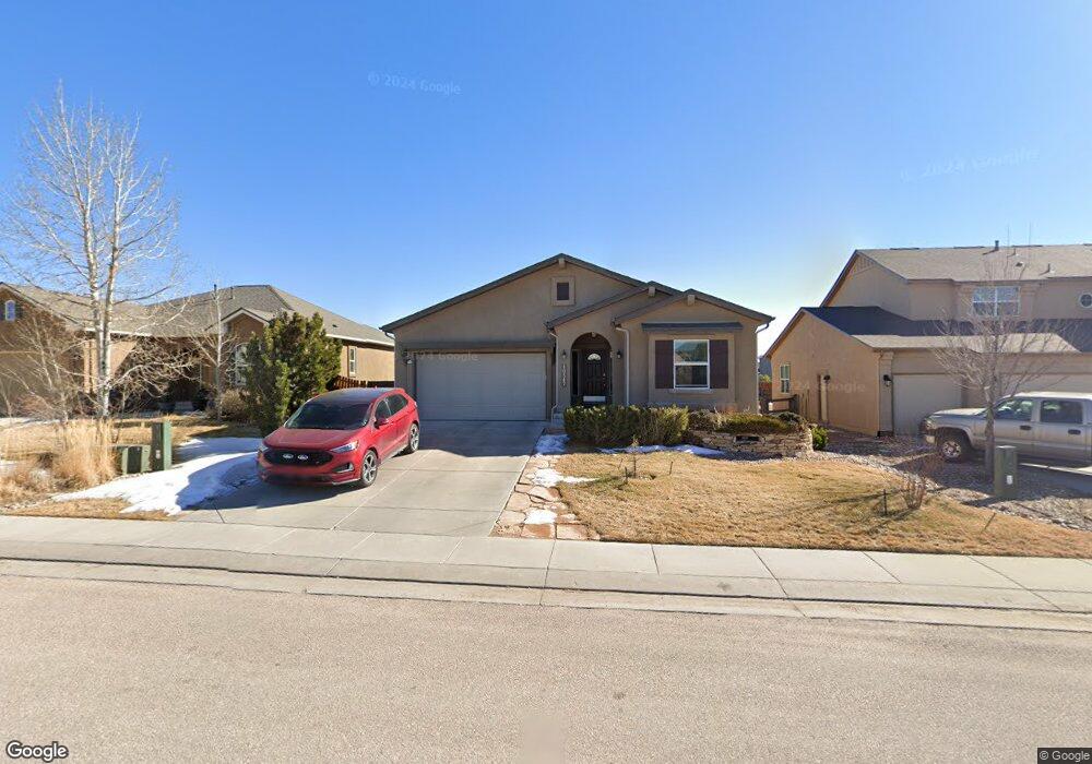
10347 Mount Evans Dr Peyton, CO 80831
Falcon NeighborhoodEstimated Value: $480,402 - $575,000
About This Home
This home is located at 10347 Mount Evans Dr, Peyton, CO 80831 and is currently estimated at $529,101, approximately $327 per square foot. 10347 Mount Evans Dr is a home located in El Paso County with nearby schools including Meridian Ranch Elementary School, Falcon Middle School, and Falcon High School.
Ownership History
We collect this data history from publicly available records. To have your information removed, we recommend requesting removal directly through your county’s website.
Purchase Details
Purchase Details
Home Values in the Area
Average Home Value in this Area
Purchase History
We collect this data history from publicly available records. To have your information removed, we recommend requesting removal directly through your county’s website.
| Date | Buyer | Sale Price | Title Company |
|---|---|---|---|
| $315,186 | Cb Title | ||
| $67,500 | Fahtco |
Mortgage History
We collect this data history from publicly available records. To have your information removed, we recommend requesting removal directly through your county’s website.
| Date | Status | Borrower | Loan Amount |
|---|---|---|---|
| Open | $80,000 | ||
| Closed | $80,000 |
Tax History
We collect this data history from publicly available records. To have your information removed, we recommend requesting removal directly through your county’s website.
| Year | Tax Paid | Tax Assessment Tax Assessment Total Assessment is a certain percentage of the fair market value that is determined by local assessors to be the total taxable value of land and additions on the property. | Land | Improvement |
|---|---|---|---|---|
| 2026 | $1,656 | $34,230 | ||
| 2025 | $3,185 | $34,230 | ||
| 2024 | $3,185 | $34,840 | $7,200 | $27,640 |
| 2022 | $2,621 | $25,970 | $5,910 | $20,060 |
| 2021 | $2,717 | $26,720 | $6,080 | $20,640 |
| 2020 | $2,647 | $24,140 | $5,510 | $18,630 |
| 2019 | $2,632 | $24,140 | $5,510 | $18,630 |
| 2018 | $2,427 | $22,030 | $5,040 | $16,990 |
| 2017 | $2,296 | $22,030 | $5,040 | $16,990 |
| 2016 | $2,468 | $24,250 | $5,570 | $18,680 |
| 2015 | $2,469 | $24,250 | $5,570 | $18,680 |
| 2014 | $2,273 | $22,050 | $4,780 | $17,270 |
Map
- 10308 Mount Evans Dr
- 12555 Handles Peak Way
- 10487 Mount Evans Dr
- 12663 Handles Peak Way
- 12432 Mount Bross Place
- 12619 Stone Valley Dr
- 12734 Mt Harvard Dr
- 10138 Golf Crest Dr
- 10614 Mt Emerald Dr
- 10078 Stonemont Dr
- 12554 Granite Springs Place
- 12752 Mt Oxford Place
- 12547 Granite Springs Place
- 10089 Golf Crest Dr
- 9982 Golf Crest Dr
- 10225 Mt Lincoln Dr
- 9826 Golf Crest Dr
- 12820 Stone Valley Dr
- 10417 Mt Lincoln Dr
- 12828 Stone Valley Dr
- 10348 Mount Evans Dr
- 10338 Mount Evans Dr
- 10358 Mount Evans Dr
- 10361 Mount Wilson Place
- 10328 Mount Evans Dr
- 10347 Mount Wilson Place
- 10375 Mount Wilson Place
- 10333 Mount Wilson Place
- 10378 Mount Evans Dr
- 10357 Mount Evans Dr
- 10337 Mount Evans Dr
- 10389 Mount Wilson Place
- 10318 Mount Evans Dr
- 10319 Mount Wilson Place
- 10403 Mount Wilson Place
- 10377 Mount Evans Dr
- 10273 Capital Peak Way
- 10387 Mount Evans Dr
- 10360 Mount Wilson Place
- 10346 Mount Wilson Place
Ask me questions while you tour the home.