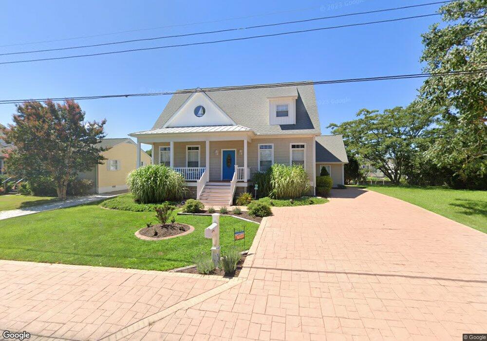
10347 New Quay Rd Ocean City, MD 21842
West Ocean City NeighborhoodEstimated Value: $654,724 - $726,000
4
Beds
3
Baths
2,052
Sq Ft
$331/Sq Ft
Est. Value
About This Home
This home is located at 10347 New Quay Rd, Ocean City, MD 21842 and is currently estimated at $680,181, approximately $331 per square foot. 10347 New Quay Rd is a home located in Worcester County with nearby schools including Ocean City Elementary School, Stephen Decatur Middle School, and Berlin Intermediate School.
Ownership History
Date
Name
Owned For
Owner Type
Purchase Details
Closed on
Nov 7, 2022
Sold by
Lloyd Ronald and Lloyd Theresa L
Bought by
Ronald Lloyd Revocable Trust and Theresa L Lloyd Revocable Trust
Current Estimated Value
Purchase Details
Closed on
Dec 22, 2008
Sold by
Withers Dale R
Bought by
Ronald Lloyd and Lloyd Theresa
Purchase Details
Closed on
Nov 1, 2008
Sold by
Withers Dale R
Bought by
Ronald Lloyd and Lloyd Theresa
Create a Home Valuation Report for This Property
The Home Valuation Report is an in-depth analysis detailing your home's value as well as a comparison with similar homes in the area
Home Values in the Area
Average Home Value in this Area
Purchase History
| Date | Buyer | Sale Price | Title Company |
|---|---|---|---|
| Ronald Lloyd Revocable Trust | -- | -- | |
| Ronald Lloyd Revocable Trust | -- | None Listed On Document | |
| Ronald Lloyd | $385,000 | -- | |
| Ronald Lloyd | $385,000 | -- |
Source: Public Records
Tax History Compared to Growth
Tax History
| Year | Tax Paid | Tax Assessment Tax Assessment Total Assessment is a certain percentage of the fair market value that is determined by local assessors to be the total taxable value of land and additions on the property. | Land | Improvement |
|---|---|---|---|---|
| 2025 | $4,529 | $490,700 | $176,600 | $314,100 |
| 2024 | $4,317 | $453,133 | $0 | $0 |
| 2023 | $3,959 | $415,567 | $0 | $0 |
| 2022 | $3,601 | $378,000 | $156,600 | $221,400 |
| 2021 | $3,554 | $371,333 | $0 | $0 |
| 2020 | $3,490 | $364,667 | $0 | $0 |
| 2019 | $3,426 | $358,000 | $169,500 | $188,500 |
| 2018 | $3,311 | $351,133 | $0 | $0 |
| 2017 | $3,260 | $344,267 | $0 | $0 |
| 2016 | -- | $337,400 | $0 | $0 |
| 2015 | $2,845 | $337,400 | $0 | $0 |
| 2014 | $2,845 | $337,400 | $0 | $0 |
Source: Public Records
Map
Nearby Homes
- 10352 Keyser Point Rd
- 10332 Walthan Rd
- 12542 Torquay Rd
- Lot 3 Windsor Rd
- Lot #1 Exeter Rd
- LOT#2 Exeter Rd
- 0 W Torquay Rd
- 12516 W Torquay Rd
- 10312 Bristol Rd
- 10427 New Quay Rd
- 10434 New Quay Rd
- 12624 Balte Rd
- Lot A Salisbury Rd
- 12524 Salisbury Rd
- 12608 Selsey Rd
- 12520 Selsey Rd
- 12403 Salisbury Rd
- 10305 Turtle Ct
- 0 Keyser Point Rd Unit MDWO118100
- 10288 Broken Sound Blvd
- 10349 New Quay Rd
- 10345 New Quay Rd
- 10355 New Quay Rd
- 10348 Keyser Point Rd
- 10346 Keyser Point Rd
- 10341 New Quay Rd
- 10357 New Quay Rd
- 10342 Keyser Point Rd
- 10344 New Quay Rd
- 10352 New Quay Rd
- 10342 New Quay Rd
- 10359 New Quay Rd
- 10356 New Quay Rd
- 10338 Keyser Point Rd
- 10354 Keyser Point Rd
- 10340 New Quay Rd
- 10358 New Quay Rd
- 10361 New Quay Rd
- 10338 New Quay Rd
- 12514 Windsor Rd