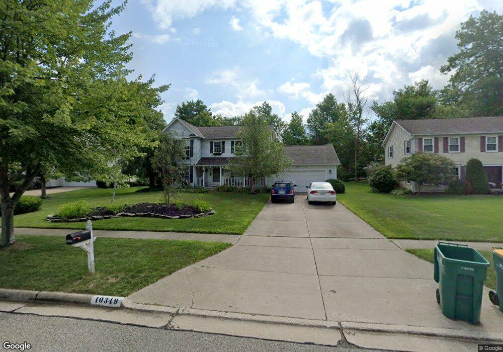
10349 Thompson Rye Cir Twinsburg, OH 44087
Estimated Value: $402,556 - $431,000
3
Beds
3
Baths
2,008
Sq Ft
$207/Sq Ft
Est. Value
About This Home
This home is located at 10349 Thompson Rye Cir, Twinsburg, OH 44087 and is currently estimated at $415,139, approximately $206 per square foot. 10349 Thompson Rye Cir is a home located in Summit County with nearby schools including Wilcox Primary School, Samuel Bissell Elementary School, and Dodge Intermediate School.
Ownership History
Date
Name
Owned For
Owner Type
Purchase Details
Closed on
May 10, 2007
Sold by
Patel Molly W
Bought by
Patel Molly W and The Molly W Patel Family Trust
Current Estimated Value
Purchase Details
Closed on
Oct 5, 2006
Sold by
Patel Jay J
Bought by
Patel Molly W
Purchase Details
Closed on
Jun 14, 1996
Sold by
Guest Richard E
Bought by
Patel Jay J and Patel Molly W
Home Financials for this Owner
Home Financials are based on the most recent Mortgage that was taken out on this home.
Original Mortgage
$152,000
Interest Rate
7%
Mortgage Type
New Conventional
Create a Home Valuation Report for This Property
The Home Valuation Report is an in-depth analysis detailing your home's value as well as a comparison with similar homes in the area
Home Values in the Area
Average Home Value in this Area
Purchase History
| Date | Buyer | Sale Price | Title Company |
|---|---|---|---|
| Patel Molly W | -- | Attorney | |
| Patel Molly W | -- | Attorney | |
| Patel Jay J | $191,000 | -- |
Source: Public Records
Mortgage History
| Date | Status | Borrower | Loan Amount |
|---|---|---|---|
| Previous Owner | Patel Jay J | $152,000 |
Source: Public Records
Tax History Compared to Growth
Tax History
| Year | Tax Paid | Tax Assessment Tax Assessment Total Assessment is a certain percentage of the fair market value that is determined by local assessors to be the total taxable value of land and additions on the property. | Land | Improvement |
|---|---|---|---|---|
| 2025 | $8,278 | $110,100 | $23,391 | $86,709 |
| 2024 | $5,584 | $110,100 | $23,391 | $86,709 |
| 2023 | $8,278 | $110,100 | $23,391 | $86,709 |
| 2022 | $4,897 | $85,485 | $18,134 | $67,351 |
| 2021 | $4,919 | $85,485 | $18,134 | $67,351 |
| 2020 | $4,779 | $85,480 | $18,130 | $67,350 |
| 2019 | $4,727 | $80,570 | $18,130 | $62,440 |
| 2018 | $4,649 | $80,570 | $18,130 | $62,440 |
| 2017 | $3,948 | $80,570 | $18,130 | $62,440 |
| 2016 | $3,976 | $72,910 | $18,130 | $54,780 |
| 2015 | $3,948 | $72,910 | $18,130 | $54,780 |
| 2014 | $3,785 | $72,910 | $18,130 | $54,780 |
| 2013 | $3,848 | $74,200 | $18,130 | $56,070 |
Source: Public Records
Map
Nearby Homes
- 10502 White Ash Trail
- 10424 Oviatt Ln
- 10393 N Pond Ln
- 10085 Glen Eagle Ln Unit 35AG
- 34105 Blue Heron Dr
- 10375 W Cobblestone Ln Unit 2
- 10169 Timothy Ln
- 10240 Orchard Hill Ln Unit I23
- 3123 Killingworth Ln
- 2923 Alling Dr
- 7471 Som Center Rd
- 10358 Townley Ct
- 2668 Walton Blvd
- 9933 Cynthia Dr
- 7460 Hillside Ln
- 10497 Kerwick Ct
- 7485 Stockwood Dr
- 2627 Post Rd
- 12162 Waywood Dr
- 10219 Wagner Ct
- 10341 Thompson Rye Cir
- 10357 Thompson Rye Cir
- 10121 Luman Ln
- 10335 Thompson Rye Cir
- 10115 Luman Ln
- 10127 Luman Ln
- 10348 Thompson Rye Cir
- 10356 Thompson Rye Cir
- 10139 Luman Ln
- 10340 Thompson Rye Cir
- 10329 Thompson Rye Cir
- 10505 White Ash Trail Unit L23
- 10505 White Ash Trail Unit 23l
- 10157 Luman Ln
- 10372 Oviatt Ln
- 10306 Thompson Rye Cir
- 10321 Thompson Rye Cir
- 10499 White Ash Trail
- 10179 Luman Ln
- 10124 Luman Ln