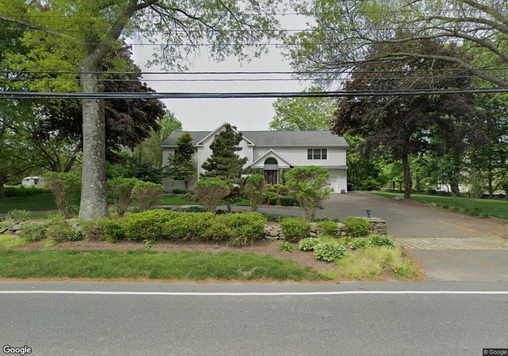
1035 Daniels Farm Rd Trumbull, CT 06611
Daniel Farm District NeighborhoodEstimated Value: $1,045,488 - $1,272,000
5
Beds
5
Baths
4,036
Sq Ft
$287/Sq Ft
Est. Value
About This Home
This home is located at 1035 Daniels Farm Rd, Trumbull, CT 06611 and is currently estimated at $1,159,122, approximately $287 per square foot. 1035 Daniels Farm Rd is a home located in Fairfield County with nearby schools including Daniels Farm School, Hillcrest Middle School, and Trumbull High School.
Ownership History
Date
Name
Owned For
Owner Type
Purchase Details
Closed on
Aug 4, 2020
Sold by
Kurup Jay and Kurup Viji
Bought by
Kurup Ft
Current Estimated Value
Purchase Details
Closed on
Jul 5, 2011
Sold by
Charles Christine
Bought by
Kurup Jay and Kurup Viji
Home Financials for this Owner
Home Financials are based on the most recent Mortgage that was taken out on this home.
Original Mortgage
$490,000
Interest Rate
4.62%
Purchase Details
Closed on
Jul 12, 2004
Sold by
Paniccia David
Bought by
Signoriello Christine
Home Financials for this Owner
Home Financials are based on the most recent Mortgage that was taken out on this home.
Original Mortgage
$452,000
Interest Rate
5%
Purchase Details
Closed on
Oct 30, 2002
Sold by
Albanese Carol A
Bought by
Panicca David
Home Financials for this Owner
Home Financials are based on the most recent Mortgage that was taken out on this home.
Original Mortgage
$282,500
Interest Rate
7.5%
Create a Home Valuation Report for This Property
The Home Valuation Report is an in-depth analysis detailing your home's value as well as a comparison with similar homes in the area
Home Values in the Area
Average Home Value in this Area
Purchase History
| Date | Buyer | Sale Price | Title Company |
|---|---|---|---|
| Kurup Ft | -- | None Available | |
| Kurup Jay | $690,000 | -- | |
| Signoriello Christine | $780,000 | -- | |
| Panicca David | $313,600 | -- |
Source: Public Records
Mortgage History
| Date | Status | Borrower | Loan Amount |
|---|---|---|---|
| Previous Owner | Panicca David | $417,000 | |
| Previous Owner | Panicca David | $490,000 | |
| Previous Owner | Panicca David | $452,000 | |
| Previous Owner | Panicca David | $282,500 |
Source: Public Records
Tax History Compared to Growth
Tax History
| Year | Tax Paid | Tax Assessment Tax Assessment Total Assessment is a certain percentage of the fair market value that is determined by local assessors to be the total taxable value of land and additions on the property. | Land | Improvement |
|---|---|---|---|---|
| 2025 | $16,933 | $458,640 | $143,290 | $315,350 |
| 2024 | $16,470 | $458,640 | $143,290 | $315,350 |
| 2023 | $16,204 | $458,640 | $143,290 | $315,350 |
| 2022 | $15,945 | $458,640 | $143,290 | $315,350 |
| 2021 | $17,268 | $472,500 | $130,340 | $342,160 |
| 2020 | $16,939 | $472,500 | $130,340 | $342,160 |
| 2018 | $16,521 | $472,500 | $130,340 | $342,160 |
| 2017 | $16,188 | $472,500 | $130,340 | $342,160 |
| 2016 | $15,862 | $472,500 | $130,340 | $342,160 |
| 2015 | $16,077 | $473,400 | $130,400 | $343,000 |
| 2014 | $15,732 | $473,400 | $130,400 | $343,000 |
Source: Public Records
Map
Nearby Homes
- 918 Daniels Farm Rd
- 21 Hill Cir
- 121 Lewis Rd
- 1209 Daniels Farm Rd
- 43 Jog Hill Rd
- 54 Barnswallow Dr
- 85 Deer Run Dr
- 66 Scenic Hill Rd
- 43 Moose Hill Rd
- 44 Fawn Hill Rd
- 89 Cranbury Dr
- 206 Beacon Hill Rd
- 17 Old Orchard Ln
- 6 Brookview Dr
- 8 Capitol Dr
- 15 Rock Spring Rd
- 133 Strobel Rd
- 20 Topaz Ln
- 18 Skating Pond Rd
- 6326 Main St
- 1021 Daniels Farm Rd
- 1057 Daniels Farm Rd
- 14 Lewis Rd
- 1059 Daniels Farm Rd
- 22 Lewis Rd
- 5 Wildfire Ln
- 1040 Daniels Farm Rd
- 1054 Daniels Farm Rd
- 1003 Daniels Farm Rd
- 30 Lewis Rd
- 1069 Daniels Farm Rd
- 19 Highwood Place
- 6 Wildfire Ln
- 9 Wildfire Ln
- 23 Highwood Place
- 11 Lewis Rd
- 1075 Daniels Farm Rd
- 3 Oxen Hill Rd
- 38 Lewis Rd
- 3 Lewis Rd