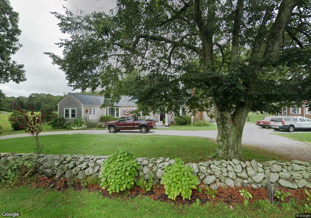
1035 Drift Rd Westport, MA 02790
Westport Point NeighborhoodEstimated Value: $750,000 - $1,109,000
4
Beds
--
Bath
3,035
Sq Ft
$329/Sq Ft
Est. Value
About This Home
This home is located at 1035 Drift Rd, Westport, MA 02790 and is currently estimated at $999,719, approximately $329 per square foot. 1035 Drift Rd is a home located in Bristol County with nearby schools including Alice A. Macomber Primary School, Westport Elementary School, and Westport Middle-High School.
Ownership History
Date
Name
Owned For
Owner Type
Purchase Details
Closed on
Apr 16, 1999
Sold by
Fhlmc
Bought by
Jonsson Gregory N and Jonsson Elizabeth K
Current Estimated Value
Home Financials for this Owner
Home Financials are based on the most recent Mortgage that was taken out on this home.
Original Mortgage
$168,610
Interest Rate
7.04%
Mortgage Type
Purchase Money Mortgage
Purchase Details
Closed on
Aug 17, 1998
Sold by
Kegler Andrew F and Chase Manhattn Mtg
Bought by
Fhlmc
Purchase Details
Closed on
Aug 18, 1995
Sold by
Shaffer Edward F and Shaffer Mary J
Bought by
Kegler Andrew F and Kegler Laura A
Home Financials for this Owner
Home Financials are based on the most recent Mortgage that was taken out on this home.
Original Mortgage
$174,400
Interest Rate
7.61%
Mortgage Type
Purchase Money Mortgage
Create a Home Valuation Report for This Property
The Home Valuation Report is an in-depth analysis detailing your home's value as well as a comparison with similar homes in the area
Home Values in the Area
Average Home Value in this Area
Purchase History
| Date | Buyer | Sale Price | Title Company |
|---|---|---|---|
| Jonsson Gregory N | $170,000 | -- | |
| Fhlmc | $149,900 | -- | |
| Kegler Andrew F | $218,000 | -- |
Source: Public Records
Mortgage History
| Date | Status | Borrower | Loan Amount |
|---|---|---|---|
| Open | Kegler Andrew F | $158,147 | |
| Closed | Kegler Andrew F | $168,610 | |
| Previous Owner | Kegler Andrew F | $21,587 | |
| Previous Owner | Kegler Andrew F | $174,400 |
Source: Public Records
Tax History Compared to Growth
Tax History
| Year | Tax Paid | Tax Assessment Tax Assessment Total Assessment is a certain percentage of the fair market value that is determined by local assessors to be the total taxable value of land and additions on the property. | Land | Improvement |
|---|---|---|---|---|
| 2025 | $5,778 | $775,600 | $269,600 | $506,000 |
| 2024 | $5,760 | $745,200 | $249,800 | $495,400 |
| 2023 | $5,505 | $674,600 | $237,900 | $436,700 |
| 2022 | $4,363 | $514,500 | $237,900 | $276,600 |
| 2021 | $3,507 | $406,800 | $181,200 | $225,600 |
| 2020 | $3,273 | $388,300 | $162,700 | $225,600 |
| 2019 | $3,252 | $393,200 | $162,700 | $230,500 |
| 2018 | $2,974 | $364,000 | $172,000 | $192,000 |
| 2017 | $2,901 | $364,000 | $172,000 | $192,000 |
| 2016 | $2,816 | $356,000 | $172,000 | $184,000 |
| 2015 | $2,626 | $331,200 | $172,000 | $159,200 |
Source: Public Records
Map
Nearby Homes
- 225 Hixbridge Rd
- 920 Drift Rd
- 837 Main Rd
- 101 Adamsville Rd
- 8 Village Way
- 7 Village Way
- 15 Village Way
- 1346 Main Rd Unit B
- 99 Sylvia Ln
- 8 Strawberry Ln
- 118 Charlotte White Rd Extension
- 1580 Main Rd
- 0 Hidden Glen Ln
- 73 White Oak Run
- 2 Slades Farm Ln
- 118 Charlotte White Rd
- 1702J Drift Rd
- 1749 Main Rd
- 1702 Drift Rd
- Lot 0 Marcotte
- 1032 Drift Rd Unit 1034
- 1038 Drift Rd
- 1025 Drift Rd
- 1024 Drift Rd
- 1053 Drift Rd
- 1017 Drift Rd
- 195 Hixbridge Rd
- 1016 Drift Rd
- 1009 Drift Rd
- 181 Hixbridge Rd Unit 183
- 234 Hixbridge Rd Unit 236
- 1067 Drift Rd
- 218 Hixbridge Rd
- 167-169 Hixbridge Rd
- 167 Hixbridge Rd Unit 169
- 202 Hixbridge Rd
- 992 Drift Rd
- Lot 12 Drift Rd
- 000 Drift Rd
- 165 Hixbridge Rd