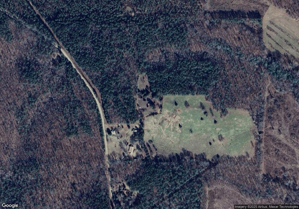
1035 Mountain Laurel Rd Franklin, GA 30217
Estimated Value: $119,000 - $226,577
--
Bed
1
Bath
--
Sq Ft
20.54
Acres
About This Home
This home is located at 1035 Mountain Laurel Rd, Franklin, GA 30217 and is currently estimated at $172,789. 1035 Mountain Laurel Rd is a home located in Heard County with nearby schools including Heard County High School.
Ownership History
Date
Name
Owned For
Owner Type
Purchase Details
Closed on
Apr 30, 2014
Sold by
Walker Karmala
Bought by
Chatman Merina
Current Estimated Value
Purchase Details
Closed on
Oct 30, 2009
Sold by
Sheets Mary Ellen
Bought by
Walker Karmala
Purchase Details
Closed on
Feb 24, 1998
Sold by
Karmala Dean
Bought by
T V and T Cooley H
Purchase Details
Closed on
Jan 1, 1985
Sold by
T V and T Cooley H
Bought by
Sheets Ralph E
Purchase Details
Closed on
Apr 13, 1984
Sold by
Sheets R C
Bought by
Sheets R E
Purchase Details
Closed on
Mar 23, 1984
Sold by
Ralph E Sheets
Bought by
Randy Dean and Karmala Dean
Purchase Details
Closed on
Mar 2, 1983
Sold by
Richard Carvie Sheets
Bought by
Willie C Cosper
Purchase Details
Closed on
Oct 2, 1980
Sold by
Sheets R C
Bought by
Dean Randy and Karmala Dean
Purchase Details
Closed on
Jan 1, 1901
Bought by
Sheets R E
Create a Home Valuation Report for This Property
The Home Valuation Report is an in-depth analysis detailing your home's value as well as a comparison with similar homes in the area
Home Values in the Area
Average Home Value in this Area
Purchase History
| Date | Buyer | Sale Price | Title Company |
|---|---|---|---|
| Chatman Merina | -- | -- | |
| Walker Karmala | -- | -- | |
| Walker Karmala | -- | -- | |
| T V | -- | -- | |
| Sheets Ralph E | -- | -- | |
| Sheets R E | -- | -- | |
| Randy Dean | -- | -- | |
| Willie C Cosper | -- | -- | |
| Dean Randy | -- | -- | |
| Sheets R E | -- | -- |
Source: Public Records
Tax History Compared to Growth
Tax History
| Year | Tax Paid | Tax Assessment Tax Assessment Total Assessment is a certain percentage of the fair market value that is determined by local assessors to be the total taxable value of land and additions on the property. | Land | Improvement |
|---|---|---|---|---|
| 2024 | $954 | $47,322 | $44,936 | $2,386 |
| 2023 | $831 | $39,833 | $37,447 | $2,386 |
| 2022 | $500 | $23,935 | $20,549 | $3,386 |
| 2021 | $521 | $23,726 | $20,549 | $3,177 |
| 2020 | $527 | $23,726 | $20,549 | $3,177 |
| 2019 | $527 | $23,726 | $20,549 | $3,177 |
| 2018 | $465 | $20,549 | $20,549 | $0 |
| 2017 | $384 | $17,010 | $17,010 | $0 |
| 2016 | $384 | $17,010 | $17,010 | $0 |
| 2015 | -- | $29,496 | $29,496 | $0 |
| 2014 | -- | $56,110 | $34,502 | $21,607 |
| 2013 | -- | $64,576 | $34,502 | $30,074 |
Source: Public Records
Map
Nearby Homes
- 260 TRACT 2 Fabiano Rd
- 260 TRACT 3 Fabiano Rd
- 6535 Ridgeway Rd
- 2451 Macedonia Rd
- 2643 Macedonia Rd
- 0 Hall Rd Unit 10620491
- 24.5+/- Ac Awebreys Gin Rd
- 543 Hall Rd
- 13.9 +/- AC Awbreys Gin Rd
- 24.5+/- AC Awbreys Gin Rd
- 24.5 +/- AC Awbreys Gin Rd
- 11 +/- AC Awbreys Gin Rd
- 0 County Road 518 Unit 11548102
- 24.3 + - Ac Awebreys Gin Rd
- 13.9 + - Ac Awebreys Gin Rd
- 319 + - Acres Hwy 100
- 11 + - Ac Awebreys Gin Rd
- 140+/- Acres Hwy 100
- 0 County Road 340 Unit 21428894
- 0 County Road 340