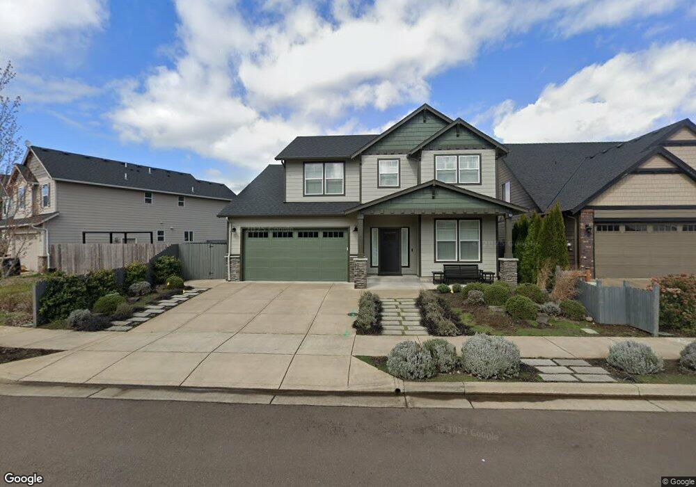
1035 Robbins Way Unit 43 Lebanon, OR 97355
Estimated Value: $511,029 - $547,000
3
Beds
3
Baths
2,200
Sq Ft
$240/Sq Ft
Est. Value
About This Home
This home is located at 1035 Robbins Way Unit 43, Lebanon, OR 97355 and is currently estimated at $529,015, approximately $240 per square foot. 1035 Robbins Way Unit 43 is a home located in Linn County with nearby schools including Riverview School, Seven Oak Middle School, and Lebanon High School.
Ownership History
Date
Name
Owned For
Owner Type
Purchase Details
Closed on
Feb 26, 2018
Sold by
Roll Tide Properties Corporation 401K Pr
Bought by
Bolen Richard P and Bolen Carrie D
Current Estimated Value
Home Financials for this Owner
Home Financials are based on the most recent Mortgage that was taken out on this home.
Original Mortgage
$474,920
Outstanding Balance
$267,453
Interest Rate
3.99%
Mortgage Type
New Conventional
Estimated Equity
$261,562
Purchase Details
Closed on
Feb 15, 2018
Sold by
Roll Tide Properties Corporation 401 K P
Bought by
Bolen Richard P and Bolen Carrie D
Home Financials for this Owner
Home Financials are based on the most recent Mortgage that was taken out on this home.
Original Mortgage
$474,920
Outstanding Balance
$267,453
Interest Rate
3.99%
Mortgage Type
New Conventional
Estimated Equity
$261,562
Purchase Details
Closed on
Mar 30, 2011
Sold by
Bursell Rondo D
Bought by
Bursell Family Limited Partnership
Create a Home Valuation Report for This Property
The Home Valuation Report is an in-depth analysis detailing your home's value as well as a comparison with similar homes in the area
Home Values in the Area
Average Home Value in this Area
Purchase History
| Date | Buyer | Sale Price | Title Company |
|---|---|---|---|
| Bolen Richard P | $324,547 | First American Title | |
| Bolen Richard P | $324,547 | First American Title | |
| Bursell Family Limited Partnership | -- | None Available |
Source: Public Records
Mortgage History
| Date | Status | Borrower | Loan Amount |
|---|---|---|---|
| Open | Bolen Richard P | $474,920 | |
| Closed | Bolen Richard P | $474,920 |
Source: Public Records
Tax History Compared to Growth
Tax History
| Year | Tax Paid | Tax Assessment Tax Assessment Total Assessment is a certain percentage of the fair market value that is determined by local assessors to be the total taxable value of land and additions on the property. | Land | Improvement |
|---|---|---|---|---|
| 2024 | $6,108 | $290,630 | -- | -- |
| 2023 | $5,910 | $282,170 | $0 | $0 |
| 2022 | $5,786 | $273,960 | $0 | $0 |
| 2021 | $5,580 | $265,990 | $0 | $0 |
| 2020 | $5,511 | $258,250 | $0 | $0 |
| 2019 | $5,236 | $250,730 | $0 | $0 |
| 2018 | $3,917 | $183,550 | $0 | $0 |
| 2017 | $893 | $42,710 | $0 | $0 |
| 2016 | $811 | $41,470 | $0 | $0 |
| 2015 | $197 | $9,920 | $0 | $0 |
Source: Public Records
Map
Nearby Homes
- 2380 Mountain River Dr
- 2368 Kokanee Way
- 2432 Robbins Way
- 2351 Gleanns Way
- 32008 Moss St
- 726 Cheadel Lake Ct
- 32763 Berlin Rd
- 2100 Park Dr
- 0 S Santiam Hwy Unit 321692493
- 301 Russell St
- 0 S Santiam (Lot Unit 102) Hwy
- 37986 River Dr
- 204 Cascade Dr Unit 23 Dr
- 2187 Mill St
- 357 Water's Edge Ct
- 300 Water's Edge Ct
- 371 Lydia Ln
- 2101 Primrose St
- 372 Jennings St
- 2464 Primrose St
- 1035 Robbins Way
- 0 Robbins (Lot #8) Way
- 0 Robbins (Lot #9) Way
- 1023 Robbins Way
- 1023 Robbins Way Unit Lot44
- 0 River Dr Unit 692490
- 0 River Dr Unit 692525
- 0 River Dr Unit 692491
- 1024 Robbins Ct
- 1024 Robbins Way
- 1011 Robbins Way
- 1011 Robbins Way Unit Lot45
- 1051 Robbins Way
- 1051 Robbins Way Unit Lot41
- 1032 Robbins Way Unit 35) Ct
- 1032 Robbins Way
- 1032 Robbins Ct
- 1032 Robbins Ct Unit 35
- 0 River Dr Unit 692484
- 0 River Dr Unit 807501