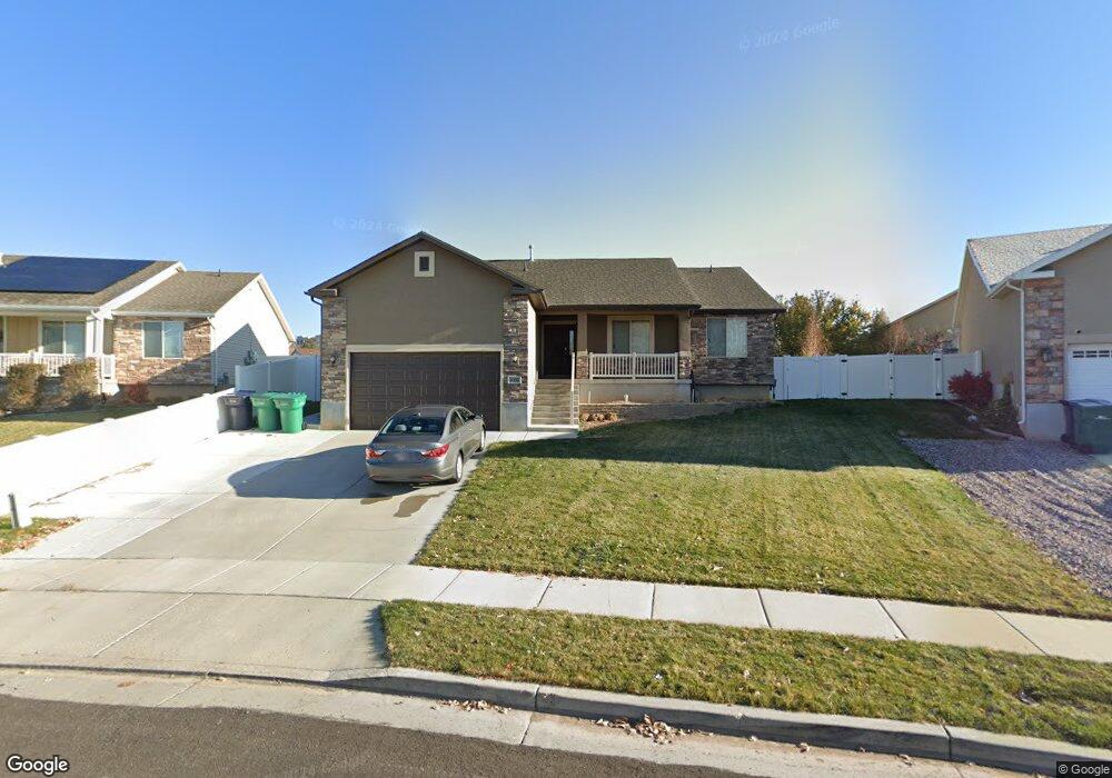
1035 S 1650 E Clearfield, UT 84015
Estimated Value: $508,000 - $543,000
3
Beds
2
Baths
2,850
Sq Ft
$185/Sq Ft
Est. Value
About This Home
This home is located at 1035 S 1650 E, Clearfield, UT 84015 and is currently estimated at $526,064, approximately $184 per square foot. 1035 S 1650 E is a home located in Davis County with nearby schools including South Clearfield Elementary School, North Davis Junior High School, and Northridge High School.
Ownership History
Date
Name
Owned For
Owner Type
Purchase Details
Closed on
Jul 17, 2014
Sold by
Moore Homes Lc
Bought by
Nutley Tyson J and Nutley Kayla
Current Estimated Value
Home Financials for this Owner
Home Financials are based on the most recent Mortgage that was taken out on this home.
Original Mortgage
$249,056
Outstanding Balance
$188,722
Interest Rate
4.1%
Mortgage Type
VA
Estimated Equity
$337,342
Purchase Details
Closed on
Jul 12, 2013
Sold by
Moore Investment Properties Lc
Bought by
Moore Homes Lc
Purchase Details
Closed on
Jun 28, 2013
Sold by
Rindlesbach Ken W
Bought by
Moore Investment Properties Lc
Purchase Details
Closed on
Sep 6, 2011
Sold by
Briarwood Hollow Llc
Bought by
Rindlesbach Ken W
Purchase Details
Closed on
Nov 27, 2006
Sold by
Murri Construction Inc
Bought by
Briarwood Hollow Llc
Create a Home Valuation Report for This Property
The Home Valuation Report is an in-depth analysis detailing your home's value as well as a comparison with similar homes in the area
Home Values in the Area
Average Home Value in this Area
Purchase History
We collect this data history from publicly available records. To have your information removed, we recommend requesting removal directly through your county’s website.
| Date | Buyer | Sale Price | Title Company |
|---|---|---|---|
| Nutley Tyson J | -- | Metro National Title | |
| Moore Homes Lc | -- | Guardian Title Ins Ag | |
| Moore Investment Properties Lc | -- | Guardian Title Ins Ag | |
| Rindlesbach Ken W | -- | Guardian Title Comp | |
| Briarwood Hollow Llc | -- | Bonneville Superior Title Co |
Source: Public Records
Mortgage History
We collect this data history from publicly available records. To have your information removed, we recommend requesting removal directly through your county’s website.
| Date | Status | Borrower | Loan Amount |
|---|---|---|---|
| Open | Nutley Tyson J | $249,056 |
Source: Public Records
Tax History
| Year | Tax Paid | Tax Assessment Tax Assessment Total Assessment is a certain percentage of the fair market value that is determined by local assessors to be the total taxable value of land and additions on the property. | Land | Improvement |
|---|---|---|---|---|
| 2025 | $3,050 | $273,350 | $82,190 | $191,160 |
| 2024 | $2,961 | $267,300 | $78,501 | $188,799 |
| 2023 | $2,831 | $469,000 | $124,581 | $344,419 |
| 2022 | $3,112 | $278,850 | $70,463 | $208,387 |
| 2021 | $2,733 | $370,000 | $80,178 | $289,822 |
| 2020 | $2,432 | $327,000 | $68,467 | $258,533 |
| 2019 | $2,351 | $312,000 | $67,993 | $244,007 |
| 2018 | $2,196 | $284,000 | $57,333 | $226,667 |
| 2016 | $2,044 | $138,215 | $24,465 | $113,750 |
| 2015 | $1,884 | $121,440 | $24,465 | $96,975 |
| 2014 | $912 | $59,574 | $24,465 | $35,109 |
| 2013 | -- | $63,920 | $63,920 | $0 |
Source: Public Records
Map
Nearby Homes
- 865 S 1650 E Unit A
- 846 S 1625 E Unit C
- 1580 E 900 S Unit H
- 1543 E 750 S Unit C5
- 1345 Valhalla Dr
- 2896 N 1175 W
- 2893 N 1150 W
- 1115 W 2600 N
- 1415 S 1250 E
- 1012 W 2525 N
- 1127 E 1050 S
- 2320 N 1085 W
- 2333 Garden Ln Unit 32
- 2234 N 1100 W
- 1058 S 1075 E
- 1142 E 1350 S
- 820 W 2350 N
- 1464 W 1920 N
- 1888 W 1575 N Unit 235
- 1883 W 1575 N Unit 236
Your Personal Tour Guide
Ask me questions while you tour the home.