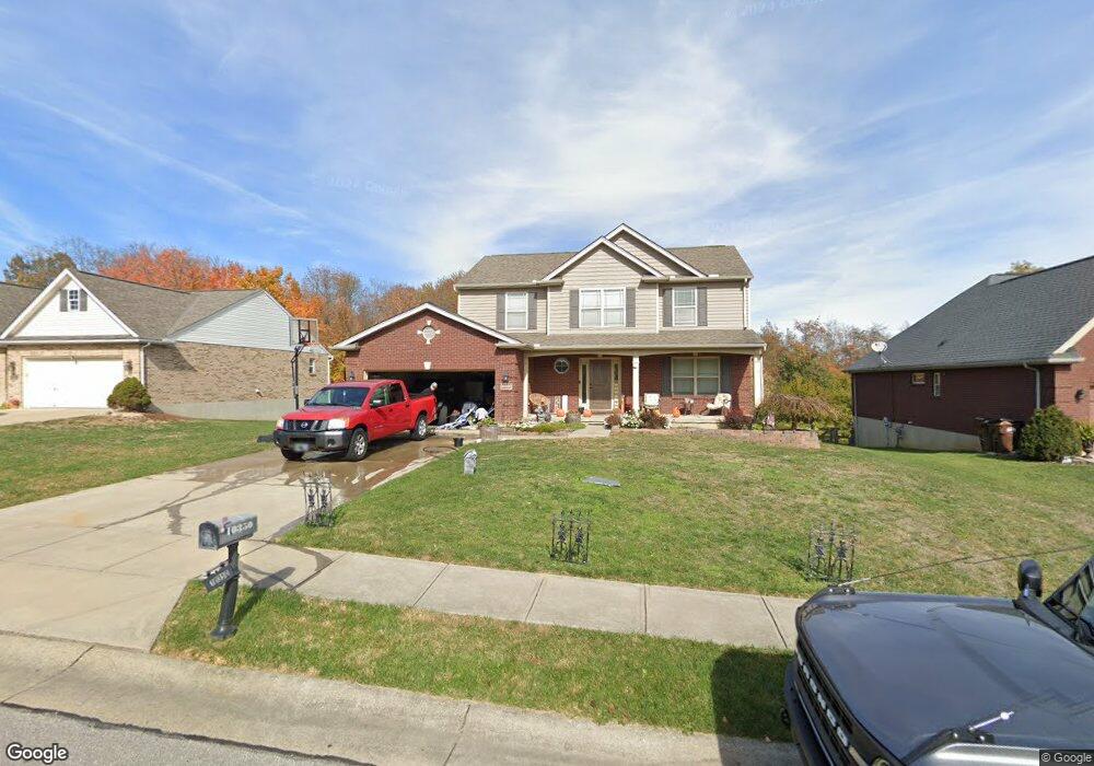
10350 Limerick Cir Covington, KY 41015
Estimated Value: $399,329 - $469,000
4
Beds
3
Baths
1,970
Sq Ft
$219/Sq Ft
Est. Value
About This Home
This home is located at 10350 Limerick Cir, Covington, KY 41015 and is currently estimated at $432,082, approximately $219 per square foot. 10350 Limerick Cir is a home with nearby schools including Ryland Heights Elementary School, Woodland Middle School, and Scott High School.
Ownership History
Date
Name
Owned For
Owner Type
Purchase Details
Closed on
Jul 7, 2021
Sold by
The Drees Company
Bought by
Rothert Rita Hammons
Current Estimated Value
Purchase Details
Closed on
Jan 1, 2021
Sold by
Mills Road Llc
Bought by
The Dress Company
Purchase Details
Closed on
Oct 25, 2013
Sold by
Dave Kinder Construction Llc
Bought by
Elsbernd Alvin R and Elsbernd Renee M
Home Financials for this Owner
Home Financials are based on the most recent Mortgage that was taken out on this home.
Original Mortgage
$180,405
Interest Rate
4.57%
Mortgage Type
New Conventional
Purchase Details
Closed on
May 31, 2013
Sold by
Mills Road Llc
Bought by
Dave Kinder Construction Llc
Create a Home Valuation Report for This Property
The Home Valuation Report is an in-depth analysis detailing your home's value as well as a comparison with similar homes in the area
Home Values in the Area
Average Home Value in this Area
Purchase History
| Date | Buyer | Sale Price | Title Company |
|---|---|---|---|
| Rothert Rita Hammons | $529,000 | None Available | |
| The Dress Company | $49,000 | Kentucky Land Title Agcy Inc | |
| Elsbernd Alvin R | $189,900 | None Available | |
| Dave Kinder Construction Llc | $35,700 | Kentucky Land Title Agency |
Source: Public Records
Mortgage History
| Date | Status | Borrower | Loan Amount |
|---|---|---|---|
| Previous Owner | Elsbernd Alvin R | $180,405 |
Source: Public Records
Tax History
| Year | Tax Paid | Tax Assessment Tax Assessment Total Assessment is a certain percentage of the fair market value that is determined by local assessors to be the total taxable value of land and additions on the property. | Land | Improvement |
|---|---|---|---|---|
| 2025 | $3,526 | $303,200 | $45,000 | $258,200 |
| 2024 | $2,675 | $218,400 | $40,000 | $178,400 |
| 2023 | $2,756 | $218,400 | $40,000 | $178,400 |
| 2022 | $2,815 | $218,400 | $40,000 | $178,400 |
| 2021 | $2,856 | $218,400 | $40,000 | $178,400 |
| 2020 | $2,546 | $189,900 | $40,000 | $149,900 |
| 2019 | $2,552 | $189,900 | $40,000 | $149,900 |
| 2018 | $2,566 | $189,900 | $40,000 | $149,900 |
| 2017 | $2,496 | $189,900 | $40,000 | $149,900 |
| 2015 | $2,425 | $189,900 | $35,700 | $154,200 |
| 2014 | $2,391 | $189,900 | $35,700 | $154,200 |
Source: Public Records
Map
Nearby Homes
- 10080 Marshall Rd
- 10171 Desmond Ct
- 3563 Capel Ct
- 3576 Gilford Ct
- 3668 Mills Rd
- 3827 Pruett Rd
- 3845 Pruett Rd
- 4011 Ryland Trace Dr
- 3118 Belleglade Dr
- 748 Stablewatch Dr
- 718 Willow Green Dr
- 714 Willow Green Dr
- 838 Stablewatch Dr
- 692 Sycamore Dr
- 3199 Summitrun Dr
- 6409 Stonemill Dr
- 685 Skyway Dr
- 907 Stablewatch Dr
- 10626 Cotswold Way
- 9738 Cloveridge Dr
- 10354 Limerick Cir
- 10346 Limerick Cir
- 10358 Limerick Cir
- 10342 Limerick Cir
- 10351 Limerick Cir
- 10347 Limerick Cir
- 10347 Limerick Cir
- 10343 Limerick Cir
- 10343 Limerick Cir Unit 71
- 10343 Limerick Cir
- 10362 Limerick Cir
- 10355 Limerick Cir
- 10355 Limerick Cir Unit 68
- 10355 Limerick Cir Unit 68
- 10339 Limerick Cir
- 10339 Limerick Cir Unit 72
- 10338 Limerick Cir
- 10359 Limerick Cir
- 10359 Limerick Cir Unit 67
- 3595 Ashford Rd
Your Personal Tour Guide
Ask me questions while you tour the home.