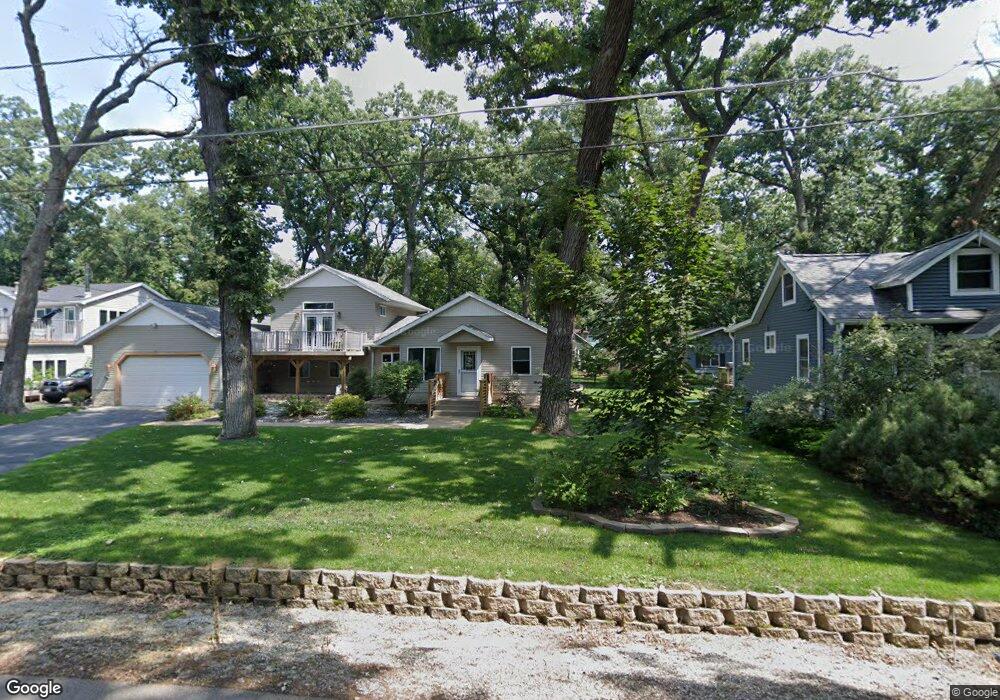
10351 187th Ave Bristol, WI 53104
Estimated Value: $294,000 - $409,687
3
Beds
3
Baths
2,266
Sq Ft
$163/Sq Ft
Est. Value
About This Home
This home is located at 10351 187th Ave, Bristol, WI 53104 and is currently estimated at $370,422, approximately $163 per square foot. 10351 187th Ave is a home located in Kenosha County with nearby schools including Bristol Elementary School and Central High School.
Ownership History
Date
Name
Owned For
Owner Type
Purchase Details
Closed on
Sep 15, 2017
Sold by
Wagner Catherine
Bought by
Wagner Robert W
Current Estimated Value
Purchase Details
Closed on
May 23, 2011
Sold by
Wagner Robert L
Bought by
Wagner Robert L
Purchase Details
Closed on
Dec 9, 2009
Sold by
Racz George D
Bought by
Wagner Robert L
Purchase Details
Closed on
Apr 27, 2006
Sold by
Nicholson Klingerman David and Nicholson Klingerman Gladys
Bought by
Racz George D
Create a Home Valuation Report for This Property
The Home Valuation Report is an in-depth analysis detailing your home's value as well as a comparison with similar homes in the area
Home Values in the Area
Average Home Value in this Area
Purchase History
| Date | Buyer | Sale Price | Title Company |
|---|---|---|---|
| Wagner Robert W | -- | -- | |
| Wagner Robert L | -- | -- | |
| Wagner Robert L | $71,200 | -- | |
| Racz George D | $140,000 | None Available |
Source: Public Records
Tax History Compared to Growth
Tax History
| Year | Tax Paid | Tax Assessment Tax Assessment Total Assessment is a certain percentage of the fair market value that is determined by local assessors to be the total taxable value of land and additions on the property. | Land | Improvement |
|---|---|---|---|---|
| 2024 | $4,216 | $214,300 | $50,000 | $164,300 |
| 2023 | $3,603 | $214,300 | $50,000 | $164,300 |
| 2022 | $3,626 | $214,300 | $50,000 | $164,300 |
| 2021 | $3,545 | $209,300 | $50,000 | $159,300 |
| 2020 | $3,545 | $209,300 | $50,000 | $159,300 |
| 2019 | $3,339 | $209,300 | $50,000 | $159,300 |
| 2018 | $4,060 | $189,800 | $41,600 | $148,200 |
| 2017 | $3,426 | $183,500 | $41,600 | $141,900 |
| 2016 | $3,678 | $183,500 | $41,600 | $141,900 |
| 2015 | $3,430 | $183,500 | $41,600 | $141,900 |
| 2014 | -- | $183,500 | $41,600 | $141,900 |
Source: Public Records
Map
Nearby Homes
- 18290 Winfield Rd
- 18828 116th St
- 11944 187th Ave
- Lt0 87th St
- 19900 128th St Unit 210
- 19900 128th St Unit 70
- 19900 128th St Unit 124
- 19900 128th St Unit 150
- 19900 128th St Unit 317
- 19900 128th St Unit 39
- 19900 128th St Unit 44
- 19900 128th St Unit 121
- 21605 117th St
- 9395 226th Ave
- L0 83rd St
- 0 83rd St Unit MRD12131806
- 20530 84th Place
- 8216 199th Ave
- 11621 224th Ave
- 8018 200th Ave
- 10345 187th Ave
- 10359 187th Ave
- 10339 187th Ave
- 10358 186th Ave
- 10338 186th Ave
- 10335 187th Ave
- 10354 186th Ave
- 10334 186th Ave
- 18718 104th St
- 18718 104th St
- 10325 187th Ave
- 18710 104th St
- 10349 186th Ave
- 18700 104th St
- 10355 186th Ave
- 10324 187th Ave
- 10335 186th Ave
- 10318 187th Ct
- 10330 187th Ave
- 10329 186th Ave