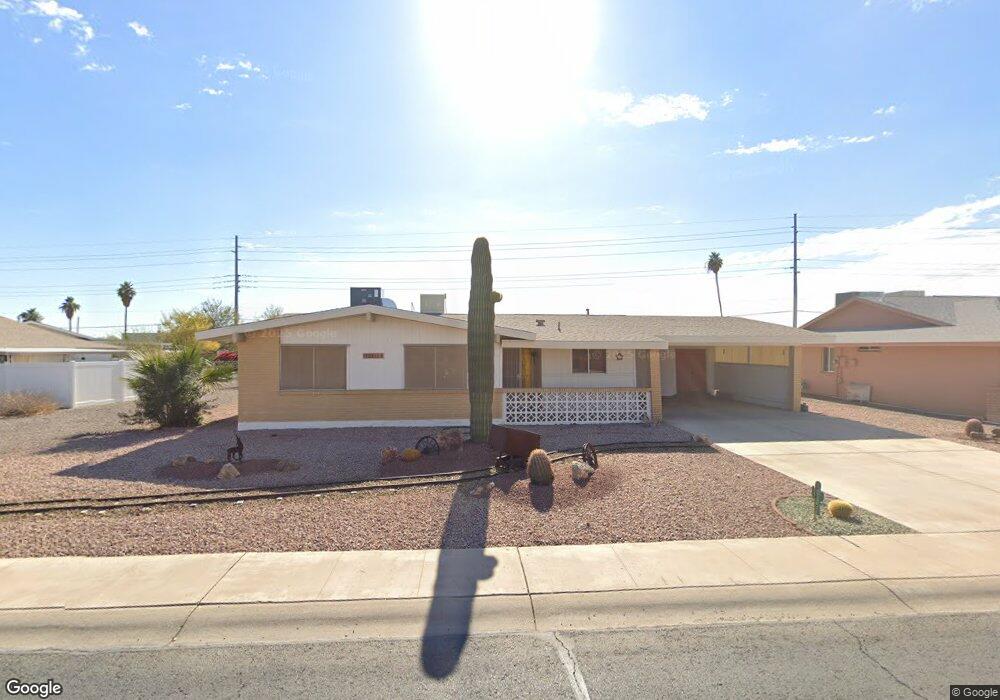
10351 W Caron Dr Sun City, AZ 85351
Estimated Value: $296,000 - $370,789
--
Bed
2
Baths
1,448
Sq Ft
$222/Sq Ft
Est. Value
About This Home
This home is located at 10351 W Caron Dr, Sun City, AZ 85351 and is currently estimated at $320,947, approximately $221 per square foot. 10351 W Caron Dr is a home located in Maricopa County with nearby schools including Ombudsman - Northwest Charter and Peoria Accelerated High School.
Ownership History
Date
Name
Owned For
Owner Type
Purchase Details
Closed on
Jan 12, 1998
Sold by
Cowherd Luther L and Cowherd Naomi L
Bought by
Anderson Judith Ann
Current Estimated Value
Home Financials for this Owner
Home Financials are based on the most recent Mortgage that was taken out on this home.
Original Mortgage
$36,600
Interest Rate
6.9%
Mortgage Type
Seller Take Back
Purchase Details
Closed on
Aug 6, 1996
Sold by
Maitlen Robert E and Maitlen Vonda L
Bought by
Cowherd Luther L and Cowherd Naomi L
Home Financials for this Owner
Home Financials are based on the most recent Mortgage that was taken out on this home.
Original Mortgage
$57,000
Interest Rate
6.75%
Mortgage Type
New Conventional
Create a Home Valuation Report for This Property
The Home Valuation Report is an in-depth analysis detailing your home's value as well as a comparison with similar homes in the area
Home Values in the Area
Average Home Value in this Area
Purchase History
| Date | Buyer | Sale Price | Title Company |
|---|---|---|---|
| Anderson Judith Ann | $98,000 | First American Title | |
| Cowherd Luther L | $87,000 | United Title Agency |
Source: Public Records
Mortgage History
| Date | Status | Borrower | Loan Amount |
|---|---|---|---|
| Previous Owner | Anderson Judith Ann | $36,600 | |
| Previous Owner | Cowherd Luther L | $57,000 |
Source: Public Records
Tax History Compared to Growth
Tax History
| Year | Tax Paid | Tax Assessment Tax Assessment Total Assessment is a certain percentage of the fair market value that is determined by local assessors to be the total taxable value of land and additions on the property. | Land | Improvement |
|---|---|---|---|---|
| 2025 | $942 | $11,647 | -- | -- |
| 2024 | $847 | $11,093 | -- | -- |
| 2023 | $847 | $21,430 | $4,280 | $17,150 |
| 2022 | $798 | $16,830 | $3,360 | $13,470 |
| 2021 | $824 | $15,710 | $3,140 | $12,570 |
| 2020 | $802 | $13,550 | $2,710 | $10,840 |
| 2019 | $787 | $12,530 | $2,500 | $10,030 |
| 2018 | $758 | $11,210 | $2,240 | $8,970 |
| 2017 | $732 | $9,910 | $1,980 | $7,930 |
| 2016 | $683 | $9,270 | $1,850 | $7,420 |
| 2015 | $652 | $8,250 | $1,650 | $6,600 |
Source: Public Records
Map
Nearby Homes
- 10326 W Caron Dr
- 10221 W Puget Ave
- 10201 W Caron Dr
- 8803 N 105th Dr
- 10001 W Caron Dr Unit 8
- 9815 N 103rd Ave
- 10014 W Mission Ln
- 10512 W Ruth Ave
- 10109 W Mountain View Rd
- 10316 W Salem Dr Unit 6D
- 10022 W Mountain View Rd
- 8601 N 103rd Ave Unit 313
- 8601 N 103rd Ave Unit 271
- 8601 N 103rd Ave Unit 58
- 8601 N 103rd Ave Unit 72
- 9202 N 107th Ave Unit 8
- 10707 W Mission Ln
- 10603 W Ruth Ave
- 9925 W Mountain View Rd Unit 27
- 9915 W Mountain View Rd
- 10355 W Caron Dr
- 10349 W Caron Dr Unit 7
- 10347 W Caron Dr
- 10401 W Caron Dr
- 10350 W Caron Dr
- 10344 W Caron Dr
- 10356 W Caron Dr
- 10345 W Caron Dr
- 10409 W Caron Dr
- 10402 W Caron Dr
- 10341 W Caron Dr
- 10338 W Caron Dr
- 10343 W Caron Dr
- 10415 W Caron Dr
- 10410 W Caron Dr
- 10345 W Kelso Dr
- 10401 W Kelso Dr
- 10339 W Kelso Dr
- 10405 W Kelso Dr
- 10337 W Caron Dr