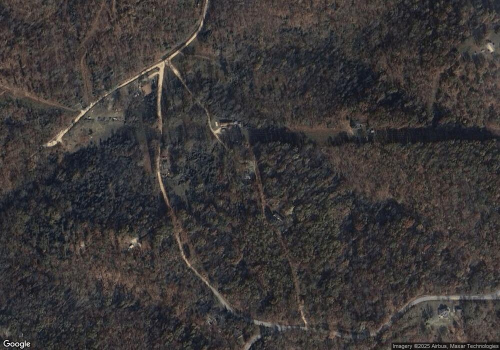
10353 E Circle Rd Rogers, AR 72756
Estimated Value: $169,045 - $410,000
--
Bed
1
Bath
960
Sq Ft
$333/Sq Ft
Est. Value
About This Home
This home is located at 10353 E Circle Rd, Rogers, AR 72756 and is currently estimated at $319,261, approximately $332 per square foot. 10353 E Circle Rd is a home located in Benton County with nearby schools including Frank Tillery Elementary School, Lingle Middle School, and Rogers Heritage High School.
Ownership History
Date
Name
Owned For
Owner Type
Purchase Details
Closed on
Feb 7, 2024
Sold by
Smith Danny J and Smith Sherry L
Bought by
Sims Sherrie E
Current Estimated Value
Purchase Details
Closed on
Feb 7, 1992
Bought by
Smith
Purchase Details
Closed on
Sep 23, 1991
Bought by
Smith
Purchase Details
Closed on
Feb 6, 1991
Bought by
Hud
Purchase Details
Closed on
Jan 2, 1991
Bought by
Superior
Purchase Details
Closed on
Nov 3, 1986
Bought by
Hunter
Purchase Details
Closed on
Jun 5, 1978
Bought by
Sammons
Create a Home Valuation Report for This Property
The Home Valuation Report is an in-depth analysis detailing your home's value as well as a comparison with similar homes in the area
Home Values in the Area
Average Home Value in this Area
Purchase History
| Date | Buyer | Sale Price | Title Company |
|---|---|---|---|
| Sims Sherrie E | -- | None Listed On Document | |
| Smith | -- | -- | |
| Smith | -- | -- | |
| Hud | -- | -- | |
| Superior | -- | -- | |
| Hunter | -- | -- | |
| Hunter | $25,000 | -- | |
| Myers | -- | -- | |
| Myers | $24,000 | -- | |
| Sammons | $24,000 | -- |
Source: Public Records
Tax History Compared to Growth
Tax History
| Year | Tax Paid | Tax Assessment Tax Assessment Total Assessment is a certain percentage of the fair market value that is determined by local assessors to be the total taxable value of land and additions on the property. | Land | Improvement |
|---|---|---|---|---|
| 2025 | $522 | $18,120 | $5,120 | $13,000 |
| 2024 | $492 | $18,120 | $5,120 | $13,000 |
| 2023 | $491 | $10,210 | $1,540 | $8,670 |
| 2022 | $648 | $10,210 | $1,540 | $8,670 |
| 2021 | $605 | $10,210 | $1,540 | $8,670 |
| 2020 | $564 | $8,030 | $1,330 | $6,700 |
| 2019 | $538 | $8,030 | $1,330 | $6,700 |
| 2018 | $510 | $8,030 | $1,330 | $6,700 |
| 2017 | $434 | $8,030 | $1,330 | $6,700 |
| 2016 | $434 | $8,030 | $1,330 | $6,700 |
| 2015 | $258 | $5,360 | $1,660 | $3,700 |
| 2014 | $408 | $5,360 | $1,660 | $3,700 |
Source: Public Records
Map
Nearby Homes
- 18-05223-001 Kindred Hollow Rd
- 10624 W High Meadows Dr
- 10288 & 10229 Deer Ridge Rd
- 15425 Morning Mist
- 14551 Point Virgo Rd
- 14559 Zimmerman Ln
- 14555 Zimmerman Ln
- 15854 Abbey Ln
- 10043 Napa Rd
- 10641 Prairie Creek Rd N
- 0 Hawks Landing Dr Unit 1316911
- 10065 Sun Ridge Cir
- 0 Arabian Ln Unit 1307468
- 14435 Grace Ln
- Lot 10 Hawks Nest Dr
- 13970 Cloverdale Rd
- 9373 Summers Rd
- 11528 Rolling Dr
- 11258 Silver Cloud Trail
- 9192 N Park Rd
- 0 Cr 907 Unit 652968
- 10354 E Circle Rd
- 10259 W Circle Rd
- 0 W Circle Rd
- 10400 E Circle Rd
- 10259 E High Meadows Dr
- 10408 Circle Rd
- 10273 W Circle Rd
- 10257 W Circle Rd
- 10382 Clancys Rd
- 15213 Cesena Rd
- 10446 E High Meadows Dr
- 14961 Muldoon Dr
- 14871 Muldoon Dr
- 10599 E High Meadows Dr
- 10384 E High Meadows Dr
- 10627 E High Meadows Dr
- 10189 E High Meadows Dr
- 11 AC Clancys Rd
- 10510 Tara Ln
