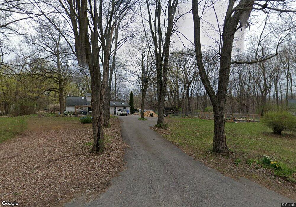
10355 Hartland Rd Fenton, MI 48430
Estimated Value: $295,000 - $437,000
4
Beds
2
Baths
1,700
Sq Ft
$206/Sq Ft
Est. Value
About This Home
This home is located at 10355 Hartland Rd, Fenton, MI 48430 and is currently estimated at $350,709, approximately $206 per square foot. 10355 Hartland Rd is a home located in Livingston County with nearby schools including Fenton Senior High School.
Ownership History
Date
Name
Owned For
Owner Type
Purchase Details
Closed on
Nov 23, 2011
Sold by
Duneske Bradley and Duneske Dennis Robert
Bought by
Bush David
Current Estimated Value
Home Financials for this Owner
Home Financials are based on the most recent Mortgage that was taken out on this home.
Original Mortgage
$92,591
Outstanding Balance
$65,320
Interest Rate
4.75%
Mortgage Type
FHA
Estimated Equity
$285,389
Purchase Details
Closed on
May 15, 2000
Sold by
Dewan Patrick J and Dewan Susan M
Bought by
Sherman Scott
Create a Home Valuation Report for This Property
The Home Valuation Report is an in-depth analysis detailing your home's value as well as a comparison with similar homes in the area
Home Values in the Area
Average Home Value in this Area
Purchase History
| Date | Buyer | Sale Price | Title Company |
|---|---|---|---|
| Bush David | $95,000 | -- | |
| Sherman Scott | $159,000 | Landmark Title Services |
Source: Public Records
Mortgage History
| Date | Status | Borrower | Loan Amount |
|---|---|---|---|
| Open | Bush David | $92,591 |
Source: Public Records
Tax History Compared to Growth
Tax History
| Year | Tax Paid | Tax Assessment Tax Assessment Total Assessment is a certain percentage of the fair market value that is determined by local assessors to be the total taxable value of land and additions on the property. | Land | Improvement |
|---|---|---|---|---|
| 2025 | $1,657 | $111,800 | $0 | $0 |
| 2024 | $600 | $103,200 | $0 | $0 |
| 2023 | $572 | $87,800 | $0 | $0 |
| 2022 | $1,508 | $71,500 | $0 | $0 |
| 2021 | $1,492 | $79,100 | $0 | $0 |
| 2020 | $1,487 | $71,500 | $0 | $0 |
| 2019 | $1,471 | $70,200 | $0 | $0 |
| 2018 | $1,448 | $65,100 | $0 | $0 |
| 2017 | $1,432 | $65,100 | $0 | $0 |
| 2016 | $1,422 | $61,900 | $0 | $0 |
| 2014 | $1,649 | $51,600 | $0 | $0 |
| 2012 | $1,649 | $49,100 | $0 | $0 |
Source: Public Records
Map
Nearby Homes
- 11461 White Lake Rd
- 00 White Lake Rd
- 10198 Carmer Rd
- 12160 White Lake Rd
- 12189 Dentonview Dr
- 10173 Carmer Rd
- 20 Grand Summit Dr
- 23 Grand Summit Dr
- 26 Grand Summit Dr
- 11030 White Lake Rd
- 10516 Merrill Dr
- 12196 Woodline Dr
- 10510 Lake Shore Dr
- 17 Sunset Ln
- 44 Retreat Way
- 24 Sunset Ln
- 12240 Woodline Dr
- 0 Walnut Shores Dr Unit 50173690
- 0 Tyrone Trail Unit 20251012607
- 0 Denton Hill Rd Unit 20240023969
- 10315 Hartland Rd
- 10363 Hartland Rd
- 10305 Hartland Rd
- 10310 Hartland Rd
- 10445 Hartland Rd
- 10295 Hartland Rd
- 10388 Hartland Rd
- 11384 White Lake Rd
- 0 Mabley Hill Rd Unit 218040586
- 0 Mabley Hill Rd
- 0 Mabley Hill Rd Unit G20445497
- 0 Mabley Hill Rd Unit R2210028456
- 0 Mabley Hill Rd Unit R2200039926
- 0 Mabley Hill Rd Unit R2210039459
- 0 Mabley Hill Rd Unit R2210039455
- 0 Mabley Hill Rd Unit R2210039450
- 0 Mabley Hill Rd Unit R2210039446
- 0 Mabley Hill Rd Unit R2210039436
- 0 Mabley Hill Rd Unit R2210039431
- 0 Mabley Hill Rd Unit R2210039381