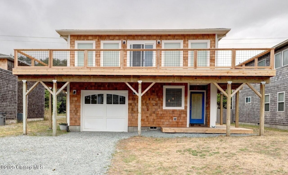
1036 Beach Cir Manzanita, OR 97130
Estimated payment $5,716/month
Highlights
- Ocean View
- Contemporary Architecture
- Den
- Nehalem Elementary School Rated 10
- Furnished
- Fireplace
About This Home
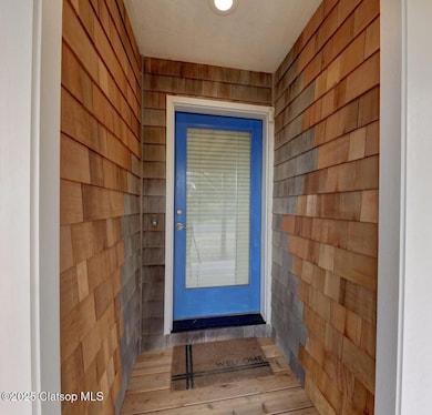
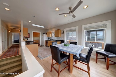
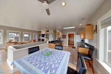
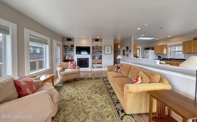
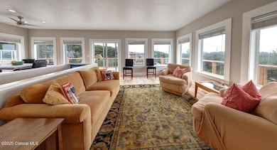
Discover your beach retreat in beautiful Manzanita, OR! This stunning 4-bedroom, 3.5-bath home boasts 2,808 sq ft with a desirable reverse floor plan that maximizes ocean views. Just three houses from oceanfront, the property features new exterior cedar shingle siding and a spacious deck perfect for entertaining. Enjoy the bright, airy spaces with wood floors and skylights, granite countertop in kitchen, and a bonus room for gathering downstaris. Fully furnished and equipped with outside RV/boat parking and EV hookup in the garage. lose to Manzanita Golf Links and downtown. Don't miss this coastal gem!
Co-Listing Agent
NON- MEMBER
NON-MEMBER
Home Details
Home Type
- Single Family
Est. Annual Taxes
- $5,355
Year Built
- Built in 1995
Lot Details
- 5,227 Sq Ft Lot
- Property is zoned R2
Parking
- 1 Car Attached Garage
- Garage Door Opener
Home Design
- Contemporary Architecture
- Pillar, Post or Pier Foundation
- Slab Foundation
- Composition Roof
- Shingle Siding
- Cedar Siding
- Cedar
Interior Spaces
- 2,448 Sq Ft Home
- 2-Story Property
- Furnished
- Fireplace
- Window Treatments
- Family Room
- Living Room
- Dining Room
- Den
- Utility Room
- Washer and Dryer
- Ocean Views
- Basement
Kitchen
- Oven or Range
- Microwave
- Dishwasher
Bedrooms and Bathrooms
- 4 Bedrooms
Accessible Home Design
- Accessible Bedroom
Utilities
- Forced Air Heating and Cooling System
- Gas Available
- Propane Water Heater
Map
Home Values in the Area
Average Home Value in this Area
Tax History
| Year | Tax Paid | Tax Assessment Tax Assessment Total Assessment is a certain percentage of the fair market value that is determined by local assessors to be the total taxable value of land and additions on the property. | Land | Improvement |
|---|---|---|---|---|
| 2024 | $5,355 | $453,910 | $194,290 | $259,620 |
| 2023 | $5,308 | $440,690 | $188,630 | $252,060 |
| 2022 | $4,991 | $427,860 | $183,130 | $244,730 |
| 2021 | $4,842 | $415,400 | $177,800 | $237,600 |
| 2020 | $4,650 | $403,310 | $172,630 | $230,680 |
| 2019 | $4,519 | $391,570 | $167,610 | $223,960 |
| 2018 | $4,401 | $380,170 | $162,730 | $217,440 |
| 2017 | $4,277 | $369,100 | $157,990 | $211,110 |
| 2016 | $4,154 | $358,350 | $153,390 | $204,960 |
| 2015 | $4,078 | $347,920 | $148,930 | $198,990 |
| 2014 | $4,010 | $337,790 | $144,600 | $193,190 |
| 2013 | -- | $327,960 | $140,380 | $187,580 |
Property History
| Date | Event | Price | List to Sale | Price per Sq Ft |
|---|---|---|---|---|
| 11/08/2025 11/08/25 | Price Changed | $998,000 | -9.3% | $408 / Sq Ft |
| 09/18/2025 09/18/25 | For Sale | $1,100,000 | -- | $449 / Sq Ft |
Purchase History
| Date | Type | Sale Price | Title Company |
|---|---|---|---|
| Bargain Sale Deed | -- | None Listed On Document |
Source: Clatsop Association of REALTORS®
MLS Number: 25-934
APN: R0106030
- 000 Puffin Ln
- 34807 Necarney (34809) Blvd
- 34807 Necarney (-34809) Bl
- 34715 Necarney Blvd
- 388 Ridge Ct
- 8916 Pelican Ln Unit 4
- 8936 Pelican Ln Unit 5
- 9195 Puffin Ln
- 9195 Puffin Ln
- 9120 Windward Ln
- 559 Ridge Dr
- 370 4th Place S
- 368 4th Place
- 0 Pine Ridge Dr Unit 24394081
- 0 Pine Ridge Dr Unit 141 24100339
- 0 Pine Ridge Dr Unit 147 24535382
- 0 Pine Ridge Dr Unit 71 24554922
- 8917 Spindrift Ln
