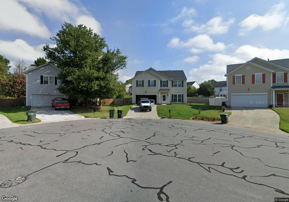
1036 Bent Branch Dr SW Concord, NC 28025
Estimated Value: $371,000 - $401,000
3
Beds
3
Baths
2,414
Sq Ft
$158/Sq Ft
Est. Value
About This Home
This home is located at 1036 Bent Branch Dr SW, Concord, NC 28025 and is currently estimated at $382,461, approximately $158 per square foot. 1036 Bent Branch Dr SW is a home located in Cabarrus County with nearby schools including Rocky River Elementary School, J.N. Fries Middle School, and Branch Christian Academy.
Ownership History
Date
Name
Owned For
Owner Type
Purchase Details
Closed on
Sep 10, 2021
Sold by
Williams Bridgette Leak and Williams James D
Bought by
Williams Bridgette Leak
Current Estimated Value
Home Financials for this Owner
Home Financials are based on the most recent Mortgage that was taken out on this home.
Original Mortgage
$234,000
Outstanding Balance
$178,905
Interest Rate
2.19%
Estimated Equity
$203,556
Purchase Details
Closed on
Oct 30, 2001
Sold by
The New Fortis Corp
Bought by
Miller Derek B and Miller Michelle Y
Home Financials for this Owner
Home Financials are based on the most recent Mortgage that was taken out on this home.
Original Mortgage
$160,650
Interest Rate
6.85%
Mortgage Type
VA
Create a Home Valuation Report for This Property
The Home Valuation Report is an in-depth analysis detailing your home's value as well as a comparison with similar homes in the area
Home Values in the Area
Average Home Value in this Area
Purchase History
| Date | Buyer | Sale Price | Title Company |
|---|---|---|---|
| Williams Bridgette Leak | -- | None Available | |
| Miller Derek B | $161,000 | -- |
Source: Public Records
Mortgage History
| Date | Status | Borrower | Loan Amount |
|---|---|---|---|
| Open | Williams Bridgette Leak | $234,000 | |
| Closed | Miller Derek B | $160,650 |
Source: Public Records
Tax History Compared to Growth
Tax History
| Year | Tax Paid | Tax Assessment Tax Assessment Total Assessment is a certain percentage of the fair market value that is determined by local assessors to be the total taxable value of land and additions on the property. | Land | Improvement |
|---|---|---|---|---|
| 2025 | $3,691 | $370,560 | $66,000 | $304,560 |
| 2024 | $3,691 | $370,560 | $66,000 | $304,560 |
| 2023 | $2,638 | $227,030 | $40,000 | $187,030 |
| 2022 | $2,638 | $216,230 | $40,000 | $176,230 |
| 2021 | $2,638 | $216,230 | $40,000 | $176,230 |
| 2020 | $2,638 | $216,230 | $40,000 | $176,230 |
| 2019 | $2,136 | $175,050 | $27,000 | $148,050 |
| 2018 | $2,101 | $175,050 | $27,000 | $148,050 |
| 2017 | $2,066 | $175,050 | $27,000 | $148,050 |
| 2016 | $1,225 | $145,700 | $20,000 | $125,700 |
| 2015 | $1,719 | $145,700 | $20,000 | $125,700 |
| 2014 | $1,719 | $145,700 | $20,000 | $125,700 |
Source: Public Records
Map
Nearby Homes
- 910/820 Archibald Rd
- 925/917 Silver Fox Dr
- 5209 Moonlight Trail SW
- 2085 Chapel Creek Rd SW
- 1433 Moss Creek Dr
- 6762 Thistle Down Dr
- 7218 Waterwheel St SW
- 4436 Falls Lake Dr SW
- 5356 Zion Church Rd
- 1150 Hearth Ln SW
- 4294 Kiser Woods Dr SW
- 4274 Kiser Woods Dr SW
- 7362 Millstone Cir SW
- 7368 Millstone Cir SW
- 2595 Shamrock Rd
- 1649 Scarbrough Cir SW
- 208 Falcon Dr
- 123 Softwind Ln
- 1500 Van Buren Ave SW
- 7321 Waterwheel St SW
- 1040 Bent Branch Dr SW
- 1032 Bent Branch Dr SW
- 5822 Dove Point Dr SW
- 5830 Dove Point Dr SW
- 5816 Dove Point Dr SW
- 5836 Dove Point Dr SW
- 1024 Bent Branch Dr SW
- 1044 Bent Branch Dr SW
- 5813 Avian Place Unit 65
- 5813 Avian Place
- 1018 Bent Branch Dr SW
- 1041 Bent Branch Dr SW
- 1041 Bent Branch Dr SW Unit 47
- 5817 Avian Place
- 1037 Bent Branch Dr SW
- 1033 Bent Branch Dr SW
- 5805 Avian Place
- 1029 Bent Branch Dr SW
- 5831 Dove Point Dr SW
- 5837 Dove Point Dr SW