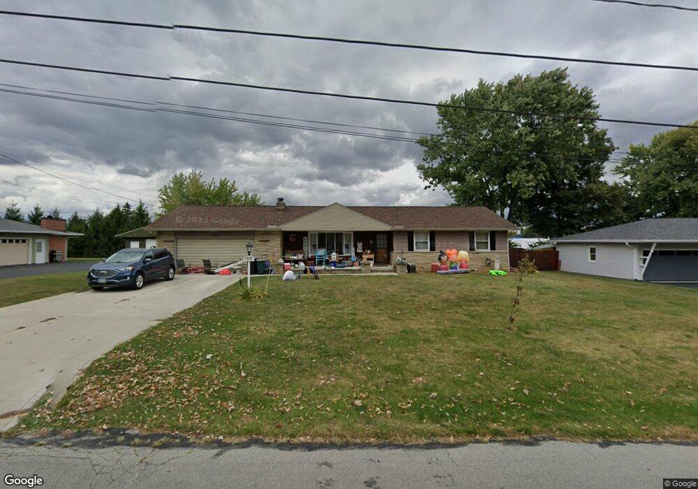
1036 Bexley Ave Marion, OH 43302
Estimated Value: $248,189 - $271,000
3
Beds
2
Baths
1,318
Sq Ft
$198/Sq Ft
Est. Value
About This Home
This home is located at 1036 Bexley Ave, Marion, OH 43302 and is currently estimated at $260,797, approximately $197 per square foot. 1036 Bexley Ave is a home located in Marion County with nearby schools including George Washington Elementary School, Ulysses S. Grant Middle School, and Harding High School.
Ownership History
Date
Name
Owned For
Owner Type
Purchase Details
Closed on
May 23, 2006
Sold by
T Co Llc
Bought by
Kane Carole A and Kane Daniel
Current Estimated Value
Home Financials for this Owner
Home Financials are based on the most recent Mortgage that was taken out on this home.
Original Mortgage
$25,400
Interest Rate
6.27%
Mortgage Type
Stand Alone Second
Purchase Details
Closed on
Nov 8, 1999
Bought by
Kane Carole A and Kane Daniel
Purchase Details
Closed on
Feb 17, 1999
Bought by
Kane Carole A and Kane Daniel
Purchase Details
Closed on
Nov 10, 1998
Bought by
Kane Carole A and Kane Daniel
Create a Home Valuation Report for This Property
The Home Valuation Report is an in-depth analysis detailing your home's value as well as a comparison with similar homes in the area
Home Values in the Area
Average Home Value in this Area
Purchase History
| Date | Buyer | Sale Price | Title Company |
|---|---|---|---|
| Kane Carole A | $127,000 | Hostetler Title & Closing Se | |
| Kane Carole A | $100,000 | -- | |
| Kane Carole A | -- | -- | |
| Kane Carole A | -- | -- |
Source: Public Records
Mortgage History
| Date | Status | Borrower | Loan Amount |
|---|---|---|---|
| Closed | Kane Carole A | $25,400 | |
| Open | Kane Carole A | $101,600 |
Source: Public Records
Tax History
| Year | Tax Paid | Tax Assessment Tax Assessment Total Assessment is a certain percentage of the fair market value that is determined by local assessors to be the total taxable value of land and additions on the property. | Land | Improvement |
|---|---|---|---|---|
| 2025 | $1,979 | $72,090 | $14,350 | $57,740 |
| 2024 | $1,979 | $58,900 | $13,830 | $45,070 |
| 2023 | $1,979 | $58,900 | $13,830 | $45,070 |
| 2022 | $2,083 | $58,900 | $13,830 | $45,070 |
| 2021 | $1,663 | $44,520 | $10,890 | $33,630 |
| 2020 | $1,599 | $44,520 | $10,890 | $33,630 |
| 2019 | $1,595 | $44,520 | $10,890 | $33,630 |
| 2018 | $1,421 | $37,380 | $10,880 | $26,500 |
| 2017 | $1,481 | $37,380 | $10,880 | $26,500 |
| 2016 | $1,300 | $37,380 | $10,880 | $26,500 |
| 2015 | $1,279 | $36,370 | $10,360 | $26,010 |
| 2014 | $972 | $36,370 | $10,360 | $26,010 |
| 2012 | $1,427 | $39,500 | $9,640 | $29,860 |
Source: Public Records
Map
Nearby Homes
- 523 Normandy Dr
- 819 Laura Dr
- 400 Forest Lawn Blvd
- 667 King Ave
- 553 King Ave
- 482 King Ave
- 557 Summit St
- 271 Uhler Ave
- 223 Forest Lawn Blvd
- 222 Uhler Ave
- 310 Hane Ave
- 645 Indiana Ave
- 0 Richland Rd
- 0 University Dr
- 210 Hane Ave
- 125 Uhler Ave
- 714 E Church St
- 151 Barnhart St
- 569 E Church St
- 194 Chicago Ave
Your Personal Tour Guide
Ask me questions while you tour the home.