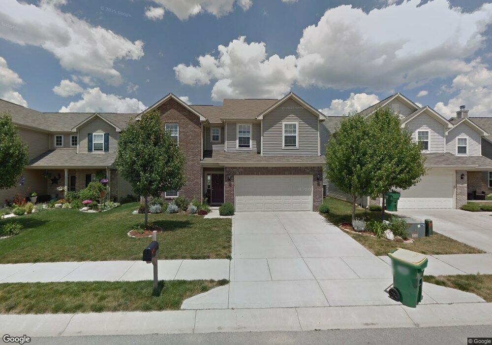
1036 Burntwood Way Westfield, IN 46074
Estimated Value: $383,000 - $438,000
4
Beds
3
Baths
2,433
Sq Ft
$165/Sq Ft
Est. Value
About This Home
This home is located at 1036 Burntwood Way, Westfield, IN 46074 and is currently estimated at $402,307, approximately $165 per square foot. 1036 Burntwood Way is a home located in Hamilton County with nearby schools including Maple Glen Elementary, Westfield Intermediate School, and Westfield Middle School.
Ownership History
Date
Name
Owned For
Owner Type
Purchase Details
Closed on
Sep 26, 2008
Sold by
Arbor Homes Llc
Bought by
Vandyke Derek and Van Dyke Lauren
Current Estimated Value
Home Financials for this Owner
Home Financials are based on the most recent Mortgage that was taken out on this home.
Original Mortgage
$172,996
Outstanding Balance
$115,534
Interest Rate
6.52%
Mortgage Type
FHA
Estimated Equity
$286,773
Purchase Details
Closed on
Jul 8, 2008
Sold by
Platinum Properties Llc
Bought by
Arbor Homes Llc
Create a Home Valuation Report for This Property
The Home Valuation Report is an in-depth analysis detailing your home's value as well as a comparison with similar homes in the area
Home Values in the Area
Average Home Value in this Area
Purchase History
| Date | Buyer | Sale Price | Title Company |
|---|---|---|---|
| Vandyke Derek | -- | None Available | |
| Arbor Homes Llc | -- | None Available |
Source: Public Records
Mortgage History
| Date | Status | Borrower | Loan Amount |
|---|---|---|---|
| Open | Vandyke Derek | $172,996 |
Source: Public Records
Tax History Compared to Growth
Tax History
| Year | Tax Paid | Tax Assessment Tax Assessment Total Assessment is a certain percentage of the fair market value that is determined by local assessors to be the total taxable value of land and additions on the property. | Land | Improvement |
|---|---|---|---|---|
| 2024 | $3,499 | $315,800 | $52,200 | $263,600 |
| 2023 | $3,564 | $309,500 | $52,200 | $257,300 |
| 2022 | $3,204 | $273,100 | $52,200 | $220,900 |
| 2021 | $2,789 | $231,800 | $52,200 | $179,600 |
| 2020 | $2,659 | $219,200 | $52,200 | $167,000 |
| 2019 | $2,572 | $212,200 | $52,200 | $160,000 |
| 2018 | $2,368 | $195,600 | $36,800 | $158,800 |
| 2017 | $2,105 | $186,200 | $36,800 | $149,400 |
| 2016 | $2,003 | $177,200 | $36,800 | $140,400 |
| 2014 | $1,772 | $160,600 | $36,800 | $123,800 |
| 2013 | $1,772 | $160,400 | $36,800 | $123,600 |
Source: Public Records
Map
Nearby Homes
- 16964 Brigg Ct
- 931 Maidstone Ave
- 963 Retford Dr
- 17346 Haxby Ln
- 871 Maidstone Ave
- The Sullivan Plan at Midland - Brookston
- The Elwood Plan at Midland - Brookston
- 17334 Ditch Rd
- 17342 Ditch Rd
- 1451 Crosstie Cir
- 1457 Beaumont Cir
- The Wells Plan at Midland - The Terraces
- The Kellogg Plan at Midland - Winslow
- The Central Plan at Midland - Conrail
- The Benton Plan at Midland - Crawford
- The Watson Plan at Midland - Winslow
- The Vandalia Plan at Midland - Conrail
- The Hadley Plan at Midland - Middleton
- The Bates Plan at Midland - Winslow
- The Albany Plan at Midland - Middleton
- 1028 Burntwood Way
- 1044 Burntwood Way
- 1020 Burntwood Way
- 1052 Burntwood Way
- 1012 Burntwood Way
- 1035 Lichfield Ln
- 1027 Lichfield Ln
- 1043 Lichfield Ln
- 1060 Burntwood Way
- 1019 Lichfield Ln
- 1051 Lichfield Ln
- 1004 Burntwood Way
- 1011 Lichfield Ln
- 1059 Lichfield Ln
- 1003 Lichfield Ln
- 1067 Lichfield Ln
- 1036 Lichfield Ln
- 1028 Lichfield Ln
- 1044 Lichfield Ln
- 1020 Lichfield Ln