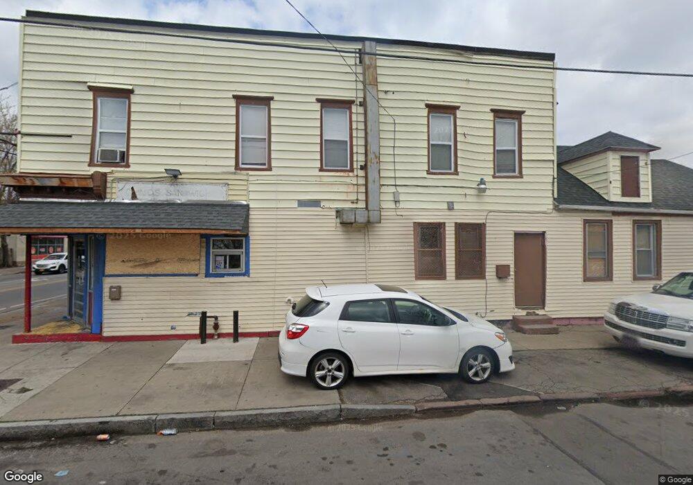
1036 Clinton Ave N Rochester, NY 14621
Northeast Rochester NeighborhoodEstimated Value: $96,313
--
Bed
--
Bath
7,248
Sq Ft
$13/Sq Ft
Est. Value
About This Home
This home is located at 1036 Clinton Ave N, Rochester, NY 14621 and is currently estimated at $96,313, approximately $13 per square foot. 1036 Clinton Ave N is a home located in Monroe County with nearby schools including School 9-DR Martin Luther King Jr, School 8-Roberto Clemente, and School 25 Nathaniel Hawthorne.
Ownership History
Date
Name
Owned For
Owner Type
Purchase Details
Closed on
Apr 11, 2024
Sold by
New Grail Inc
Bought by
Clinton Ave Power Llc
Current Estimated Value
Purchase Details
Closed on
Aug 25, 2021
Sold by
Pecoraro Robert
Bought by
The New Grail Inc
Purchase Details
Closed on
Jun 13, 2018
Sold by
Taliento Thomas
Bought by
Pecararo Robert
Purchase Details
Closed on
Sep 2, 2015
Sold by
141 Grosvenor Road Llc
Bought by
Taliento Thomas
Purchase Details
Closed on
May 7, 2014
Sold by
Cristo Louis B
Bought by
141 Grosvenor Road Llc
Purchase Details
Closed on
Apr 2, 2001
Sold by
Militello David
Bought by
Montero Freddy Otilio
Purchase Details
Closed on
Apr 26, 1999
Sold by
Bunce Gary
Bought by
Militello David
Create a Home Valuation Report for This Property
The Home Valuation Report is an in-depth analysis detailing your home's value as well as a comparison with similar homes in the area
Home Values in the Area
Average Home Value in this Area
Purchase History
| Date | Buyer | Sale Price | Title Company |
|---|---|---|---|
| Clinton Ave Power Llc | -- | None Listed On Document | |
| The New Grail Inc | -- | None Available | |
| Pecararo Robert | $55,000 | None Available | |
| Taliento Thomas | $22,000 | None Available | |
| 141 Grosvenor Road Llc | $12,000 | None Available | |
| Montero Freddy Otilio | $44,400 | Hope Olsson | |
| Militello David | -- | -- | |
| Militello David | -- | Leonardo Stephen M |
Source: Public Records
Tax History Compared to Growth
Tax History
| Year | Tax Paid | Tax Assessment Tax Assessment Total Assessment is a certain percentage of the fair market value that is determined by local assessors to be the total taxable value of land and additions on the property. | Land | Improvement |
|---|---|---|---|---|
| 2024 | $905 | $96,600 | $7,500 | $89,100 |
| 2023 | $936 | $67,700 | $7,500 | $60,200 |
| 2022 | $821 | $67,700 | $7,500 | $60,200 |
| 2021 | $784 | $67,700 | $7,500 | $60,200 |
| 2020 | $852 | $67,700 | $7,500 | $60,200 |
| 2019 | $804 | $67,700 | $7,500 | $60,200 |
| 2018 | $3,853 | $67,700 | $7,500 | $60,200 |
| 2017 | $3,853 | $67,700 | $7,500 | $60,200 |
| 2016 | $804 | $67,700 | $7,500 | $60,200 |
| 2015 | -- | $67,700 | $7,500 | $60,200 |
| 2014 | -- | $67,700 | $7,500 | $60,200 |
Source: Public Records
Map
Nearby Homes
- 19 Bloomingdale St
- 75 Mead St
- 15-17 Wilkins St
- 184 Remington St
- 58 Flower St
- 16 Seabrook St Unit 2
- 340 Clifford Ave
- 462 Avenue D Unit 464
- 255 Avenue A
- 57 Dale St
- 78 Wilkins St
- 280 Avenue D
- 232 Avenue A
- 22 Sullivan St
- 522 Avenue D
- 1227 N Clinton Ave Unit 1221
- 256 Avenue D
- 275 Clifford Ave
- 26 Kohlman St
- 621 Joseph Ave
- 1042 Clinton Ave N
- 1048 N Clinton Ave
- 420 Avenue A
- 415 Avenue A
- 1054-1062 N Clinton Ave
- 1054 N Clinton Ave
- 417 Avenue A
- 424 Avenue A
- 428 Avenue A
- 23 Ketchum St
- 29 Ketchum St
- 432 Avenue A
- 372 Avenue A
- 429 Avenue A Unit 431
- 1072 N Clinton Ave
- 369 Avenue A
- 33 Ketchum St
- 438 Avenue A
- 20 Ketchum St
- 439 Avenue A