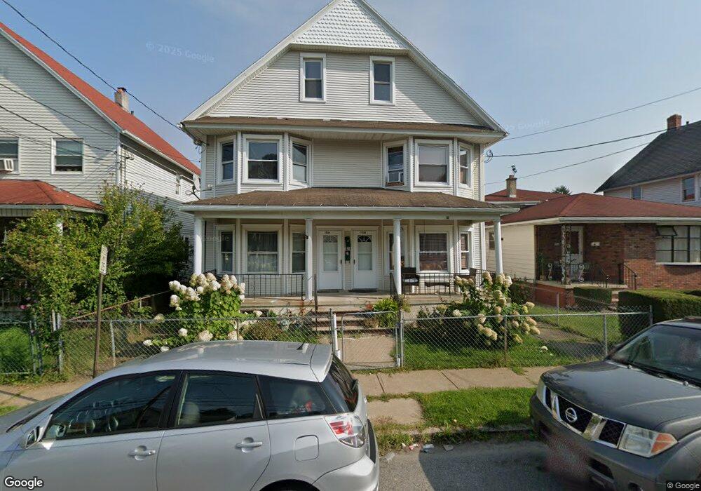
1036 Diamond Ave Unit 1038 Scranton, PA 18508
The Plot NeighborhoodEstimated Value: $136,000 - $281,000
--
Bed
--
Bath
--
Sq Ft
5,968
Sq Ft Lot
About This Home
This home is located at 1036 Diamond Ave Unit 1038, Scranton, PA 18508 and is currently estimated at $198,675. 1036 Diamond Ave Unit 1038 is a home located in Lackawanna County with nearby schools including Isaac Tripp Elementary School, West Scranton Intrmd School, and Scranton High School.
Ownership History
Date
Name
Owned For
Owner Type
Purchase Details
Closed on
Oct 22, 2020
Sold by
Monahan Martin F and Monahan Candice E
Bought by
Reyes Alicia and Viloria Andres
Current Estimated Value
Home Financials for this Owner
Home Financials are based on the most recent Mortgage that was taken out on this home.
Original Mortgage
$96,000
Interest Rate
2.7%
Mortgage Type
New Conventional
Purchase Details
Closed on
Jul 21, 2016
Sold by
Monahan Martin F
Bought by
Monahan Martin F and Monahan Candice E
Home Financials for this Owner
Home Financials are based on the most recent Mortgage that was taken out on this home.
Original Mortgage
$77,000
Interest Rate
3.56%
Mortgage Type
Commercial
Purchase Details
Closed on
Oct 25, 2002
Bought by
Monahan Martin F
Create a Home Valuation Report for This Property
The Home Valuation Report is an in-depth analysis detailing your home's value as well as a comparison with similar homes in the area
Home Values in the Area
Average Home Value in this Area
Purchase History
| Date | Buyer | Sale Price | Title Company |
|---|---|---|---|
| Reyes Alicia | $120,000 | Mountain Abstract | |
| Monahan Martin F | -- | None Available | |
| Monahan Martin F | $89,000 | -- |
Source: Public Records
Mortgage History
| Date | Status | Borrower | Loan Amount |
|---|---|---|---|
| Previous Owner | Reyes Alicia | $96,000 | |
| Previous Owner | Monahan Martin F | $77,000 |
Source: Public Records
Tax History Compared to Growth
Tax History
| Year | Tax Paid | Tax Assessment Tax Assessment Total Assessment is a certain percentage of the fair market value that is determined by local assessors to be the total taxable value of land and additions on the property. | Land | Improvement |
|---|---|---|---|---|
| 2025 | $4,159 | $13,000 | $1,950 | $11,050 |
| 2024 | $3,799 | $13,000 | $1,950 | $11,050 |
| 2023 | $3,799 | $13,000 | $1,950 | $11,050 |
| 2022 | $3,716 | $13,000 | $1,950 | $11,050 |
| 2021 | $3,716 | $13,000 | $1,950 | $11,050 |
| 2020 | $3,646 | $13,000 | $1,950 | $11,050 |
| 2019 | $3,429 | $13,000 | $1,950 | $11,050 |
| 2018 | $3,429 | $13,000 | $1,950 | $11,050 |
| 2017 | $3,368 | $13,000 | $1,950 | $11,050 |
| 2016 | $0 | $13,000 | $1,950 | $11,050 |
| 2015 | $2,195 | $13,000 | $1,950 | $11,050 |
| 2014 | -- | $13,000 | $1,950 | $11,050 |
Source: Public Records
Map
Nearby Homes
- 1008 Mount Vernon Ave
- 942 Providence Rd
- 1206 Blair Ave Unit Rear
- 938 Providence Rd
- 375 Grove St
- 1227 Providence Rd
- 656 Philo St
- 1123 Court St
- 1311 Short Ave
- 1235 N Sumner Ave
- 991 N Sumner Ave Unit 1/2 L 13
- 1425 Bulwer St
- 1126 W Gibson St
- 0 Philo St Unit GSBSC4763
- 1430 N Main Ave
- 833 Powderly Ct
- 1431 Dorothy St
- 1012 Clearview St
- 1436 Church Ave
- 1513 Meylert Ave
- 1040-1042 Diamond Ave
- 1038 Diamond Ave
- 1040 Diamond Ave Unit 1042
- 1042 Diamond Ave
- 1030 Diamond Ave
- 1046 Diamond Ave
- 1044-1046 Diamond Ave
- 1028 Diamond Ave Unit R
- 1028 Diamond Ave
- 1044 Diamond Ave Unit 1046
- 1024 Diamond Ave Unit 1026
- 1037 Diamond Ave Unit 39
- 0 Diamond Ave Unit GSB008323
- 1033 Diamond Ave Unit 1035
- 1041 Diamond Ave
- 1031 Diamond Ave
- 1096 Diamond Ave
- 1029-1031 Diamond Ave
- 1029 Diamond Ave Unit 31
- 1027 Diamond Ave