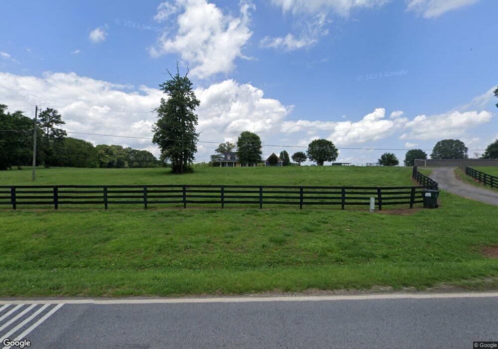
1036 Double Bridge Rd Winder, GA 30680
Estimated Value: $438,000 - $531,827
3
Beds
3
Baths
2,517
Sq Ft
$193/Sq Ft
Est. Value
About This Home
This home is located at 1036 Double Bridge Rd, Winder, GA 30680 and is currently estimated at $485,957, approximately $193 per square foot. 1036 Double Bridge Rd is a home located in Barrow County with nearby schools including Statham Elementary School, Bear Creek Middle School, and Winder-Barrow High School.
Ownership History
Date
Name
Owned For
Owner Type
Purchase Details
Closed on
Jun 20, 2014
Sold by
Gaston Walter Arnold K
Bought by
Tanner Penny D
Current Estimated Value
Purchase Details
Closed on
Feb 7, 2001
Sold by
Gaston Walter A
Bought by
Gaston Walter A and Gaston Alison L
Home Financials for this Owner
Home Financials are based on the most recent Mortgage that was taken out on this home.
Original Mortgage
$205,000
Interest Rate
6.91%
Mortgage Type
Stand Alone Refi Refinance Of Original Loan
Create a Home Valuation Report for This Property
The Home Valuation Report is an in-depth analysis detailing your home's value as well as a comparison with similar homes in the area
Home Values in the Area
Average Home Value in this Area
Purchase History
| Date | Buyer | Sale Price | Title Company |
|---|---|---|---|
| Tanner Penny D | $170,000 | -- | |
| Gaston Walter A | -- | -- |
Source: Public Records
Mortgage History
| Date | Status | Borrower | Loan Amount |
|---|---|---|---|
| Previous Owner | Gaston Walter A | $205,000 |
Source: Public Records
Tax History Compared to Growth
Tax History
| Year | Tax Paid | Tax Assessment Tax Assessment Total Assessment is a certain percentage of the fair market value that is determined by local assessors to be the total taxable value of land and additions on the property. | Land | Improvement |
|---|---|---|---|---|
| 2024 | $3,526 | $179,588 | $40,725 | $138,863 |
| 2023 | $4,033 | $179,588 | $40,725 | $138,863 |
| 2022 | $3,102 | $137,692 | $40,725 | $96,967 |
| 2021 | $2,636 | $117,559 | $28,673 | $88,886 |
| 2020 | $2,406 | $100,719 | $19,913 | $80,806 |
| 2019 | $2,458 | $101,119 | $19,913 | $81,206 |
| 2018 | $2,429 | $101,119 | $19,913 | $81,206 |
| 2017 | $2,598 | $89,229 | $19,913 | $69,316 |
| 2016 | $1,951 | $83,836 | $17,220 | $66,616 |
| 2015 | $1,982 | $84,601 | $17,220 | $67,382 |
| 2014 | $2,062 | $86,826 | $19,444 | $67,382 |
| 2013 | -- | $82,554 | $19,444 | $63,110 |
Source: Public Records
Map
Nearby Homes
- 385 Finch Landing Rd
- 206 Ballast Trail
- 330 Anchors Way
- 1212 Highway 211 NE
- 1226 Highway 211 NE
- 1955 Paynes Point
- 1228 Georgia Highway 211
- 1228 Highway 211 NE
- 1415 Red Oak Way
- 1423 Red Oak Way
- 1642 White Oak Dr
- 670 Cedar Grove Church Rd
- 670 Cedar Grove Church Rd
- 315 Paige Way
- 1553 Shoal Creek Dr
- 207 Cedar Grove Church Rd
- 1014 Brynn Dr
- 380 Glenn Trail
- 504 Stoney Creek Dr
- 1724 Cedar Grove Church Rd
- 1007 Solomon Way
- 290 Finch Ct Unit LOT 29
- 201 Finch Landing Rd Unit LOT 47
- 270 Finch Ct Unit LOT 28
- 304 Finch Ct Unit LOT 30
- 305 Finch Ct Unit 34
- 315 Finch Ct Unit LOT 33
- 316 Finch Ct Unit LOT 32
- 275 Finch Ct Unit LOT 36
- 240 Finch Ct Unit 26
- 103 Finch Ct Unit 44
- 123 Finch Ct Unit 43
- 250 Finch Ct Unit 27
- 214 Finch Landing Rd Unit 5
- 353 Finch Landing Rd
- 405 Finch Landing Rd Unit 17
- 408 Finch Landing Rd Unit 16
- 400 Finch Landing Rd Unit 15
- 385 Finch Landing Rd Unit 18
- 394 Finch Landing Rd Unit 14