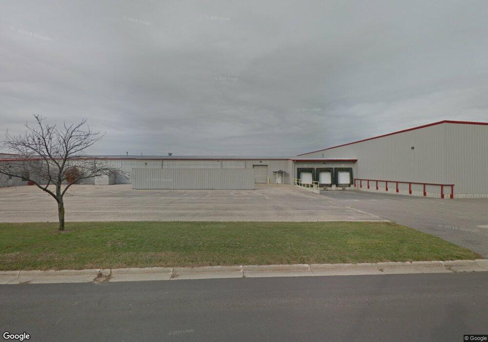
1036 Fairway St Mauston, WI 53948
Estimated Value: $4,022,219
--
Bed
--
Bath
107,005
Sq Ft
$38/Sq Ft
Est. Value
About This Home
This home is located at 1036 Fairway St, Mauston, WI 53948 and is currently estimated at $4,022,219, approximately $37 per square foot. 1036 Fairway St is a home located in Juneau County with nearby schools including West Side Elementary School, Lyndon Station Elementary School, and Grayside Elementary School.
Ownership History
Date
Name
Owned For
Owner Type
Purchase Details
Closed on
Dec 30, 2014
Sold by
Brunner Ronald E and Brunner Barbara J
Bought by
Rbj Logistics Llc
Current Estimated Value
Purchase Details
Closed on
Dec 27, 2013
Sold by
Cardinal Ig Company
Bought by
Brunner Ronald E and Brunner Barbara J
Create a Home Valuation Report for This Property
The Home Valuation Report is an in-depth analysis detailing your home's value as well as a comparison with similar homes in the area
Home Values in the Area
Average Home Value in this Area
Purchase History
| Date | Buyer | Sale Price | Title Company |
|---|---|---|---|
| Rbj Logistics Llc | -- | -- | |
| Brunner Ronald E | $1,500,000 | -- |
Source: Public Records
Tax History Compared to Growth
Tax History
| Year | Tax Paid | Tax Assessment Tax Assessment Total Assessment is a certain percentage of the fair market value that is determined by local assessors to be the total taxable value of land and additions on the property. | Land | Improvement |
|---|---|---|---|---|
| 2024 | $32,740 | $1,328,900 | $63,100 | $1,265,800 |
| 2023 | $34,382 | $1,525,700 | $72,400 | $1,453,300 |
| 2022 | $36,434 | $1,641,600 | $69,400 | $1,572,200 |
| 2021 | $37,431 | $1,222,800 | $51,700 | $1,171,100 |
| 2020 | $40,426 | $1,340,000 | $56,600 | $1,283,400 |
| 2019 | $40,541 | $1,358,500 | $56,400 | $1,302,100 |
| 2018 | $40,904 | $1,414,300 | $58,600 | $1,355,700 |
| 2017 | $39,519 | $1,381,300 | $57,300 | $1,324,000 |
| 2016 | $41,559 | $1,522,100 | $63,100 | $1,459,000 |
| 2015 | $46,338 | $1,522,100 | $63,100 | $1,459,000 |
| 2014 | $45,547 | $1,536,800 | $60,500 | $1,476,300 |
| 2013 | $59,309 | $1,912,900 | $60,500 | $1,852,400 |
Source: Public Records
Map
Nearby Homes
- 207 Highview Ave
- 506 W State St
- 515 Grove St
- 470 West Ave
- 314 W State St
- 0 Fleet St Unit 1978417
- 314 W St
- L31 Heath Ct
- 725 Turner Dr
- L5 Buttner Ct
- 12.35 AC Highway 58 Trunk
- 333 S Hickory St
- 510 N Union St
- 1.6 acres Prospect and Lincoln St
- 0.53 acres Prospect Ave
- 511 Pine St
- 0.3 acres Lincoln St
- 1001 Elm St
- N5070 Pfaff Rd
- 712 La Crosse St
- 1.41 Ac Fairway St
- 1110 North Rd
- W6553 North Rd
- N4591 Us Highway 12 and 16
- N4585 Us Highway 12 and 16
- N4579 Us Highway 12 and 16
- 29.94 Ac North Rd
- 29.94 Acres North Rd
- N4618 Us Highway 12 and 16
- N4604 Us Highway 12 and 16
- N4624 Us Highway 12 and 16
- 161 Ensch St
- 0 Highway 12 & 16 Unit 22200503
- N4727 Hwy 12 16
- N4717 Us Highway 12 and 16
- N4723 Us Highway 12 and 16
- N4735 Hwy 12 16
- 000 Hwy 12-16 W
- N4727 Us Highway 12 and 16
- 31.82 Acres Us Hwy 12-16