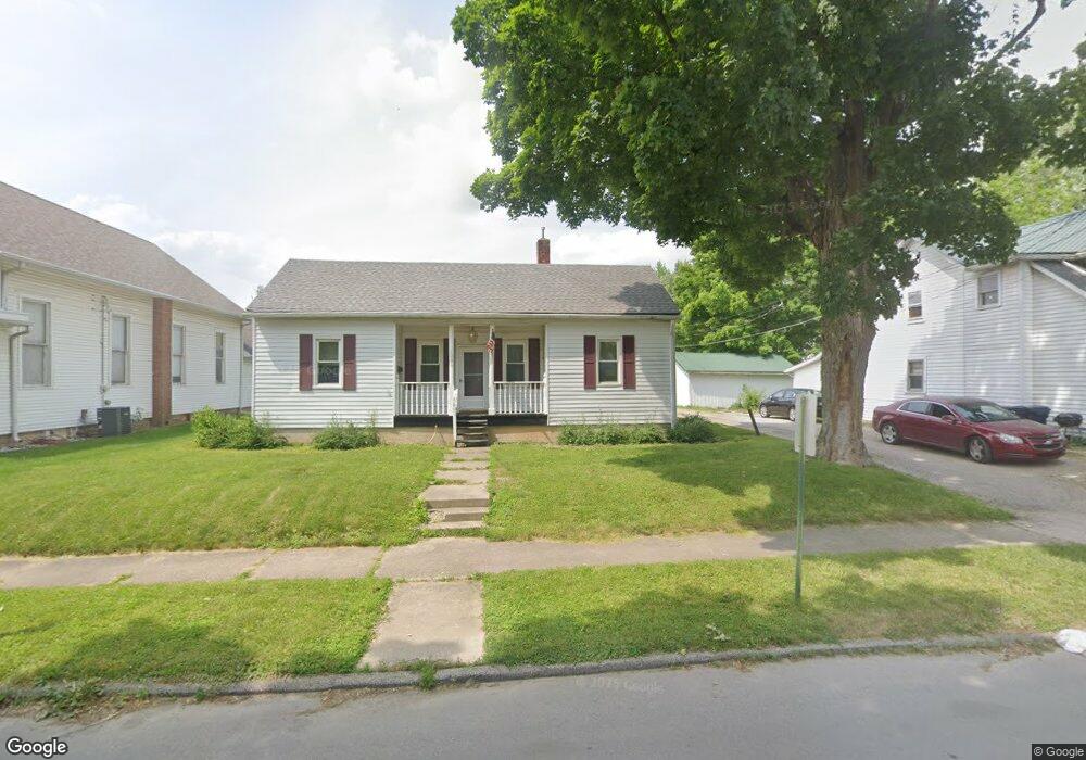
1036 Locust St Middletown, IN 47356
Estimated Value: $118,000 - $139,000
2
Beds
1
Bath
1,644
Sq Ft
$78/Sq Ft
Est. Value
About This Home
This home is located at 1036 Locust St, Middletown, IN 47356 and is currently estimated at $127,572, approximately $77 per square foot. 1036 Locust St is a home located in Henry County with nearby schools including Shenandoah Elementary School, Shenandoah Middle School, and Shenandoah High School.
Ownership History
Date
Name
Owned For
Owner Type
Purchase Details
Closed on
Oct 21, 2016
Sold by
F & J Mccrocklin Rentals
Bought by
1036 F & J Llc
Current Estimated Value
Purchase Details
Closed on
Jul 13, 2010
Sold by
Marx Rentals Llc
Bought by
F & J Mccrocklin Rentals
Purchase Details
Closed on
Mar 2, 2009
Sold by
Sneil Llc
Bought by
Marx Rentals Llc
Purchase Details
Closed on
Dec 29, 2006
Sold by
Ratcliff Linda and State Of Indiana
Bought by
Sneil Llc
Create a Home Valuation Report for This Property
The Home Valuation Report is an in-depth analysis detailing your home's value as well as a comparison with similar homes in the area
Home Values in the Area
Average Home Value in this Area
Purchase History
| Date | Buyer | Sale Price | Title Company |
|---|---|---|---|
| 1036 F & J Llc | -- | None Available | |
| F & J Mccrocklin Rentals | -- | None Available | |
| Marx Rentals Llc | -- | None Available | |
| Sneil Llc | $20,000 | None Available |
Source: Public Records
Tax History
| Year | Tax Paid | Tax Assessment Tax Assessment Total Assessment is a certain percentage of the fair market value that is determined by local assessors to be the total taxable value of land and additions on the property. | Land | Improvement |
|---|---|---|---|---|
| 2025 | $1,128 | $55,300 | $13,700 | $41,600 |
| 2024 | $1,128 | $56,400 | $13,700 | $42,700 |
| 2023 | $994 | $48,900 | $13,700 | $35,200 |
| 2022 | $1,020 | $50,000 | $13,700 | $36,300 |
| 2021 | $855 | $41,800 | $11,900 | $29,900 |
| 2020 | $849 | $40,900 | $11,900 | $29,000 |
| 2019 | $833 | $40,100 | $11,900 | $28,200 |
| 2018 | $827 | $39,900 | $11,900 | $28,000 |
| 2017 | $1,061 | $50,500 | $11,900 | $38,600 |
| 2016 | $1,033 | $49,500 | $11,600 | $37,900 |
| 2014 | $962 | $47,300 | $12,000 | $35,300 |
| 2013 | $962 | $43,200 | $12,400 | $30,800 |
Source: Public Records
Map
Nearby Homes
- 1190 Cottage Ave
- 1456 Congress St
- 247 N 8th St
- 608 N 10th St
- 224 N 5th St
- 508 N 5th St
- 687 W Mill St
- 7140 W County Road 950 N
- 6912 N County Road 700 W
- 4998 67
- 4326 E County Road 500 S
- 5333 S County Road 450 E
- 5634 N Quail Ln
- 6671 N County Road 525 W
- 6875 N Spruce St
- 3346 E State Road 236
- 7255 W US Highway 36
- No Street Number N County Road 525 W
- 5405 Emerson Way
- 0 W Commerce Rd Unit 202540549
- 1036 Locust St
- 1074 Locust St
- 1028 Locust St
- 1028 Locust St
- 101 N 10th St
- 125 N 10th St
- 1045 Locust St
- 1075 Locust St
- 1007 Cottage Ave
- 1017 Locust St
- 998 Locust St
- 1125 Locust St
- 1036 Cottage Ave
- 188 N 10th St
- 1141 Locust St
- 1006 Cottage Ave
- 964 Locust St
- 993 Locust St
- 1110 Cottage Ave
- 953 Cottage Ave
Your Personal Tour Guide
Ask me questions while you tour the home.