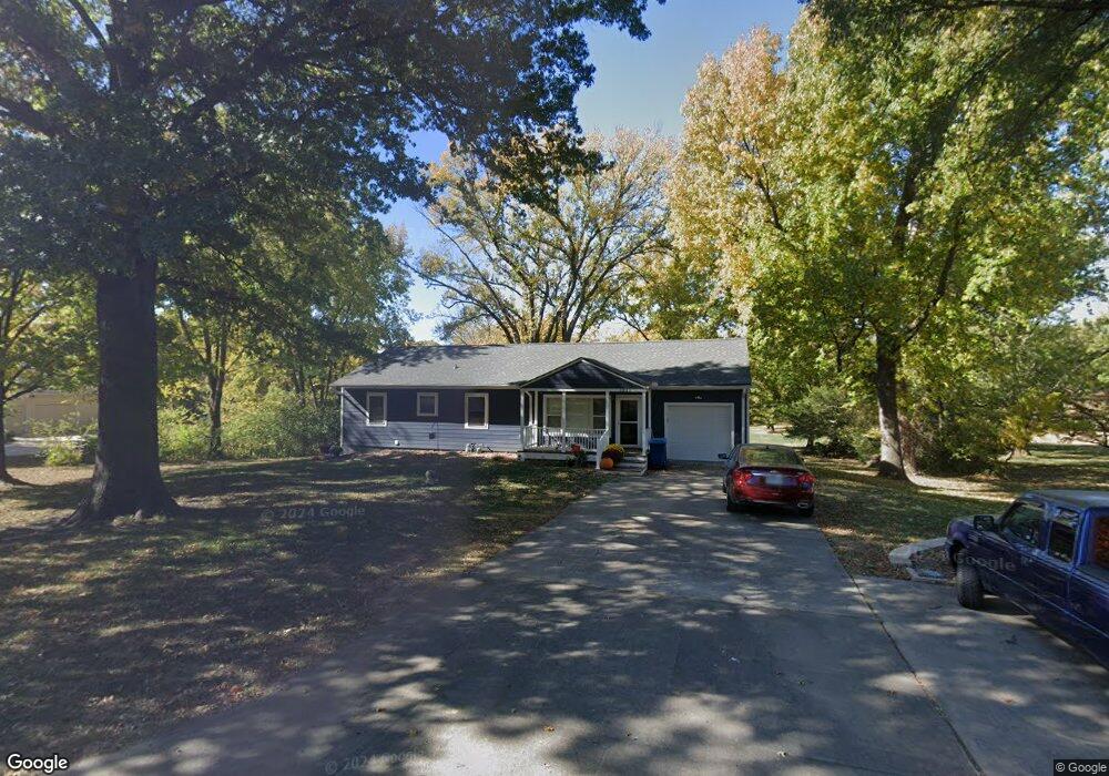
1036 Manchester Rd Liberty, MO 64068
Estimated Value: $369,311 - $410,000
4
Beds
3
Baths
1,944
Sq Ft
$201/Sq Ft
Est. Value
About This Home
This home is located at 1036 Manchester Rd, Liberty, MO 64068 and is currently estimated at $390,328, approximately $200 per square foot. 1036 Manchester Rd is a home located in Clay County with nearby schools including Alexander Doniphan Elementary School, Discovery Middle School, and Liberty High School.
Ownership History
Date
Name
Owned For
Owner Type
Purchase Details
Closed on
Jul 31, 2009
Sold by
Schwegler J Stephan and Schwegler Napaporn
Bought by
Sloan Crystal Gay
Current Estimated Value
Home Financials for this Owner
Home Financials are based on the most recent Mortgage that was taken out on this home.
Original Mortgage
$165,300
Outstanding Balance
$108,871
Interest Rate
5.41%
Mortgage Type
New Conventional
Estimated Equity
$281,457
Create a Home Valuation Report for This Property
The Home Valuation Report is an in-depth analysis detailing your home's value as well as a comparison with similar homes in the area
Home Values in the Area
Average Home Value in this Area
Purchase History
| Date | Buyer | Sale Price | Title Company |
|---|---|---|---|
| Sloan Crystal Gay | -- | None Available |
Source: Public Records
Mortgage History
| Date | Status | Borrower | Loan Amount |
|---|---|---|---|
| Open | Sloan Crystal Gay | $165,300 |
Source: Public Records
Tax History Compared to Growth
Tax History
| Year | Tax Paid | Tax Assessment Tax Assessment Total Assessment is a certain percentage of the fair market value that is determined by local assessors to be the total taxable value of land and additions on the property. | Land | Improvement |
|---|---|---|---|---|
| 2025 | $3,862 | $57,700 | -- | -- |
| 2024 | $3,862 | $50,220 | -- | -- |
| 2023 | $3,928 | $50,220 | $0 | $0 |
| 2022 | $3,587 | $45,280 | $0 | $0 |
| 2021 | $3,559 | $45,277 | $11,400 | $33,877 |
| 2020 | $2,915 | $34,830 | $0 | $0 |
| 2019 | $2,915 | $34,827 | $5,700 | $29,127 |
| 2018 | $2,800 | $32,850 | $0 | $0 |
| 2017 | $2,774 | $32,850 | $5,320 | $27,530 |
| 2016 | $2,774 | $32,850 | $5,320 | $27,530 |
| 2015 | $2,774 | $32,850 | $5,320 | $27,530 |
| 2014 | $2,654 | $31,180 | $5,320 | $25,860 |
Source: Public Records
Map
Nearby Homes
- 1124 Amesbury Ave
- 918 Amesbury Ave
- 415 Monterey Ave
- 862 Amesbury Ave
- 509 Belmont St
- 420 Belmont St
- 1323 Amesbury Ave
- 1218 Canterbury Ln
- 716 Bristol Ct
- 1507 Amesbury Ave
- 1331 Park Ln
- 1733 Welleslay Ln
- 1317 Park Ln
- 253 S Stewart Rd
- 1537 Canterbury Ln
- 1209 Liberty Drive Terrace
- 1304 Wellington Way
- 1327 Easton Ct
- 7908 N Ditzler Ave
- 9102 NE 79th Terrace
- 1020 Manchester Rd
- 1106 Manchester Rd
- 1037 Manchester Rd
- 1107 Manchester Rd
- 1021 Manchester Rd
- 1120 Manchester Rd
- 1006 Manchester Rd
- 1007 Manchester Rd
- 1121 Manchester Rd
- 936 Manchester Rd
- 1140 Manchester Rd
- 937 Manchester Rd
- 1934 Barford Rd
- 1930 Barford Rd
- 313 Wilshire Blvd
- 309 Wilshire Blvd
- 317 Wilshire Blvd
- 305 Wilshire Blvd
- 401 Wilshire Blvd
- 920 Manchester Rd