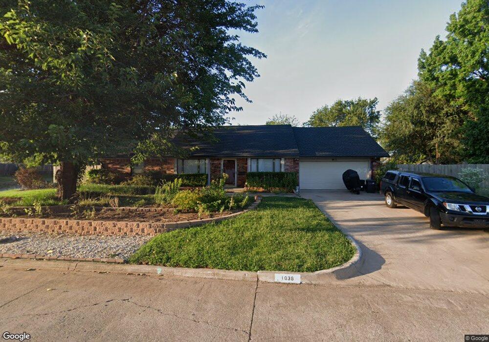
1036 Mockingbird Ln Norman, OK 73071
Southeast Norman NeighborhoodEstimated Value: $284,694 - $358,000
3
Beds
2
Baths
2,252
Sq Ft
$141/Sq Ft
Est. Value
About This Home
This home is located at 1036 Mockingbird Ln, Norman, OK 73071 and is currently estimated at $317,674, approximately $141 per square foot. 1036 Mockingbird Ln is a home located in Cleveland County with nearby schools including Lincoln Elementary School, Irving Middle School, and Norman High School.
Ownership History
Date
Name
Owned For
Owner Type
Purchase Details
Closed on
Sep 14, 2012
Sold by
Allen Kay L
Bought by
Smith James W and Martine Smith K
Current Estimated Value
Home Financials for this Owner
Home Financials are based on the most recent Mortgage that was taken out on this home.
Original Mortgage
$109,500
Outstanding Balance
$15,269
Interest Rate
3.59%
Mortgage Type
New Conventional
Estimated Equity
$302,405
Create a Home Valuation Report for This Property
The Home Valuation Report is an in-depth analysis detailing your home's value as well as a comparison with similar homes in the area
Home Values in the Area
Average Home Value in this Area
Purchase History
| Date | Buyer | Sale Price | Title Company |
|---|---|---|---|
| Smith James W | $191,000 | None Available |
Source: Public Records
Mortgage History
| Date | Status | Borrower | Loan Amount |
|---|---|---|---|
| Open | Smith James W | $109,500 |
Source: Public Records
Tax History
| Year | Tax Paid | Tax Assessment Tax Assessment Total Assessment is a certain percentage of the fair market value that is determined by local assessors to be the total taxable value of land and additions on the property. | Land | Improvement |
|---|---|---|---|---|
| 2025 | $3,010 | $26,077 | $5,152 | $20,925 |
| 2024 | $2,912 | $25,317 | $5,351 | $19,966 |
| 2023 | $2,952 | $24,580 | $5,979 | $18,601 |
| 2022 | $2,695 | $23,409 | $5,875 | $17,534 |
| 2021 | $2,706 | $22,295 | $3,360 | $18,935 |
| 2020 | $2,648 | $22,295 | $3,360 | $18,935 |
| 2019 | $2,693 | $22,295 | $3,360 | $18,935 |
| 2018 | $2,612 | $22,295 | $3,360 | $18,935 |
| 2017 | $2,641 | $22,295 | $0 | $0 |
| 2016 | $2,684 | $22,295 | $3,360 | $18,935 |
| 2015 | $2,604 | $22,295 | $3,360 | $18,935 |
| 2014 | $2,630 | $22,295 | $3,360 | $18,935 |
Source: Public Records
Map
Nearby Homes
- 1313 Melisa Dr
- 401 12th Ave SE Unit 137
- 401 12th Ave SE Unit 111
- 401 12th Ave SE Unit 224
- 401 12th Ave SE Unit 136
- 401 12th Ave SE Unit 252
- 401 12th Ave SE Unit 300
- 401 12th Ave SE Unit 179
- 902 Mockingbird Ln
- 818 Mockingbird Ln
- 1218 Benson Dr
- 1406 Abbey Dr
- 1205 Charleston Ct
- 1332 Beaumont St
- 1510 Sunrise Cir
- 1322 Columbia Cir
- 205 Jason Dr
- 1220 E Brooks St
- 1414 Bill Carrol Dr
- 1423 Bill Carrol Dr
- 1017 Melisa Dr
- 1028 Mockingbird Ln
- 1013 Melisa Dr
- 1106 Mockingbird Ln
- 1009 Melisa Dr
- 1103 Mockingbird Ln
- 1 Mockingbird Ct
- 1101 Melisa Dr
- 1018 Mockingbird Ln
- 1107 Mockingbird Ln
- 1005 Melisa Dr
- 1110 Mockingbird Ln
- 1105 Melisa Dr
- 1012 Mockingbird Ln
- 1111 Mockingbird Ln
- 1014 Melisa Dr
- 1018 Melisa Dr
- 1019 Mockingbird Ln
- 1010 Melisa Dr
- 2 Mockingbird Ct
Your Personal Tour Guide
Ask me questions while you tour the home.