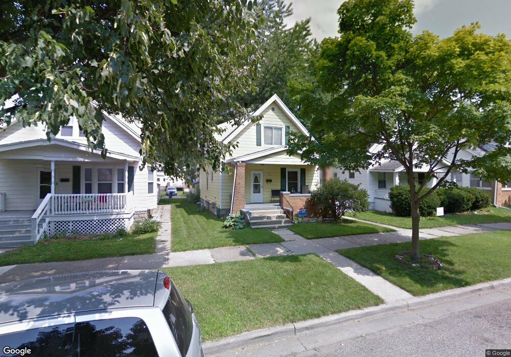
1036 Powers Ave NW Grand Rapids, MI 49504
West Grand NeighborhoodEstimated Value: $269,956 - $312,000
4
Beds
2
Baths
1,544
Sq Ft
$185/Sq Ft
Est. Value
About This Home
This home is located at 1036 Powers Ave NW, Grand Rapids, MI 49504 and is currently estimated at $285,489, approximately $184 per square foot. 1036 Powers Ave NW is a home located in Kent County with nearby schools including Harrison Elementary School, Westwood Middle School, and Union High School.
Ownership History
Date
Name
Owned For
Owner Type
Purchase Details
Closed on
Mar 25, 2020
Sold by
Mcdermed Shawn M and Mcdermed Jill M
Bought by
Mcdermed Shawn M and Mcdermed Jill M
Current Estimated Value
Home Financials for this Owner
Home Financials are based on the most recent Mortgage that was taken out on this home.
Original Mortgage
$97,000
Outstanding Balance
$76,170
Interest Rate
3.4%
Mortgage Type
New Conventional
Estimated Equity
$209,319
Purchase Details
Closed on
Aug 29, 1994
Sold by
Kaser Kaser D D and Kaser Hurst P
Bought by
Mcdermed Shawn M Dulfo Jill M
Create a Home Valuation Report for This Property
The Home Valuation Report is an in-depth analysis detailing your home's value as well as a comparison with similar homes in the area
Home Values in the Area
Average Home Value in this Area
Purchase History
| Date | Buyer | Sale Price | Title Company |
|---|---|---|---|
| Mcdermed Shawn M | -- | None Available | |
| Mcdermed Shawn M Dulfo Jill M | $64,500 | -- |
Source: Public Records
Mortgage History
| Date | Status | Borrower | Loan Amount |
|---|---|---|---|
| Open | Mcdermed Shawn M | $97,000 |
Source: Public Records
Tax History Compared to Growth
Tax History
| Year | Tax Paid | Tax Assessment Tax Assessment Total Assessment is a certain percentage of the fair market value that is determined by local assessors to be the total taxable value of land and additions on the property. | Land | Improvement |
|---|---|---|---|---|
| 2025 | $1,355 | $119,900 | $0 | $0 |
| 2024 | $1,355 | $104,200 | $0 | $0 |
| 2023 | $1,374 | $88,500 | $0 | $0 |
| 2022 | $1,305 | $77,300 | $0 | $0 |
| 2021 | $1,276 | $70,900 | $0 | $0 |
| 2020 | $1,220 | $61,100 | $0 | $0 |
| 2019 | $1,260 | $54,600 | $0 | $0 |
| 2018 | $1,172 | $48,000 | $0 | $0 |
| 2017 | $1,141 | $38,800 | $0 | $0 |
| 2016 | $1,155 | $35,000 | $0 | $0 |
| 2015 | $1,074 | $35,000 | $0 | $0 |
| 2013 | -- | $32,000 | $0 | $0 |
Source: Public Records
Map
Nearby Homes
- 1044 Van Buren Ave NW
- 1200 Leonard St NW
- 914 Courtney St NW
- 833 Pine Ave NW
- 1140 Fremont Ave NW
- 868 10th St NW
- 1054 Crosby St NW
- 905 Courtney St NW
- 856 10th St NW
- 1014 Jennette Ave NW
- 1320 Tamarack Ave NW
- 1352 Walker Ave NW
- 931 Frederick Ave NW
- 1001 6th St NW
- 1060 Myrtle St NW
- 824 Arianna St NW
- 1132 Davis Ave NW
- 1433 Escott Ave NW
- 921 4th St NW
- 627 Lane Ave NW
- 1032 Powers Ave NW
- 1040 Powers Ave NW
- 1028 Powers Ave NW
- 1044 Powers Ave NW
- 1024 Powers Ave NW
- 1035 Pine Ave NW
- 1041 Pine Ave NW
- 1033 Pine Ave NW
- 1050 12th St NW
- 1020 Powers Ave NW
- 1045 Pine Ave NW
- 1046 12th St NW
- 1054 12th St NW
- 1027 Pine Ave NW
- 1041 Pine Ave NW
- 1049 Pine Ave NW
- 1037 Powers Ave NW
- 1033 Powers Ave NW
- 1023 Pine Ave NW
- 1029 Powers Ave NW