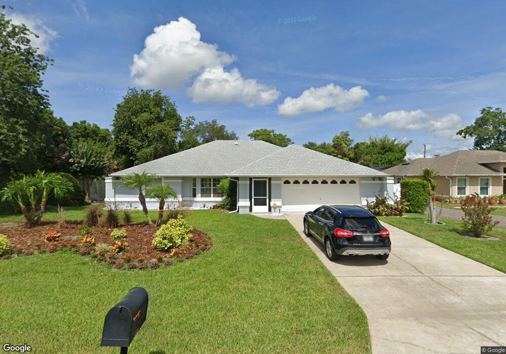
1036 Shepherd Ave Deltona, FL 32738
Estimated Value: $311,000 - $359,000
3
Beds
2
Baths
1,874
Sq Ft
$181/Sq Ft
Est. Value
About This Home
This home is located at 1036 Shepherd Ave, Deltona, FL 32738 and is currently estimated at $338,990, approximately $180 per square foot. 1036 Shepherd Ave is a home located in Volusia County with nearby schools including Deltona Lakes Elementary School, Heritage Middle School, and Pine Ridge High School.
Ownership History
Date
Name
Owned For
Owner Type
Purchase Details
Closed on
Oct 26, 2007
Sold by
Argentina Mary J and Argentina Arthur
Bought by
Durham Lawrence R and Durham Maureen M
Current Estimated Value
Home Financials for this Owner
Home Financials are based on the most recent Mortgage that was taken out on this home.
Original Mortgage
$164,000
Outstanding Balance
$103,174
Interest Rate
6.27%
Mortgage Type
Purchase Money Mortgage
Estimated Equity
$235,816
Purchase Details
Closed on
Sep 15, 1988
Bought by
Durham Lawrence R and Durham Maureen M
Purchase Details
Closed on
Nov 15, 1977
Bought by
Durham Lawrence R and Durham Maureen M
Create a Home Valuation Report for This Property
The Home Valuation Report is an in-depth analysis detailing your home's value as well as a comparison with similar homes in the area
Home Values in the Area
Average Home Value in this Area
Purchase History
| Date | Buyer | Sale Price | Title Company |
|---|---|---|---|
| Durham Lawrence R | $205,000 | B D R Title Corporation | |
| Durham Lawrence R | $9,500 | -- | |
| Durham Lawrence R | $1,800 | -- |
Source: Public Records
Mortgage History
| Date | Status | Borrower | Loan Amount |
|---|---|---|---|
| Open | Durham Lawrence R | $164,000 |
Source: Public Records
Tax History Compared to Growth
Tax History
| Year | Tax Paid | Tax Assessment Tax Assessment Total Assessment is a certain percentage of the fair market value that is determined by local assessors to be the total taxable value of land and additions on the property. | Land | Improvement |
|---|---|---|---|---|
| 2025 | $1,407 | $103,804 | -- | -- |
| 2024 | $1,407 | $100,879 | -- | -- |
| 2023 | $1,407 | $97,941 | $0 | $0 |
| 2022 | $1,377 | $95,088 | $0 | $0 |
| 2021 | $1,390 | $92,318 | $0 | $0 |
| 2020 | $1,368 | $91,043 | $0 | $0 |
| 2019 | $1,366 | $88,996 | $0 | $0 |
| 2018 | $1,336 | $87,337 | $0 | $0 |
| 2017 | $1,301 | $85,541 | $0 | $0 |
| 2016 | $1,256 | $83,782 | $0 | $0 |
| 2015 | $1,274 | $83,200 | $0 | $0 |
| 2014 | $1,243 | $82,540 | $0 | $0 |
Source: Public Records
Map
Nearby Homes
- 973 Radford Dr
- 732 Fort Smith Blvd
- 747 Fort Smith Blvd
- 2067 Everest St
- 968 Fort Smith Blvd
- 2304 Harding Cir
- 2303 Harding Cir
- 2046 Galahad Dr
- 2301 Weatherford Dr
- 884 Fort Smith Blvd
- 2287 Belen Dr
- 2332 Salem Dr
- 745 Mentmore Cir
- 1082 Worthington Dr
- 2375 Belen Dr
- 2351 Montano St Unit 41
- 2375 Salem Dr
- 787 Leeward Dr
- 2180 MacHardy Rd
- 2346 Greenbrier St
- 1044 Shepherd Ave
- 2198 Swanson Dr
- 1045 Radford Dr
- 2192 Swanson Dr
- 1052 Shepherd Ave
- 1037 Radford Dr
- 1035 Shepherd Ave
- 1053 Radford Dr
- 1043 Shepherd Ave
- 2186 Swanson Dr
- 1051 Shepherd Ave
- 1060 Shepherd Ave
- 2203 Swanson Dr
- 1029 Radford Dr
- 2209 Swanson Dr
- 1059 Shepherd Ave
- 2180 Swanson Dr
- 1034 Leeward Dr
- 1068 Shepherd Ave
- 1042 Leeward Dr