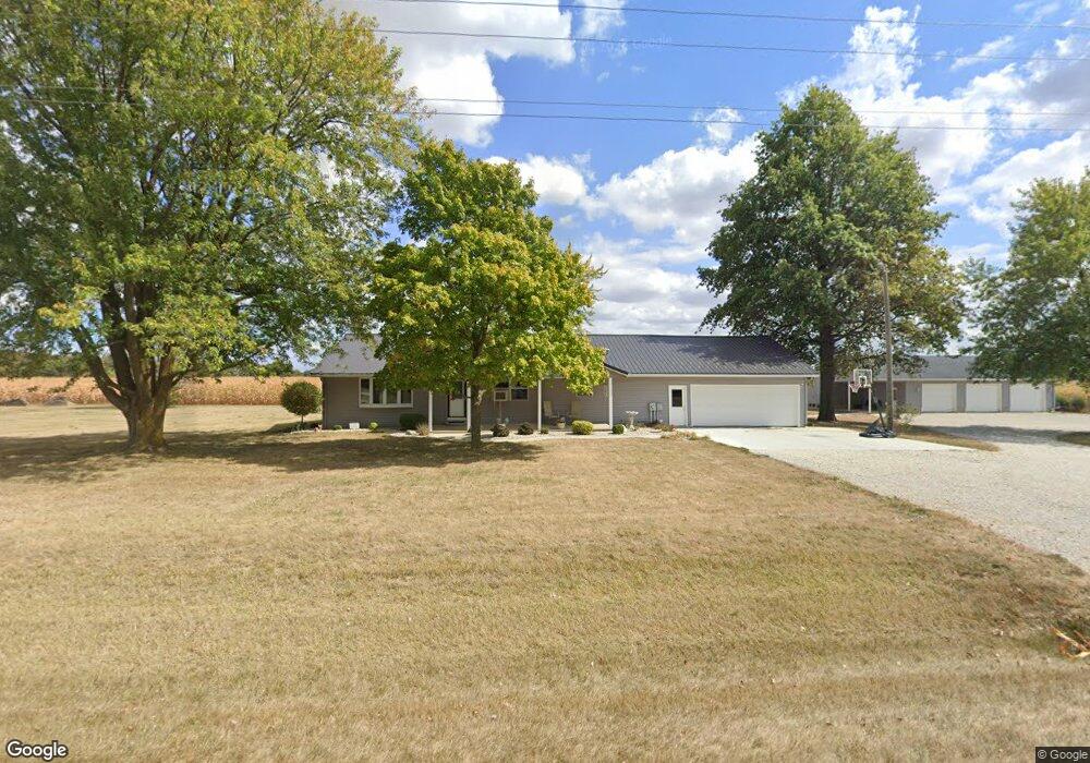
1036 Union City Rd Fort Recovery, OH 45846
Estimated Value: $211,000 - $447,000
2
Beds
2
Baths
1,792
Sq Ft
$196/Sq Ft
Est. Value
About This Home
This home is located at 1036 Union City Rd, Fort Recovery, OH 45846 and is currently estimated at $352,095, approximately $196 per square foot. 1036 Union City Rd is a home located in Mercer County with nearby schools including Fort Recovery Elementary School, Fort Recovery Middle School, and Fort Recovery High School.
Ownership History
Date
Name
Owned For
Owner Type
Purchase Details
Closed on
Mar 12, 2018
Sold by
Thobe Jerry J and Thobe Beth A
Bought by
Thobe Jerry J
Current Estimated Value
Purchase Details
Closed on
Jul 15, 2016
Sold by
Thobe Jerry J and Thobe Beth A
Bought by
Thobe Jerry J and Thobe Beth A
Purchase Details
Closed on
Dec 22, 1999
Bought by
Thobe Jerry J and Thobe Beth A
Create a Home Valuation Report for This Property
The Home Valuation Report is an in-depth analysis detailing your home's value as well as a comparison with similar homes in the area
Home Values in the Area
Average Home Value in this Area
Purchase History
| Date | Buyer | Sale Price | Title Company |
|---|---|---|---|
| Thobe Jerry J | -- | None Available | |
| Thobe Jerry J | -- | Attorney | |
| Thobe Jerry J | $10,000 | -- |
Source: Public Records
Tax History Compared to Growth
Tax History
| Year | Tax Paid | Tax Assessment Tax Assessment Total Assessment is a certain percentage of the fair market value that is determined by local assessors to be the total taxable value of land and additions on the property. | Land | Improvement |
|---|---|---|---|---|
| 2024 | $2,698 | $95,940 | $13,440 | $82,500 |
| 2023 | $2,698 | $95,940 | $13,440 | $82,500 |
| 2022 | $2,409 | $78,160 | $10,220 | $67,940 |
| 2021 | $2,246 | $71,300 | $10,220 | $61,080 |
| 2020 | $2,242 | $71,300 | $10,220 | $61,080 |
| 2019 | $2,084 | $63,740 | $9,070 | $54,670 |
| 2018 | $2,161 | $63,740 | $9,070 | $54,670 |
| 2017 | $2,150 | $63,740 | $9,070 | $54,670 |
| 2016 | $2,124 | $63,770 | $9,030 | $54,740 |
| 2015 | $2,039 | $63,770 | $9,030 | $54,740 |
| 2014 | $2,039 | $62,720 | $9,030 | $53,690 |
| 2013 | $2,024 | $59,190 | $8,540 | $50,650 |
Source: Public Records
Map
Nearby Homes
- 201 W Wiggs St
- 304 S Wayne St
- 1291 State Route 219
- 2729 S 300 E
- 4475 Ohio 705
- 4543 Lange Rd
- 0 Ohio 118
- 3709 Rossburg-Lightsville Rd
- 1610 E Division Rd
- 1096 E 26 Hwy
- 820 Mary Ln
- 401 N Cedar St
- 420 S 1st St
- 912 Emerald Ave
- 821 Butler St
- 2957 S Southtown Place
- 92 W Golf Brook Dr
- 604 E Water St
- 606 E Walnut St
- TBD W 550 S
- 1066 Union City Rd
- 1067 Union City Rd
- 1085 Union City Rd
- 1133 Union City Rd
- 685 Fox Rd
- 1122 Union City Rd
- 1121 Union City Rd
- 721 Fox Rd
- 753 Fox Rd
- 411 Fox Rd
- 811 Union City Rd
- 1263 Union City Rd
- 377 Fox Rd
- 357 Fox Rd
- 1301 Union City Rd
- 689 Union City Rd
- 754 Union City Rd
- 301 Fox Rd
- 1068 Benner Rd
- 1008 Benner Rd