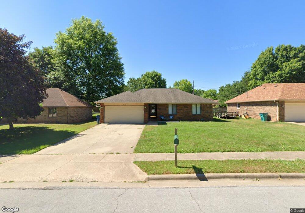
1036 W Lindberg St Springfield, MO 65807
Mark Twain NeighborhoodEstimated Value: $203,000 - $243,000
3
Beds
2
Baths
1,265
Sq Ft
$176/Sq Ft
Est. Value
About This Home
This home is located at 1036 W Lindberg St, Springfield, MO 65807 and is currently estimated at $223,163, approximately $176 per square foot. 1036 W Lindberg St is a home located in Greene County with nearby schools including Mark Twain Elementary School, Jarrett Middle, and Parkview High School.
Ownership History
Date
Name
Owned For
Owner Type
Purchase Details
Closed on
Sep 20, 2007
Sold by
Mccall David Earl
Bought by
Vong Sang S and Vong Que Ngo
Current Estimated Value
Home Financials for this Owner
Home Financials are based on the most recent Mortgage that was taken out on this home.
Original Mortgage
$91,857
Interest Rate
6.33%
Mortgage Type
New Conventional
Create a Home Valuation Report for This Property
The Home Valuation Report is an in-depth analysis detailing your home's value as well as a comparison with similar homes in the area
Home Values in the Area
Average Home Value in this Area
Purchase History
| Date | Buyer | Sale Price | Title Company |
|---|---|---|---|
| Vong Sang S | -- | None Available |
Source: Public Records
Mortgage History
| Date | Status | Borrower | Loan Amount |
|---|---|---|---|
| Closed | Vong Sang S | $91,857 |
Source: Public Records
Tax History Compared to Growth
Tax History
| Year | Tax Paid | Tax Assessment Tax Assessment Total Assessment is a certain percentage of the fair market value that is determined by local assessors to be the total taxable value of land and additions on the property. | Land | Improvement |
|---|---|---|---|---|
| 2025 | $1,366 | $27,420 | $5,700 | $21,720 |
| 2024 | $1,283 | $23,920 | $4,330 | $19,590 |
| 2023 | $1,276 | $23,920 | $4,330 | $19,590 |
| 2022 | $1,093 | $20,020 | $4,330 | $15,690 |
| 2021 | $1,093 | $20,020 | $4,330 | $15,690 |
| 2020 | $1,304 | $18,870 | $4,330 | $14,540 |
| 2019 | $1,047 | $18,870 | $4,330 | $14,540 |
| 2018 | $953 | $17,170 | $4,330 | $12,840 |
| 2017 | $943 | $16,220 | $4,330 | $11,890 |
| 2016 | $889 | $16,220 | $4,330 | $11,890 |
| 2015 | $881 | $16,220 | $4,330 | $11,890 |
| 2014 | $868 | $15,860 | $4,330 | $11,530 |
Source: Public Records
Map
Nearby Homes
- 1010 W Cherokee St
- 853 W Whiteside St
- 1858 S Franklin Ave
- 2250 S Nettleton Ave
- 1824 S Thelma Ave
- 1909 S Nettleton Ave
- 1503 W Broadmoor St
- 1623 W Tracy St
- 2456 S Ferguson Ave
- 623 W Broadmoor St
- 1651 W Lindberg St
- 1632 W Berkeley St
- 2558 S Fort Ave
- 1614 S Weaver Ave
- 306 W McGee St
- 1135 W Portland St
- 1707 W Glenwood St
- 901 W Portland St
- 810 W Minota St
- 526 W Portland St
- 1044 W Lindberg St
- 1030 W Lindberg St
- 1106 W Lindberg St
- 1035 W Whiteside St
- 1022 W Lindberg St
- 1043 W Whiteside St
- 1029 W Whiteside St
- 1037 W Lindberg St
- 1045 W Lindberg St
- 1105 W Whiteside St
- 1031 W Lindberg St
- 1112 W Lindberg St
- 1107 W Lindberg St
- 1023 W Lindberg St
- 1111 W Whiteside St
- 1113 W Lindberg St
- 1120 W Lindberg St
- 2104 S Broadway Ave
- 2110 S Broadway Ave
- 1119 W Whiteside St