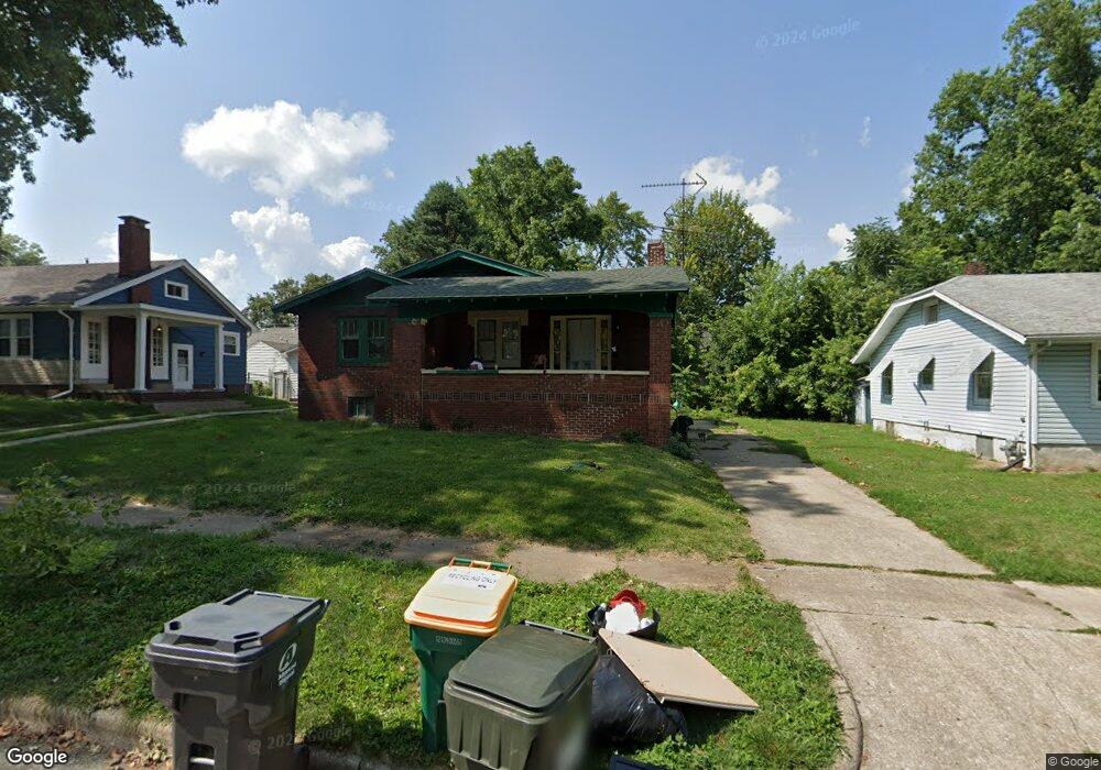
1036 W Packard St Decatur, IL 62522
Garfield Park NeighborhoodEstimated Value: $31,000 - $53,000
3
Beds
2
Baths
2,628
Sq Ft
$17/Sq Ft
Est. Value
About This Home
This home is located at 1036 W Packard St, Decatur, IL 62522 and is currently estimated at $44,924, approximately $17 per square foot. 1036 W Packard St is a home located in Macon County with nearby schools including Stephen Decatur Middle School, St. Patrick School, and Teen Challenge-Home For Girls.
Ownership History
Date
Name
Owned For
Owner Type
Purchase Details
Closed on
Mar 16, 2021
Sold by
Blankenship Ronald K and Blankenship Jane L
Bought by
Word Dorrel
Current Estimated Value
Purchase Details
Closed on
Feb 23, 2018
Sold by
Crutchfield Steven
Bought by
Wells Spring Properties Llc
Purchase Details
Closed on
Feb 16, 2016
Sold by
Macon County
Bought by
Crutchfield Steven
Purchase Details
Closed on
Aug 21, 2015
Sold by
Strayhorn Barbara A
Bought by
Macon County
Purchase Details
Closed on
Apr 1, 2001
Create a Home Valuation Report for This Property
The Home Valuation Report is an in-depth analysis detailing your home's value as well as a comparison with similar homes in the area
Home Values in the Area
Average Home Value in this Area
Purchase History
| Date | Buyer | Sale Price | Title Company |
|---|---|---|---|
| Word Dorrel | -- | None Available | |
| Wells Spring Properties Llc | -- | -- | |
| Crutchfield Steven | -- | Attorney | |
| Macon County | -- | None Available | |
| -- | $34,000 | -- |
Source: Public Records
Tax History Compared to Growth
Tax History
| Year | Tax Paid | Tax Assessment Tax Assessment Total Assessment is a certain percentage of the fair market value that is determined by local assessors to be the total taxable value of land and additions on the property. | Land | Improvement |
|---|---|---|---|---|
| 2024 | $879 | $9,080 | $436 | $8,644 |
| 2023 | $872 | $8,759 | $421 | $8,338 |
| 2022 | $845 | $8,262 | $389 | $7,873 |
| 2021 | $794 | $7,716 | $364 | $7,352 |
| 2020 | $783 | $7,359 | $348 | $7,011 |
| 2019 | $783 | $7,359 | $348 | $7,011 |
| 2018 | $841 | $8,008 | $193 | $7,815 |
| 2017 | $861 | $8,222 | $198 | $8,024 |
| 2016 | $0 | $98 | $49 | $49 |
| 2015 | -- | $98 | $49 | $49 |
| 2014 | $734 | $8,112 | $222 | $7,890 |
| 2013 | $726 | $8,416 | $230 | $8,186 |
Source: Public Records
Map
Nearby Homes
- 1065 W Green St
- 837 W Grand Ave
- 917 N Wilder Ave
- 1429 N Walnut Grove Ave
- 1319 W Waggoner St
- 875 N Monroe St
- 933 W Division St
- 1545 N Monroe St
- 1451 W Marietta St
- 1504 N Monroe St
- 925 W Olive St
- 1653 N Maple Ave
- 958 W William St
- 415 W Green St
- 844 N Edward St
- 644 W Division St
- 1245 N Union St
- 1535 N Mcclellan Ave
- 254 N Pine St
- 1530 W Cushing St
- 1044 W Packard St
- 1028 W Packard St
- 1020 W Packard St
- 1056 W Packard St
- 1011 W Leafland Ave
- 1031 W Packard St
- 1037 W Leafland Ave
- 1025 W Leafland Ave
- 1047 W Leafland Ave
- 1039 W Packard St
- 1021 W Packard St
- 1062 W Packard St
- 1010 W Packard St
- 1125 N Dunham Ave
- 1059 W Leafland Ave
- 1059 W Packard St
- 1075 N Dunham Ave
- 1076 W Packard St
- 1061 W Leafland Ave
- 1075 N Dunham St