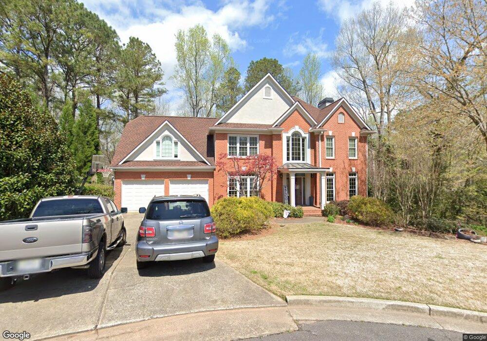
1036 Wellesley Crest Dr Unit II Woodstock, GA 30189
Oak Grove NeighborhoodEstimated Value: $642,419 - $731,000
4
Beds
4
Baths
4,405
Sq Ft
$156/Sq Ft
Est. Value
About This Home
This home is located at 1036 Wellesley Crest Dr Unit II, Woodstock, GA 30189 and is currently estimated at $686,710, approximately $155 per square foot. 1036 Wellesley Crest Dr Unit II is a home located in Cherokee County with nearby schools including Bascomb Elementary School, E. T. Booth Middle School, and Etowah High School.
Ownership History
Date
Name
Owned For
Owner Type
Purchase Details
Closed on
Jul 9, 2021
Sold by
Dobson Tyler H
Bought by
Heaney Matthew and Heaney Samantha S
Current Estimated Value
Home Financials for this Owner
Home Financials are based on the most recent Mortgage that was taken out on this home.
Original Mortgage
$401,327
Outstanding Balance
$362,905
Interest Rate
2.96%
Mortgage Type
VA
Estimated Equity
$323,805
Purchase Details
Closed on
Nov 2, 1999
Sold by
Vandenberg Thomas P and Vandenberg Terry D
Bought by
Fidelity National Bank
Create a Home Valuation Report for This Property
The Home Valuation Report is an in-depth analysis detailing your home's value as well as a comparison with similar homes in the area
Home Values in the Area
Average Home Value in this Area
Purchase History
| Date | Buyer | Sale Price | Title Company |
|---|---|---|---|
| Heaney Matthew | $430,000 | -- | |
| Fidelity National Bank | $220,000 | -- |
Source: Public Records
Mortgage History
| Date | Status | Borrower | Loan Amount |
|---|---|---|---|
| Open | Heaney Matthew | $401,327 |
Source: Public Records
Tax History Compared to Growth
Tax History
| Year | Tax Paid | Tax Assessment Tax Assessment Total Assessment is a certain percentage of the fair market value that is determined by local assessors to be the total taxable value of land and additions on the property. | Land | Improvement |
|---|---|---|---|---|
| 2025 | $1,576 | $243,424 | $45,752 | $197,672 |
| 2024 | $5,891 | $243,424 | $45,752 | $197,672 |
| 2023 | $4,987 | $222,416 | $46,000 | $176,416 |
| 2022 | $4,412 | $172,000 | $29,950 | $142,050 |
| 2021 | $4,344 | $161,752 | $30,560 | $131,192 |
| 2020 | $3,627 | $148,620 | $27,800 | $120,820 |
| 2019 | $3,756 | $136,240 | $25,600 | $110,640 |
| 2018 | $3,632 | $130,040 | $23,200 | $106,840 |
| 2017 | $3,515 | $315,900 | $23,200 | $103,160 |
| 2016 | $3,515 | $307,600 | $23,200 | $99,840 |
| 2015 | $3,522 | $305,200 | $23,800 | $98,280 |
| 2014 | $3,546 | $306,700 | $23,800 | $98,880 |
Source: Public Records
Map
Nearby Homes
- 3009 High Vista Walk
- 509 Courtyard Way
- 3007 Clove Tree Ln
- 159 W Putnam Ferry Rd
- 331 Mirramont Ct
- 706 Rose Creek Bluff
- 1412 Briarcliff Dr
- 333 Ironhill Trace
- 1086 Atherton Ln
- 327 Ironhill Trace
- 130 Grove Park Ln
- 321 Ironhill Trace
- 2038 Britley Park Crossing
- 308 Quiet Hill Ln
- 211 Chelsea Ct
- 2012 Spicers Ln
- 125 Tambourine Trail
- 1085 Britley Park Ln
- 1171 Britley Park Ln
- 1092 Britley Park Ln
- 1037 Wellesley Crest Dr Unit 2
- 1034 Wellesley Crest Dr
- 1035 Wellesley Crest Dr
- 1032 Wellesley Crest Dr Unit 2
- 1033 Wellesley Crest Dr
- 1030 Wellesley Crest Dr
- 1031 Wellesley Crest Dr
- 406 Mercer Dr
- 403 Mercer Ct
- 404 Mercer Dr
- 2183 Summerchase Dr Unit 5B
- 1029 Wellesley Crest Dr
- 408 Mercer Dr
- 408 Mercer Dr Unit IV
- 404 Mercer Ct
- 2181 Summerchase Dr Unit 5B
- 1028 Wellesley Crest Dr Unit 2
- 402 Mercer Dr Unit 4
- 1027 Wellesley Crest Dr
- 402 Mercer Ct