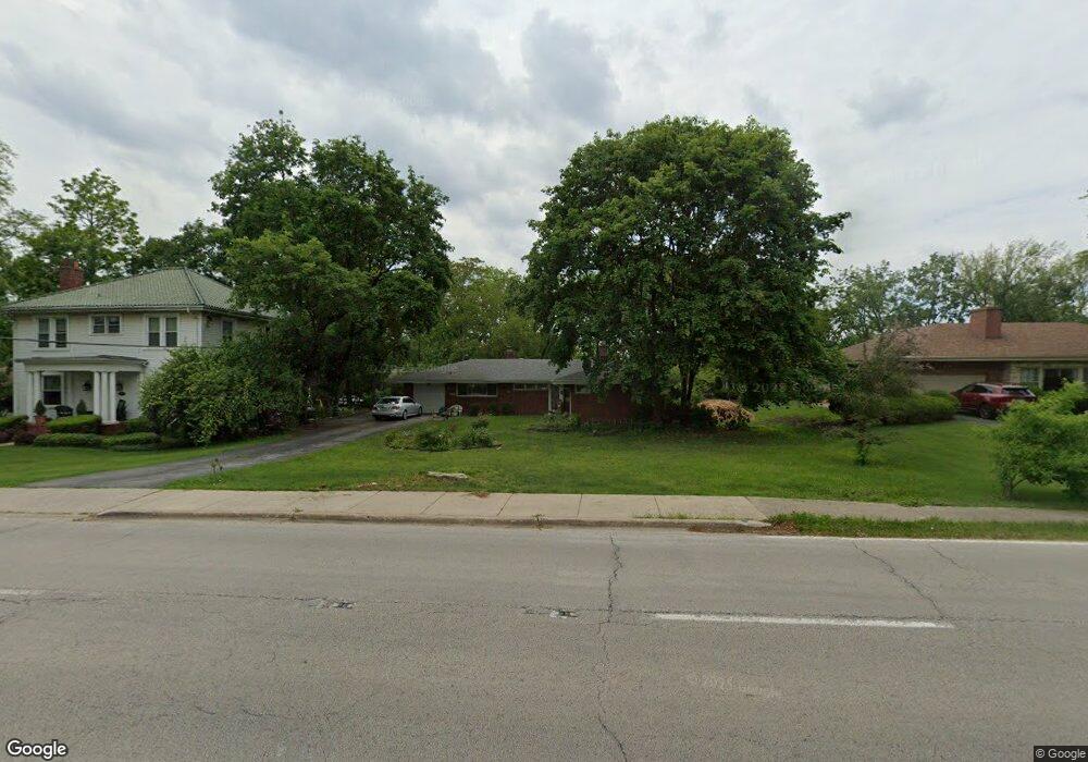
1036 Western Ave Flossmoor, IL 60422
Estimated Value: $234,000 - $323,000
3
Beds
2
Baths
1,585
Sq Ft
$184/Sq Ft
Est. Value
About This Home
This home is located at 1036 Western Ave, Flossmoor, IL 60422 and is currently estimated at $291,543, approximately $183 per square foot. 1036 Western Ave is a home located in Cook County with nearby schools including Western Avenue Elementary School, Parker Junior High School, and Homewood-Flossmoor High School.
Ownership History
Date
Name
Owned For
Owner Type
Purchase Details
Closed on
Apr 26, 2017
Sold by
Muzzy Helan
Bought by
Gucludal Tasyurek Gulcin and Tasyurek Nihat K
Current Estimated Value
Home Financials for this Owner
Home Financials are based on the most recent Mortgage that was taken out on this home.
Original Mortgage
$142,274
Outstanding Balance
$118,802
Interest Rate
4.25%
Mortgage Type
FHA
Estimated Equity
$172,741
Purchase Details
Closed on
Oct 22, 2001
Sold by
Muzzy Fredrick D and Muzzy Helen
Bought by
Muzzy Fredrick D and Muzzy Helen
Create a Home Valuation Report for This Property
The Home Valuation Report is an in-depth analysis detailing your home's value as well as a comparison with similar homes in the area
Home Values in the Area
Average Home Value in this Area
Purchase History
| Date | Buyer | Sale Price | Title Company |
|---|---|---|---|
| Gucludal Tasyurek Gulcin | $145,000 | None Available | |
| Muzzy Fredrick D | -- | -- |
Source: Public Records
Mortgage History
| Date | Status | Borrower | Loan Amount |
|---|---|---|---|
| Open | Gucludal Tasyurek Gulcin | $142,274 |
Source: Public Records
Tax History Compared to Growth
Tax History
| Year | Tax Paid | Tax Assessment Tax Assessment Total Assessment is a certain percentage of the fair market value that is determined by local assessors to be the total taxable value of land and additions on the property. | Land | Improvement |
|---|---|---|---|---|
| 2024 | $8,400 | $23,050 | $11,550 | $11,500 |
| 2023 | $5,835 | $23,050 | $11,550 | $11,500 |
| 2022 | $5,835 | $14,268 | $4,725 | $9,543 |
| 2021 | $5,894 | $14,268 | $4,725 | $9,543 |
| 2020 | $5,764 | $14,268 | $4,725 | $9,543 |
| 2019 | $5,250 | $13,171 | $4,200 | $8,971 |
| 2018 | $5,049 | $13,171 | $4,200 | $8,971 |
| 2017 | $7,601 | $14,928 | $4,200 | $10,728 |
| 2016 | $3,671 | $12,556 | $3,675 | $8,881 |
| 2015 | $3,875 | $12,556 | $3,675 | $8,881 |
| 2014 | $3,299 | $12,556 | $3,675 | $8,881 |
| 2013 | $3,487 | $11,806 | $3,675 | $8,131 |
Source: Public Records
Map
Nearby Homes
- 950 Gardner Rd
- 2622 Central Dr Unit 2N
- 2640 Central Dr Unit 1-N
- 2633 Hawthorne Ln Unit B
- 1117 Leavitt Ave Unit 110
- 1139 Leavitt Ave Unit 313
- 1141 Leavitt Ave Unit 115
- 802 Argyle Ave
- 1418 Western Ave
- 1430 Brassie Ave
- 846 Park Dr
- 2817 Flossmoor Rd
- 710 Bruce Ave
- 2007 Amherst Ct
- 625 Perth Ave
- 830 Latimer Ln
- 18646 Palmer Cir
- 2039 Marston Ln
- 1248 Oakmont Ave
- 1421 Lawrence Crescent
- 1028 Western Ave
- 1044 Western Ave
- 2411 Flossmoor Rd
- 1020 Western Ave
- 1035 Brassie Ave
- 1041 Brassie Ave
- 1027 Brassie Ave
- 2341 Carroll Pkwy
- 2338 Carroll Pkwy
- 1019 Brassie Ave
- 1012 Western Ave
- 2412 Flossmoor Rd
- 2333 Carroll Pkwy
- 1015 Western Ave
- 2430 Vardon Place
- 1109 Brassie Ave
- 2333 Flossmoor Rd
- 1007 Western Ave
- 2344 Flossmoor Rd
- 2325 Carroll Pkwy