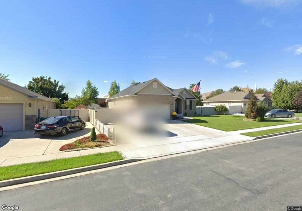
10363 N 6680 W American Fork, UT 84003
Estimated Value: $762,917 - $782,000
6
Beds
3
Baths
2,960
Sq Ft
$261/Sq Ft
Est. Value
About This Home
This home is located at 10363 N 6680 W, American Fork, UT 84003 and is currently estimated at $772,479, approximately $260 per square foot. 10363 N 6680 W is a home located in Utah County with nearby schools including Freedom Elementary School, Mountain Ridge Junior High School, and American Fork High School.
Ownership History
Date
Name
Owned For
Owner Type
Purchase Details
Closed on
Dec 9, 2020
Sold by
Williams Kyle Roy and Williams Shantel K
Bought by
Jambor Jared and Jambor Tiffany
Current Estimated Value
Home Financials for this Owner
Home Financials are based on the most recent Mortgage that was taken out on this home.
Original Mortgage
$456,000
Outstanding Balance
$406,700
Interest Rate
2.8%
Mortgage Type
New Conventional
Estimated Equity
$365,779
Purchase Details
Closed on
Jun 19, 2015
Sold by
William Kyle Roy
Bought by
Williams Kyle Roy and Williams Shantel K
Home Financials for this Owner
Home Financials are based on the most recent Mortgage that was taken out on this home.
Original Mortgage
$284,905
Interest Rate
3.81%
Mortgage Type
New Conventional
Purchase Details
Closed on
Jan 7, 2015
Sold by
Brereton Weston and Brereton Jennifer
Bought by
Re Investments Llc
Purchase Details
Closed on
Mar 24, 2009
Sold by
Brereton Weston and Brereton Jennifer
Bought by
Brereton Jennifer
Purchase Details
Closed on
Sep 8, 2004
Sold by
Patterson Construction
Bought by
Brereton Weston and Brereton Jennifer
Home Financials for this Owner
Home Financials are based on the most recent Mortgage that was taken out on this home.
Original Mortgage
$187,800
Interest Rate
5.25%
Mortgage Type
Purchase Money Mortgage
Create a Home Valuation Report for This Property
The Home Valuation Report is an in-depth analysis detailing your home's value as well as a comparison with similar homes in the area
Home Values in the Area
Average Home Value in this Area
Purchase History
| Date | Buyer | Sale Price | Title Company |
|---|---|---|---|
| Jambor Jared | -- | Integrated Title Insurance S | |
| Williams Kyle Roy | -- | American Secure Title St | |
| Williams Kyle Ray | -- | Select Title Ins Agency | |
| Re Investments Llc | $274,000 | Accommodation | |
| Brereton Jennifer | -- | Atlas Title | |
| Brereton Weston | -- | Signature Title Insurance A | |
| Patterson Construction | -- | Signature Title Insurance A | |
| Patterson Homes Inc | -- | Signature Title Insurance A |
Source: Public Records
Mortgage History
| Date | Status | Borrower | Loan Amount |
|---|---|---|---|
| Open | Jambor Jared | $456,000 | |
| Previous Owner | Williams Kyle Ray | $284,905 | |
| Previous Owner | Brereton Weston | $187,800 | |
| Closed | Brereton Weston | $46,960 |
Source: Public Records
Tax History Compared to Growth
Tax History
| Year | Tax Paid | Tax Assessment Tax Assessment Total Assessment is a certain percentage of the fair market value that is determined by local assessors to be the total taxable value of land and additions on the property. | Land | Improvement |
|---|---|---|---|---|
| 2025 | $2,961 | $402,160 | $334,800 | $396,400 |
| 2024 | $2,961 | $365,750 | $0 | $0 |
| 2023 | $2,713 | $361,460 | $0 | $0 |
| 2022 | $2,564 | $331,265 | $0 | $0 |
| 2021 | $2,211 | $425,400 | $178,700 | $246,700 |
| 2020 | $2,092 | $394,900 | $155,400 | $239,500 |
| 2019 | $1,842 | $363,700 | $155,400 | $208,300 |
| 2018 | $1,777 | $333,500 | $149,000 | $184,500 |
| 2017 | $1,659 | $166,155 | $0 | $0 |
| 2016 | $1,812 | $169,620 | $0 | $0 |
| 2015 | $1,872 | $166,045 | $0 | $0 |
| 2014 | $1,787 | $157,135 | $0 | $0 |
Source: Public Records
Map
Nearby Homes
- 6372 W 10400 N
- 6373 W 10500 N
- 9967 N 6670 W
- 1602 E Center Pointe Dr
- 1602 E Center Pointe Dr Unit 1
- 1610 E Center Pointe Dr
- 1618 E Center Pointe Dr
- 6576 W 9810 N
- 6190 W 10050 N
- 6271 W 10830 St N
- 975 E 2850 N
- 2208 N 825 E
- 859 E 2125 N
- 11337 N 5950 W Unit 7
- 10818 N 6000 W
- 1961 N 825 E
- 2752 N 600 E
- 9780 N 6000 W
- 9435 N Aspen Hollow Cir
- 3368 N 700 E