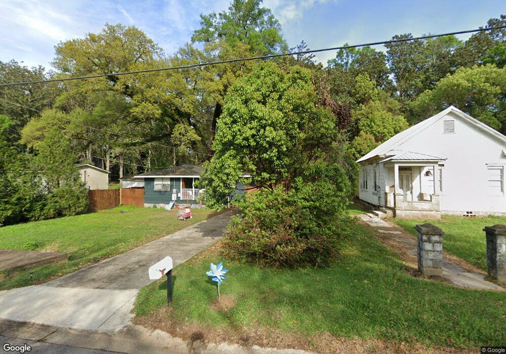
10367 Freeland Ave Grand Bay, AL 36541
Estimated Value: $38,974 - $110,000
2
Beds
1
Bath
724
Sq Ft
$87/Sq Ft
Est. Value
About This Home
This home is located at 10367 Freeland Ave, Grand Bay, AL 36541 and is currently estimated at $62,994, approximately $87 per square foot. 10367 Freeland Ave is a home located in Mobile County with nearby schools including Cora Castlen Elementary School, Grand Bay Middle School, and Alma Bryant High School.
Ownership History
Date
Name
Owned For
Owner Type
Purchase Details
Closed on
Jun 21, 2024
Sold by
Adams Royce and Estes Deborah J
Bought by
Pioneer 2000 Llc
Current Estimated Value
Purchase Details
Closed on
Dec 13, 2013
Sold by
Fannie Mae
Bought by
Adams Royce
Purchase Details
Closed on
Mar 12, 2012
Sold by
Deas June and Bny Mortgage Company Llc
Bought by
Federal National Mortgage Association
Purchase Details
Closed on
Nov 16, 2007
Sold by
Deas June
Bought by
Deas June
Home Financials for this Owner
Home Financials are based on the most recent Mortgage that was taken out on this home.
Original Mortgage
$88,800
Interest Rate
4.72%
Mortgage Type
Reverse Mortgage Home Equity Conversion Mortgage
Create a Home Valuation Report for This Property
The Home Valuation Report is an in-depth analysis detailing your home's value as well as a comparison with similar homes in the area
Home Values in the Area
Average Home Value in this Area
Purchase History
| Date | Buyer | Sale Price | Title Company |
|---|---|---|---|
| Pioneer 2000 Llc | $35,000 | None Listed On Document | |
| Adams Royce | $10,000 | None Available | |
| Federal National Mortgage Association | $23,000 | None Available | |
| Deas June | $89,300 | None Available |
Source: Public Records
Mortgage History
| Date | Status | Borrower | Loan Amount |
|---|---|---|---|
| Previous Owner | Deas June | $88,800 |
Source: Public Records
Tax History Compared to Growth
Tax History
| Year | Tax Paid | Tax Assessment Tax Assessment Total Assessment is a certain percentage of the fair market value that is determined by local assessors to be the total taxable value of land and additions on the property. | Land | Improvement |
|---|---|---|---|---|
| 2024 | $111 | $2,420 | $250 | $2,170 |
| 2023 | $98 | $2,110 | $270 | $1,840 |
| 2022 | $42 | $1,950 | $270 | $1,680 |
| 2021 | $48 | $2,100 | $250 | $1,850 |
| 2020 | $48 | $2,100 | $250 | $1,850 |
| 2019 | $46 | $2,060 | $0 | $0 |
| 2018 | $45 | $2,040 | $0 | $0 |
| 2017 | $49 | $2,140 | $0 | $0 |
| 2016 | $48 | $2,120 | $0 | $0 |
| 2013 | $211 | $4,220 | $0 | $0 |
Source: Public Records
Map
Nearby Homes
- 0 Pine St
- 10400 Freeland Ave
- 0 Cedar St
- 10581 Potter Tract Rd
- 12850 Saeger Rd
- 0 Saeger Rd Unit 7630044
- 11950 Highway 90
- 10025 School House Rd
- 13030 Holly Ct
- 10051 Pecan St
- 12700 Longview Dr
- 12275 Oakdale Ave
- 12801 Cherokee Ct
- 13041 Border Dr
- 10750 Grand Ave
- 12400 Dailey Rd
- 13120 Border Dr
- 12700 Rainey Dr
- 12925 Bonnievale Dr N
- 0 Warren Creek Rd
- 10365 Freeland Ave
- 10355 Freeland Ave
- 10375 Freeland Ave
- 10347 Potter Tract Rd
- 12620 Pine St
- 12643 Potter Tract Rd
- 12651 Freeland Ave
- 10309 Potter Tract Rd
- 10421 Potter Tract Rd
- 12611 Pine St
- 12601 Dezauche Ln
- 12640 Pecan St
- 10441 Potter Tract Rd
- 12571 Dezauche Ln
- 10418 Potter Tract Rd
- 12620 Pecan St
- 12620 Pecan St Unit 8
- 12571 Pine St
- 12541 Dezauche Ln
- 12711 Us Highway 90