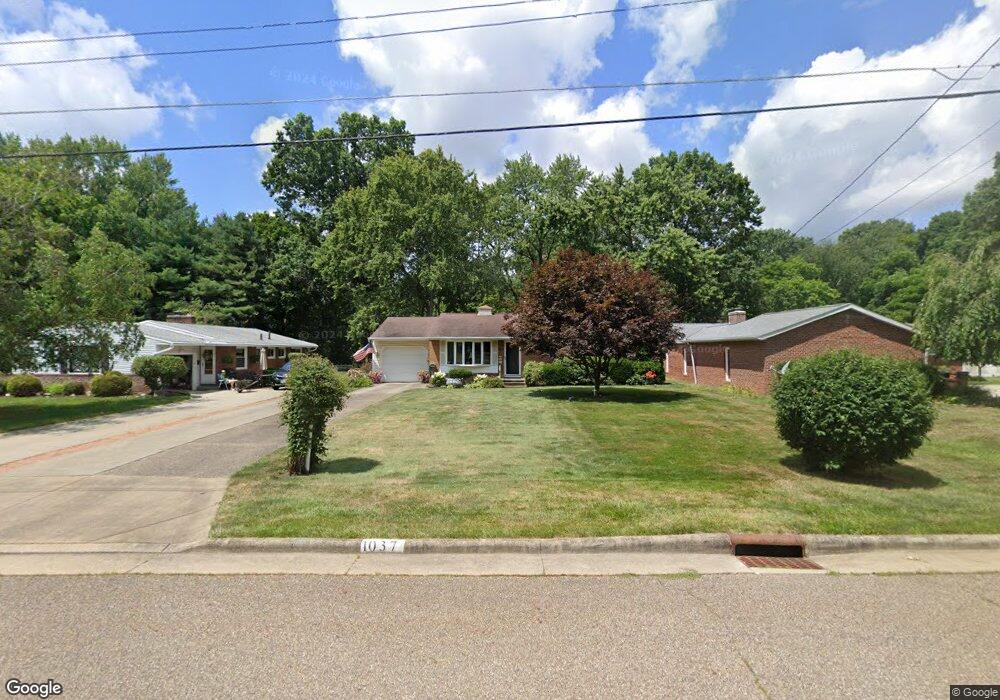
1037 Browning Ave NW North Canton, OH 44720
Estimated Value: $211,000 - $239,000
3
Beds
2
Baths
1,372
Sq Ft
$166/Sq Ft
Est. Value
About This Home
This home is located at 1037 Browning Ave NW, North Canton, OH 44720 and is currently estimated at $228,162, approximately $166 per square foot. 1037 Browning Ave NW is a home located in Stark County with nearby schools including Orchard Hill Intermediate School, North Canton Middle School, and Hoover High School.
Ownership History
Date
Name
Owned For
Owner Type
Purchase Details
Closed on
Aug 18, 2016
Bought by
Mcclung Timothy A Trustee
Current Estimated Value
Home Financials for this Owner
Home Financials are based on the most recent Mortgage that was taken out on this home.
Interest Rate
3.43%
Purchase Details
Closed on
Nov 19, 2004
Sold by
Leeds Paula F and Hertz Robin Sue
Bought by
Mcclung James B and Mcclung Carol E
Purchase Details
Closed on
Sep 13, 1995
Sold by
Waters Patricia E
Bought by
Hertz Robin S
Home Financials for this Owner
Home Financials are based on the most recent Mortgage that was taken out on this home.
Original Mortgage
$80,070
Interest Rate
7.81%
Mortgage Type
New Conventional
Purchase Details
Closed on
Aug 10, 1993
Purchase Details
Closed on
Apr 20, 1992
Create a Home Valuation Report for This Property
The Home Valuation Report is an in-depth analysis detailing your home's value as well as a comparison with similar homes in the area
Home Values in the Area
Average Home Value in this Area
Purchase History
| Date | Buyer | Sale Price | Title Company |
|---|---|---|---|
| Mcclung Timothy A Trustee | -- | -- | |
| Mcclung James B | $115,000 | -- | |
| Hertz Robin S | $94,200 | -- | |
| -- | $79,500 | -- | |
| -- | -- | -- |
Source: Public Records
Mortgage History
| Date | Status | Borrower | Loan Amount |
|---|---|---|---|
| Closed | Mcclung Timothy A Trustee | -- | |
| Previous Owner | Hertz Robin S | $80,070 |
Source: Public Records
Tax History Compared to Growth
Tax History
| Year | Tax Paid | Tax Assessment Tax Assessment Total Assessment is a certain percentage of the fair market value that is determined by local assessors to be the total taxable value of land and additions on the property. | Land | Improvement |
|---|---|---|---|---|
| 2025 | -- | $73,790 | $18,310 | $55,480 |
| 2024 | -- | $73,790 | $18,310 | $55,480 |
| 2023 | $2,120 | $48,790 | $11,340 | $37,450 |
| 2022 | $2,060 | $48,790 | $11,340 | $37,450 |
| 2021 | $1,987 | $48,790 | $11,340 | $37,450 |
| 2020 | $1,832 | $41,900 | $9,870 | $32,030 |
| 2019 | $1,710 | $41,900 | $9,870 | $32,030 |
| 2018 | $1,773 | $41,900 | $9,870 | $32,030 |
| 2017 | $1,551 | $39,200 | $9,380 | $29,820 |
| 2016 | $1,557 | $39,200 | $9,380 | $29,820 |
| 2015 | $1,563 | $39,200 | $9,380 | $29,820 |
| 2014 | $1,465 | $35,390 | $8,470 | $26,920 |
| 2013 | $736 | $35,390 | $8,470 | $26,920 |
Source: Public Records
Map
Nearby Homes
- 1015 Lois Ave NW
- 608 Werstler Ave NW
- 1263 Los Angeles Blvd NW
- 1482 Democracy Dr NW
- 404 7th St NW
- 742 Portage St NW
- 455 Royer Ave NW
- 1171 Terrace Rd NW
- 624 Portage St NW
- 140 5th St NE
- 1350 Overland Ave NE
- 0 W Maple St Unit 5135089
- 1060 Park Ave NE
- 1222 W Maple St Unit 6A
- 1246 W Maple St Unit 4A
- 1236 W Maple St
- 5948 Shuffel St NW
- 3858 Cranwood St NW
- 727 Lorena St SW
- 434 Heather Cir NE
- 1101 Browning Ave NW
- 1031 Browning Ave NW
- 1111 Browning Ave NW
- 1001 Woodrow St NW
- 1015 Woodrow St NW
- 1030 Browning Ave NW
- 1019 Woodrow St NW
- 1100 Browning Ave NW
- 1022 Browning Ave NW
- 1110 Browning Ave NW
- 927 Woodrow St NW
- 1101 Woodrow St NW
- 919 Woodrow St NW
- 915 Woodrow St NW
- 1113 Woodrow St NW
- 905 Woodrow St NW
- 1034 Lois Ave NW
- 1020 Lois Ave NW
- 1028 Lois Ave NW
- 1012 Woodrow St NW