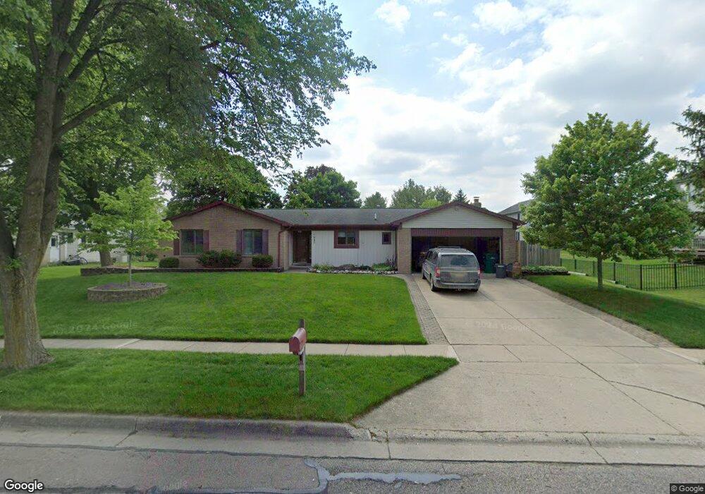
1037 Colony Dr Saline, MI 48176
Estimated Value: $370,460 - $404,000
3
Beds
2
Baths
1,598
Sq Ft
$244/Sq Ft
Est. Value
About This Home
This home is located at 1037 Colony Dr, Saline, MI 48176 and is currently estimated at $389,865, approximately $243 per square foot. 1037 Colony Dr is a home located in Washtenaw County with nearby schools including Heritage School, Woodland Meadows Elementary School, and Saline Middle School.
Ownership History
Date
Name
Owned For
Owner Type
Purchase Details
Closed on
Dec 13, 2018
Sold by
Finfrock Janet S and Finfrock Thomas L
Bought by
Finfrock Janet S and Finfrock Family Trust
Current Estimated Value
Purchase Details
Closed on
Nov 30, 1995
Sold by
Murray Ted F
Bought by
Finfrock Tom and Finfrock Janet
Home Financials for this Owner
Home Financials are based on the most recent Mortgage that was taken out on this home.
Original Mortgage
$108,000
Outstanding Balance
$2,227
Interest Rate
7.45%
Mortgage Type
New Conventional
Estimated Equity
$387,638
Create a Home Valuation Report for This Property
The Home Valuation Report is an in-depth analysis detailing your home's value as well as a comparison with similar homes in the area
Home Values in the Area
Average Home Value in this Area
Purchase History
| Date | Buyer | Sale Price | Title Company |
|---|---|---|---|
| Finfrock Janet S | -- | None Available | |
| Finfrock Tom | $135,000 | -- |
Source: Public Records
Mortgage History
| Date | Status | Borrower | Loan Amount |
|---|---|---|---|
| Open | Finfrock Tom | $108,000 |
Source: Public Records
Tax History
| Year | Tax Paid | Tax Assessment Tax Assessment Total Assessment is a certain percentage of the fair market value that is determined by local assessors to be the total taxable value of land and additions on the property. | Land | Improvement |
|---|---|---|---|---|
| 2025 | $5,023 | $169,400 | $0 | $0 |
| 2024 | $4,877 | $160,100 | $0 | $0 |
| 2023 | $4,692 | $151,600 | $0 | $0 |
| 2022 | $4,840 | $142,300 | $0 | $0 |
| 2021 | $4,647 | $140,400 | $0 | $0 |
| 2020 | $4,601 | $142,200 | $0 | $0 |
| 2019 | $4,495 | $141,500 | $141,500 | $0 |
| 2018 | $4,309 | $122,900 | $0 | $0 |
| 2017 | $254 | $121,900 | $0 | $0 |
| 2016 | $4,133 | $85,924 | $0 | $0 |
| 2015 | -- | $85,667 | $0 | $0 |
| 2014 | -- | $82,400 | $0 | $0 |
| 2013 | -- | $82,400 | $0 | $0 |
Source: Public Records
Map
Nearby Homes
- 1040 Heritage Dr
- 767 Berkshire Dr
- 7663 Ann Arbor-Saline Rd
- 165 Harper Dr
- 224 Wallace Dr
- 327 Cottonwood Ln
- 372 Highland Dr
- 249 Sheffield
- 514 Mills Rd
- 2204 Mill Ln
- 404 Mills Rd
- 548 Park Place
- 116 W Mckay St
- 1782 Sycamore Ct
- 29 Black Cherry Ln
- 708 Pembroke Dr
- 202 W Henry St
- 631 Gretchen Ln
- 630 Gretchen Ln
- 110 Parsons Ln
- 337 Bennington Ct Unit 14
- 1013 Colony Ct
- 363 Bennington Ct Unit 15
- 1009 Colony Ct
- 389 Bennington Ct
- 415 Bennington Ct Unit 17
- 979 Colony Dr
- 1005 Colony Ct
- 330 Bennington Ct Unit 29
- 356 Bennington Ct
- 988 Colony Dr
- 985 Colony Ct
- 382 Bennington Ct
- 989 Colony Ct
- 441 Bennington Ct Unit 18
- 408 Bennington Ct
- 966 Colony Dr
- 1001 Colony Ct
- 957 Colony Dr
- 993 Colony Ct