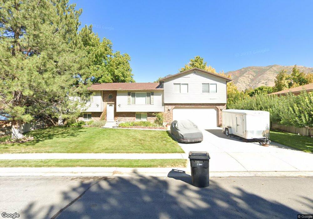
1037 E 1200 S Springville, UT 84663
East Hobble Creek NeighborhoodEstimated Value: $592,829 - $656,000
4
Beds
2
Baths
2,016
Sq Ft
$305/Sq Ft
Est. Value
About This Home
This home is located at 1037 E 1200 S, Springville, UT 84663 and is currently estimated at $614,276, approximately $304 per square foot. 1037 E 1200 S is a home located in Utah County with nearby schools including Sage Creek Elementary, Springville High School, and Springville Junior High School.
Ownership History
Date
Name
Owned For
Owner Type
Purchase Details
Closed on
Jul 13, 2020
Sold by
Rios Daniel L and Rios Lea R
Bought by
Rios Daniel L and Rios Lea Rose
Current Estimated Value
Home Financials for this Owner
Home Financials are based on the most recent Mortgage that was taken out on this home.
Original Mortgage
$253,600
Outstanding Balance
$179,174
Interest Rate
3.1%
Mortgage Type
New Conventional
Estimated Equity
$435,102
Purchase Details
Closed on
Jul 30, 1997
Sold by
Dunn Earl F and Dunn Bonita B
Bought by
Rios Daniel L and Rios Lea R
Home Financials for this Owner
Home Financials are based on the most recent Mortgage that was taken out on this home.
Original Mortgage
$123,927
Interest Rate
7.58%
Mortgage Type
FHA
Create a Home Valuation Report for This Property
The Home Valuation Report is an in-depth analysis detailing your home's value as well as a comparison with similar homes in the area
Home Values in the Area
Average Home Value in this Area
Purchase History
| Date | Buyer | Sale Price | Title Company |
|---|---|---|---|
| Rios Daniel L | -- | First American Title Ins Co | |
| Rios Daniel L | -- | Old Republic Title Co Of Uta |
Source: Public Records
Mortgage History
| Date | Status | Borrower | Loan Amount |
|---|---|---|---|
| Open | Rios Daniel L | $253,600 | |
| Closed | Rios Daniel L | $123,927 |
Source: Public Records
Tax History
| Year | Tax Paid | Tax Assessment Tax Assessment Total Assessment is a certain percentage of the fair market value that is determined by local assessors to be the total taxable value of land and additions on the property. | Land | Improvement |
|---|---|---|---|---|
| 2025 | $2,641 | $295,240 | -- | -- |
| 2024 | $2,641 | $270,545 | $0 | $0 |
| 2023 | $2,585 | $265,100 | $0 | $0 |
| 2022 | $2,668 | $268,675 | $0 | $0 |
| 2021 | $2,350 | $368,400 | $95,800 | $272,600 |
| 2020 | $2,270 | $345,000 | $79,800 | $265,200 |
| 2019 | $2,068 | $349,100 | $79,800 | $269,300 |
| 2018 | $2,316 | $341,900 | $72,600 | $269,300 |
| 2017 | $2,094 | $164,175 | $0 | $0 |
| 2016 | $2,053 | $157,795 | $0 | $0 |
| 2015 | $1,778 | $139,700 | $0 | $0 |
| 2014 | $1,653 | $129,085 | $0 | $0 |
Source: Public Records
Map
Nearby Homes
- 1206 E 1150 S
- 1121 W 1800 N
- 949 S 1060 E
- 1195 W 1600 N
- 1518 S 600 E
- 883 E 700 S
- 677 E 800 South St
- 1330 N 800 W
- 1518 E Pheasant Run Dr
- 1225 N 1380 W
- 1410 W 1200 N
- 405 W 1200 N Unit 4
- 487 W 1200 N Unit 1
- 579 E 800 St S
- 629 E 800 St S
- 645 Swenson Ave Unit 5
- 645 Swenson Ave Unit 3
- 942 Sage Creek Cir
- 1010 S 400 E Unit 21
- 1010 S 400 E Unit 39
- 1179 E 1200 S
- 1172 E 1200 S
- 1315 E 1200 S Unit 53
- 1019 E 1200 S
- 1159 E 1200 S
- 1158 E 1200 S
- 1061 E 1200 S
- 1148 E 1200 S Unit 69
- 1030 E 1150 S
- 1139 E 1200 S
- 1136 E 1200 S Unit 70
- 1136 E 1200 S
- 1058 E 1150 S
- 1131 E 1200 S
- 1124 E 1200 S Unit 71
- 1124 E 1200 S
- 1119 E 1200 S
- 1038 E 1200 S
- 1191 S 980 E
- 1112 E 1200 S
Your Personal Tour Guide
Ask me questions while you tour the home.